Thursday, October 30, 2014

Fiery Gizzard - Friends of the South Cumberland


The meet up group Friends of the South Cumberland scheduled a hike on a Friday so I signed up.Fiery Gizzard the destination. I got there early and the gate was still locked. The other hikers got there, except for our hike leader. We waited for a while, sent him a text and took off without him. It was chilly so we started out at a fast pace. My short legs were not up for it so I was sweep for most of the day. We stopped here and there to take pics and catch our breath (me). When we got to the rock hopping section I was telling them how I always miss a turn here cause I am always watching my feet and not the blazes. One guy said Oh well I guess that would be easy to do, and proceeded to do exactly that. I looked up in time to see the blaze to the right going down and pointed him in the right direction. 

I remembered to look for the arch as we got close to the top of the ridge. No one had seen it before.

We ate lunch at Raven's Point and then walked to Anderson Falls. Lots of steps down to see the 90 ft waterfall from the bottom.
We went down the Dog Hole Trail to finish the loop. I met some nice folks to hike with, and it was a great day.

Pictures:

Sunday, October 26, 2014

2014 TTA annual meeting at Montgomery Bell State Park


The 2014 annual meeting at Montgomery Bell State Park was another great success.  About 150 people were in attendance. There were lots of hikes planed for all the days.

I arrived late for Dinner, but caught the musical entertainment.  Lora arrived even later.

Live Musical Entertainment: Claudia Nyguaard Singer, songwriter, and storyteller.

Natchez Trace Parkway:

Twelve of us went hiking on the trace.  Amy Sutton and Alice were our fearless leaders.  We started at Hwy 7 and went South.  Our first stop was the Gordon House Historic site where we walked around the house and then hiked down to the Duck river. From there we headed over to the Baker Bluff overlook for a view.  Some of us hiked and the rest drove down to Jackson falls.  Our next stop was the Devil's Backbone State Natural Area.  Here we hiked a three mile trail which included our lunch stop along a nice creek.  After our hike we continued on to Fall Hollow and viewed the many water falls there. Our next stop was Meriwether Lewis monument and visitor center.

We had a great time with some great people and saw lots of stuff.

Back at the park we had a good dinner and then the meeting began.  After the meeting they had the auction and then we were entertained by the Nashville Old Time String Band.

Cub Lake:

Sunday morning I had to go play firefighter and drove to M'Boro in the thick pea soup that covered Hwy 840. Lora stayed so she could hike. She packed up camp and had a quick breakfast at the Inn. Sunday's hike was at Natchez Trace State Park, about an hour drive west from Montgomery Bell. The Cub Lake Trail was the destination. 19 hikers, mostly the Memphis group as this was on their way home. The trail is really pretty even though the State Forest folks have clear cut some of the area along the trail. I don't know why thy can't leave a strip of trees between the trail and where they cut. The leaves were very colorful along the lakeshore. We saw some metal bands by a creek a creek that probably were left by the moonshiners in this area. One of the creek crossings had a nice bridge but one of our more adventurous hikers had to cross on the cables....see pics. After the hike we were driving out of the park and spotted the fire tower. We hoped to climb, but the bottom ladder had been removed, probably to keep curious hikers away. On the drive east, Lora stopped at the Station 3 to visit and had supper with us.

Pictures:

Wednesday, October 15, 2014

Father / Son Hike 2014


This year we were going to the Old Settlers trail again.  Yes, after a number of cancellations, we were going to do it.  Then the weather set in.  Heavy storm warnings for the second day of our hike.  We made an attempt to reschedule a day earlier, but they could not change our permit.  We headed over early anyway to make last minute changes if necessary.

After the arrival of Steve and Kathy, we started the heavy studying of the weather through several different sources.  We decided to stay with the original plan and do a day hike on Sunday.

Sunday morning we headed out to Tremont and did four miles up the Middle Prong Trail to Indian Flat Falls.  We ate lunch here and then headed back.  We even got to try out the poncho's which really worked well with what was to come. On the hike back I almost put my foot down on a large rattle snake.  Dad had already passed it on the right side of the trail.  I was walking on the left side. As we were driving out we picked up three backpackers from University of Michigan who had been out for their first backpack and had injuries.  We drove them back to their car at Elkmont.  They were happy campers to have a ride, which I am familiar with.

Our backpack started on Monday, leaving a car at the Gabes Mountain trailhead in Cosby, we started in Greenbrier.  We had 6 miles to campsite #33.  We had a doe cross close to the trail and then a buck came onto the trail by Dad and walked towards Steve and I.  The camera went wild only to catch a couple of pictures worth a damn. We passed the only two backpackers that we would see on the trail. It was a beautiful day with chimneys and rock walls to see.  We made it to camp with plenty of time to gather firewood for the evening fire.  There is a chimney in the campsite as well.

Sometime late in the evening the wind gusts began to blow.  Waking up to find the tarp flapping against the hammock a few times.  Sometime in the early morning the rain began.  We ended up eating breakfast under my tarp.  It stopped long enough to get packed up and then rained off and on, with on being more often.  We saw more history all along the trail.  The creek crossing got bigger and bigger.  It stopped long enough for us to have lunch and then cross Webb creek to find the barn.

The biggest crossing was of Indian Camp creek, which had a lot of flow and was deep.  We ended up going about one hundred feet upstream to find a place to cross which was only knee deep.  After crossing that it rained all the way to campsite #34 on Gabes Mountain trail.  This is a really nice campsite along Gabes Creek. We set up the tarp for dinner and drinks in the dark.  Sometime late in the night the rain stopped and the stars came out.  We were done with the rain.

The next morning we hiked out. There were lots of branches and trees down from the wind.  On the way out we saw a sight never seen.  A black cat was leading a couple up the trail.  When we asked the people about it, they said it was not their cat.  They thought it was the campground hosts cat.

With the Old Settlers trail finally done, we celebrated back at the Ponderosa with Pizza and drinks. We got in 22.4 miles.

Pictures:

Wednesday, October 8, 2014

AT - Devils Fork Gap to Carvers Gap


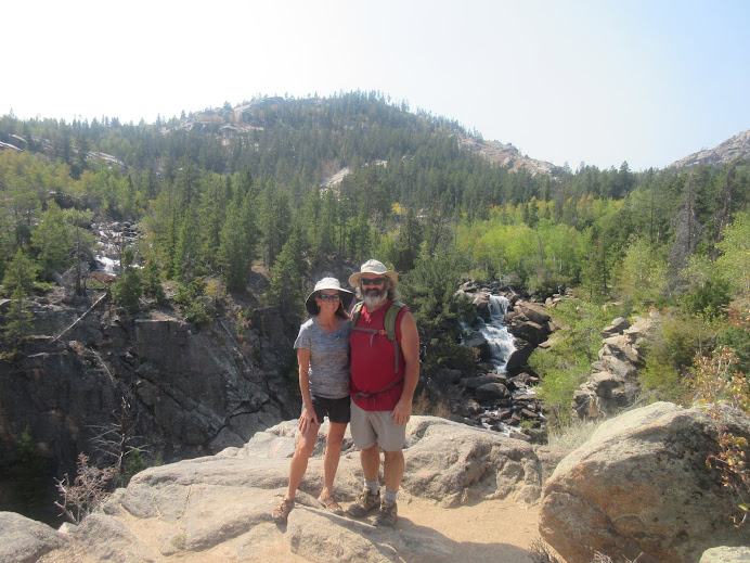
Appalachian Trail - Devils Fork Gap to Carvers Gap in six days 67.8 miles.

The trail head was a Stile over a farm fence and just on the other side was an apple tree with ripe apples.  What a way to get going.  Our packs were heavy with eight days worth of food including a foot long Subway hanging on the back of mine for tonight's dinner.

It didn't take long for us to get our rain gear on to start the hike right and off we went.  At 1.8 we were at 4000 feet at Sugarloaf Gap.  Fog had rolled in so no good views.  We hiked to the Hogback Ridge Shelter for the night.  We were thinking about maybe staying in the shelter, but Rare Breed from Louisiana and Mike from Chicago where already there. Rare Breed was a Southbound through hiker, which were just now coming through this area. We set up our tent, ate, and called it a night. 6.1 miles.

Day Two:

We got up to Mike telling us it was morning.  We got on the trail not long after him. Not too far until our first view of the mountains from a vista just off the trail. We went up to High Rock (4,460 ft) for another great view and then caught up to Mike coming out of Sam's Gap.  He hiked with us until lunch time. We climbed up from the trail and found ourselves standing in someones back yard.  As we ate, some bird tagging people came through and said that they would see us up on Big Bald.

After lunch, as usual, we climbed.  Went up to 5,516 feet to Big Bald.  We noticed icicles on the trees.  Lot's of great views from there.  The next hill was Big Stamp where they had nets set up to tag birds.  There was a group up there and they had already caught a few. The nets stay up there and they had had problems with the nets freezing in the closed position. On the way down we passed Bald Mountain Shelter where Mike was planning on staying. Never did see him again.

We hiked on to Whistling Gap to camp for the night.  When we went to the spring, we found it dry so we climbed down a little further, across an old roadbed, and into the Rhododendron to find water. We sat around a fire that night and listened to a Great Horned owl. I talked back to him and got him to come closer, Later that night we woke to a screech owl talking to us.  13.5 miles.

Day Three:

We decided to start the day with a climb as if we didn't every day.  We climbed up to High Rocks at 4,100 feet for a view. There was a car parked at Spivey Gap and we found it to belonged to some trail Maintainers who we met further up the mountain.  The were with the Tennessee Eastman Hiking and Canoe Club and were lopping some branches.

We have seen our first concrete block shelter.  No Business Knob shelter has a concrete foundation and block walls.  Now that took some work!  We ate lunch at the shelter and then headed to Erwin, TN.  You get some good high views of Erwin before you drop the 1500 feet over two and a quarter miles down to the Nolichucky River.  At the bridge we saw a few hikers at Uncle Johnny's Hostel. We continued the 1.2 miles to the Nolichucky Gorge Campground.  Here we were met with some very friendly people.  They even invited us to a potluck Spaghetti dinner that they do every Sunday.
After we showered and put on some fresh clothes, we spent the evening eating and visiting with a group including a great campfire. The campground is under new management which they say the old manager was against thru hikers.  14.7 miles.

Day Four:

The day started with a 2300 foot climb to get started.  We passed a doe that was just staring at us. She just stood there watching us as we went by.  Acorns were like marbles on the trail.  We passed Curley Maple Gap shelter, another block structure.   As we were going down to Indian Grave Gap four backpackers with very large grins on their faces told us that there was a trail angel at the road. We were served sweet tea, banana bread, and brownies.  He also had coffee and an a assortment of fruit. He said that this was his ministry and did it every weekday. It was SOOO good!

As we climbed from the road to the Beauty Spot, the bottom dropped out. The wind was strong and it was pretty miserable out for the climb.  We get a view from the top with the clouds coming over the mountains, but no pics.  You will have to look at our pics from our last visit to this area. We continued on scaring two more deer to Deep Gap for the night. Lora's rain jacket gave up and started leaking. Guess who's going shopping after this trip? We had a good piped spring here.  No fire as the rain continued through the night. Hunters drove the road through the evening and morning hours. 12.1 miles.

Day Five:

Today we started out with a climb.  Unaka Mountain is 5,180 feet. We passed Cherry Gap shelter and climbed Little Bald Knob where we had lunch and dried out our equipment.  We passed some other hikers and headed down to Iron Mountain Gap.  After the gap the rain began again.  We passed through the apple orchard and ate us some apples.  Yummy good!  The wind was crazy strong and we finally found a large rock to take shelter under.

The wind continued all the way to Greasy Creek Gap where we stayed the night. We were out of the strong wind, so we dried all our gear out and had a good campfire.  There was a piped spring for our water.  We heard owls as we went to sleep and then hear the rain all night long again. 12.2 miles.

Day Six:

After treating blisters, Lora was going to call it day today.  We hiked lots of ups and downs today. Roan High Bluff is at 6,200 feet. The closer we got to Roan Mountain the more people we saw.  We stopped on the climb for some lunch. Somewhere on the climb up Roan Mountain a buck passed us on the down hill side.  He was plumb getting it and got a good jump out of us. We had a few good startles from grouse as well.

When we got up to where the old Cloudland Hotel used to stand, we tried to get a phone signal out with no luck. A man came by and told us that the road was closed from Carver's Gap.  He had a book in his car with the phone number to the Mountain Harbour Hostel.  So we hiked down to Carver's Gap and went down the row of cars to find his.  He left the book in the window of his car for us to get the number.  As we were looking another couple asked if we needed anything.  Turns out they were staying at the Roan Mountain State Park and gave us a ride to the hostel.  The Owner of the B&B recognized us from our stay a few years ago. You have to do her breakfast there even if you are not hiking!  As we were signing in, a young man was trying to get a ride back to Uncle Johnny's.  So we shared the shuttle to Uncle Johnny's and then he gave us a ride back to our car at Devils Fork Gap. It is amazing how everything works out.  God is Good! We drove to Hot Springs and had dinner at Still Mountain Restaurant and Pub. Really good food. After dinner we asked the waitress where a good motel was and she said here. Really? yes out back they run the Creekside Court Motel. OK and good for us! 10.4 miles.

Pictures: