Monday, April 7, 2014
Ladies Spring Backpack 2014
Once again Diane inspired another backpack in the Smokys. She, Nancy and Judy planned the trails to take, Nancy made all the reservations.They, Amy and I met up at Cades Cove to start our trip. Judy's husband Gene brought her to the park, he loaded up all our packs and delivered them to the Anthony Creek trailhead while we walked from the Stable parking area. He is such a gentleman. He wished us happy trails and off we went.
The weather outlook for the day wasn't very good; possible high winds and rain thru the afternoon and night. Not too far into the hike, the ponchos were deployed and down came the rain, sprinkles and mist. It's good for the wildflowers and we got to see some on the lower sections of trail.Spring Beauties, Trout lily, Hepatica, vinca, Rue anemones, violets, and wood betony.
We hiked into a cloud of fog at Spence Field. The shelter was getting crowded, with 4 thru hikers and 2 other backpackers. 5 of us. The shelter sleeps 12. Judy had brought treats for the thru hikers, a little trail magic. We set up for the night, I walked back up the hill and got a cell signal to call Craig and let him know we made it here. Back at the shelter we were trying to decide when to eat, it was still early but rainy and wet outside, not much room to move around inside. We sat out around the cooking area with the thru hikers and had good conversations, enjoyed talking with the blue collar Kansas guy; he came from a farming family, and had a little white lightning in his family history. We have a lot in common. We climbed into our bags to get warm. Nancy got a rousing game of dots going with 2 of the NBers. We had 2 more hikers come in around 9 and asked to squeeze in, they had reservations too and couldn't understand why it was so crowded. Welcome to thru hiker season in the Smoky's. I got up in the night to visit a tree and it was so foggy, I barely found my way back to the shelter. The reflective hiking poles outside the shelter really helped.
Day 2
We packed up and started up Spence Field in a cloud. We were looking for Stinkin Jenkins, aka Jenkins Ridge Trail. Someone had done some great trail work, this trail isn't very popular and is usually overgrown in places with briers and brambles. It looked good today. Nice work! We could see ice on the timber on the ridges around us. and then on the ridge we were hiking. Steep downhill hike. Diane stirred up some turkeys, she counted 8, I saw one of them. Judy saw a grouse. We saw flowers, trailing arbutus and pussy toes. Good brakes kept us upright on the trail, oops except for Judy. She had an adventure trying to tumble down the hill. We reached the junction with Hazel Creek and set up camp at 84. We found a cool pair of sunglasses, a nice water shoe, a bandanna and a sock. We collected firewood to last thru the evening. Then every one abandoned the fire one by one and left me to watch for the stars.
Day 3
Nancy, Diane and I set out for the Bone Valley Trail. Amy and Judy had already hiked this one and decided on a leisurely morning of fire watching and laundry. Diane had hiked it twice before but graciously hiked it again for us. We had to cross Hazel Creek 4 times. The water was refreshingly bone chilling COLD. Just like in January. And July. The little brown book describes the crossings as knee deep in normal conditions. It had rained 2 days ago and I don't know how tall the writer of the trail description was but he wasn't 5'1 and 1/2. Four crossings plus Mill Creek which was only ankle deep. At the trail's end is Hall Cabin, the most remote historic structure in the park. The Kress family built a mansion here, the foundation and chimney are still here. It was a base camp for wealthy sportsmen who fished the creek for rainbow trout.
We hiked back to camp and ate lunch by the campfire that Amy and Judy were lounging by. Packed up and headed to the Lakeshore trail to camp at 86, the Proctor site. We were setting up camp and a next door camper came by to say hi and offer his luxury camp to us for the night. Steve is a fishing outfitter and had set up 5 tents with cots that have memory foam mattresses and he wouldn't have guests until tomorrow and feel free to enjoy the luxury for the night. We checked out his camp. Nice digs. I walked to the lake shore, two kayakers had come in and Steve was transporting stuff from his boat to the camp from there also. The kayakers wanted to know where to get a wheeled cart to haul their stuff. I told them about Steve's camp. They found a cart there. I got back to camp and Steve had served the ladies apple turnovers and they saved one for me. Nice. I sat in the sand by the creek and dipped my bare feet in the cool water. I noticed little blue butterflies, the ones you see on horse manure and poop. And some pretty yellow butterflies.....they were feasting on my boots and socks. Surely my boots don't smell THAT bad! Back at camp, Amy had packed up and moved next door, then Nancy packed up and joined Amy in the Taj Mahal of tents. They did join us for dinner and built the campfire. Some of us stayed up late enough for the stars to come out. Amy and I stayed up a little later and a big noise by the creek got our attention in a hurry. We both thought bear, but no other noise and our headlamps searching eased our minds a little. Amy went to bed and I stayed out listening to the night sounds of the creek for a while. Just after I turned in, the coyotes started singing. Wow they were close. After much prayer I went to sleep too.....
Day 4
After a good breakfast of gravy, biscuits, and venison sausage (my breakfast) Steve came in with a group of folks. He also brought coffee and crumbcake. Then we started uphill on the Lakeshore Trail. Always uphill after breakfast. We tried for phone signals on the top of this first ridge. I had no luck, maybe Judy did. Simple phone, yes, Smartphone, Nope. Onward and upward. This section of Lakeshore has a lot of homesites with old rusty cars and parts of cars. There are good views of Fontana Lake on this trail. We hiked to the Eagle Creek Junction and headed toward the creek. We got to the first crossing and sat down for lunch. Diane walked into the creek to see how deep it was, got out and pulled out the map to check out other options in case we changed our minds. Each one of us put on our water shoes and they decided I was the shortest, I could check it out. I got in and it was up to my thighs and I wasn't in the deep part yet. The water was moving swift and I didn't like the was it was talking to me. I shook my head and heard the creek laugh at me.
It sang Fe Fie Fo Fumb, I smell the blood of hikers dumb.
If you dare to wet your feet, it's not my fault if your pack I eat.
You're not the first to try your luck
If you can't swim, you'll be sunk. Bah ha ha ha ha!!!!!!
Not today Eagle Creek, we will toast you with the Butterscotch Schnapps and come back another day.
Back down the trail to Lakeshore Trail and on toward Fontana Dam. We saw a lot more wildflowers today on the ridges around the lake. Lots of trilliums and violets. We stopped to get more water. Everyone was out at the same time. As we got close to the dam, we met hikers looking for wildflowers. We hiked across the dam and used the phone to try to get a shuttle back to Cades Cove. Gene was our shuttle. He shared a lot of history with us, as he had grown up on Hazel Creek. He said as a boy, he dug night crawlers and worms for the fisherman at the Kress Sportsmans House for $3 dollars a day. He is in his 80's now so $3 a day when he was a boy was a lot of money. He wanted some more today, @ $25 dollars per hiker for the shuttle. I guess with the park history and info on where to dig ramps and how to cook them and for the adventure of the drive across the Dragon Tail, the Foothills Parkway and into Cades Cove defying the speed limit to get us back there before dark, it was worth it.
Our hike was shortened by a day but it was a great spring backpack once again.
Thanks Diane, Nancy, Amy and Judy!
Pictures:
Diane Pictures:
Monday, March 31, 2014
Local Falls Exploration
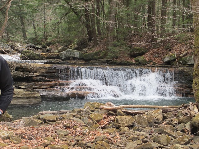
Lora and I headed out in search of four waterfalls in our local area. We headed towards Graysville and found a pull over just at the west end of the chicken houses on Brayton Road. We headed into the woods in search of Moonshine Falls that some of the family told us about. 0.15 miles in we found it and were able to climb down to the bottom of it as well.
From there we headed to the Cumberland trail Rough Creek segment and hiked in. We stayed on the roadbed past the cut off for the Cumberland trail. We hiked a total of 1.42 miles to where the roadbed crossed Brush Creek. Just up from there is Polecat Falls. Then we did some bushwhacking along the bluffs 0.14 miles to Skunk Tail Falls. We had lunch just upstream from there.
We headed back to the car and drove to the top of the mountain again and parked just past the sharp curves to hike to the Brayton Road overlook. From there we followed the roadbed down to Flora branch and walked the creek down to Flora Branch Falls.
It was a great adventure with lots of wildflowers and falls.
Pictures:
Sunday, March 30, 2014
Cumberland Gap
Day One: 7.4
Thomas Walker Trail 0.7
Object Lesson Trail 0.6
Harlan Road Trail 0.8
Ridge Trail 5.3
Day Two: 12
Ridge Trail 10.8
Sand Cave 0.4
White Rocks campsite 0.6
Ewing Trail 0.2
Day Three: 4.3
Ewing Trail 2.9
Road to Ewing 1.2
Wilderness Road 0.2
Total Miles: 23.7
Lora and I headed up to Kentucky at the Cumberland Gap for a backpack. We headed to the visitor center and left our car there. The staff is actually quite knowledgeable, which we are not used to.
We used the paved Thomas Walker trail to get started to the Object Lesson Road trail. We went up to the "Saddle of the Gap" and took the Harlan Road trail to Fort McCook where there is a cannon and overlook. From there we continued to the Pinnacle Overlook for a great view from the mountain top. Yes, all of this has been uphill. By the Pinnacle you can stand in Kentucky and Virginia at the same time. They do have a Tri-State Peak where you can stand in all three states going the other way from the Saddle of the Gap.
We took the loop around Fort Lyon where there is another cannon and started the Ridge trail from there. The Ridge trail is a old roadbed that follows the ridge up and down across the mountain top. There are many views from the trail of the valley below especially in the winter. We hiked 5.3 miles of this trail to Gibson Gap campsite for the night. We saw deer twice on this hike so far.
At the Gibson Gap campsite there are bear bag cables. The spring is 270 yards down hill in a Rhododendron patch. After you climb your way in there is a black pipe with water running out of it. There is a large rock formation next to the camp that you can climb for an aerial view of the campsite. We talked to the owls that night and enjoyed an evening around the campfire.
Day two:
We got up this morning and ate breakfast. It had rained during the night and was sprinkling as we headed out on the trail. The rain continued on and off all day so we did not get many pictures. We stopped for lunch right before Indian Rock which is a rockhouse. We went by the Hensley Settlement and continued on towards White Rocks.
We passed another couple who were headed out to Martin's cabin for the night. The wind started picking up and we took a short break as we headed down to Sand Cave. Sand Cave is a 75-foot high sandstone overhang that is decorated by at least seven different colors of sand. In rainy seasons, a small waterfall cascades over the edge. The room is over an acre in size and the water fall was going strong for us. You do have to climb a fifty foot pile of sand to get into it.
From here we headed to the White Rocks campsite for the night. The wind was blowing so strong we couldn't hold the tent still to stake it down so we headed back up over the ridge top and started down the Ewing trail until we found a flat spot to make camp. After we set up the freezing rain started and then the wet snow. We ate in the tent and wiped the snow off the outside before going to sleep.
We woke up with a thud and the tent was in my face! I told Lora that our tent had collapsed and we started pushing up and banging the snow off. After we got the tent back in standing order, I got out and swept the three inches of wet snow away from the sides.
Day three:
The next morning we ate breakfast inside again. After we got all packed up Lora didn't feel well so we hiked the Ewing trail down to Ewing VA and started hitching for a ride. Nobody picks up hitchhikers anymore. We went door to door for a while and finally got someone to tell us it is Sunday and that is why everyone is gone. She did not have a car so we kept looking. We saw the guy come home in the first house we checked so we went back and met him. He is a very nice older gentleman who gave us a ride back to our car.
In the parking lot we met the other couple that was out for the night. They froze in the cabin and were wet.
This is a beautiful area and we will have to go back to see all the trails and sites we didn't get to cover.
Pictures:
Saturday, March 22, 2014
Prater Place - Fall Creek Falls
Lora and I went to Fall Creek Falls for their Spring Hike. There was 13 people plus the Ranger. We had a great time and met some very nice people from Middle and East Tennessee.
Fall Creek Falls hosts Spring Hike
Mar 22 @ Fall Creek Falls
Meet Ranger Matt at the Nature Center at 9 a.m. CT to carpool to the Prater Place Trail Head. This trail is 2.9 miles one way into Camps Gulf and features beautiful wildflowers in the spring and a small but gorgeous waterfall called Hemlock Falls at the end of the trail. Be prepared for a 6 mile roundtrip hike with a few steep slopes. A parent or guardian must accompany youngsters 12 years old and younger. Contact the Nature Center at 423-881-5708 by Friday the 21st if there have been heavy rains since there is a seasonal creek crossing involved. For more information call 423-881-5708.
Thursday, March 20, 2014
Break Away 2014
Lora and I got the opportunity to spend some time with the college students building the Cumberland trail on Graysville Mt. We met them at the trail head and hiked in to where they were working in the Gilbreath Creek area. The students have built close to a mile so far this month. We got to celebrate Larry Hill's birthday at lunch time with the traditional Happy Birthday song. It's good exercise, you get to meet good people, and it makes you appreciate the trails you hike.
Pictures:
Wednesday, March 19, 2014
Baxter Creek - Smoky Mountains
Two days off and Craig had to work. Hooked up with Amy and we headed for the mountains and Big Creek Ranger Station in the GSMNP. There were lots of cars in both parking areas, the campground was still closed. Our trail crossed the creek and went uphill. And up, and up and up. The elevation profile looked almost vertical, from 1700 ft to 5820 ft. 6.2 miles. We saw a few violets blooming and the leaves and buds of trilliums. This trail is filled with ferns and moss. And some of the rocks were covered with really large lichens. We did see a few huge trees. Then we really started climbing. We saw a huge rock that looked inviting for a lunch spot but two guys with chain saws had the best seats so we kept going until we found another sunny spot. Then we really started climbing. We had a view of the valley below, looked for the power plant, only saw a tower. We did see a HUGE chestnut stump and some giants that had fallen. Higher up we started seeing red spruces. There were blackberry briars further up but I don’t think I would want to do this climb when it’s hot enough for the berries to be ripe! We kept thinking we were at the top and the trail would turn and we kept climbing. We met some folks coming down the mountain. One man and 3 young ladies from Indiana on their first backpack ever. And they picked this trail, and it rained on them last night. They were still so happy to be there and I find that very cool. They said they would definitely be back.
Then we really started climbing. We passed the trail to the water source and knew we were near the camp. The Firetower greeted us at the top. We looked around for a flat spot to set up our tents, most areas are somewhat slanted except at the tower and that spot was taken. We set up and then climbed the tower. The views were incredible. Thankful for clear skies. We hiked back .2 miles to the water trail. We found a small stream, where it was running over and down a rock Amy started collecting water. I hiked on down to find the pipe. It was a trickle. The better source was where Amy stopped. Back at camp the wind had picked up. And then it howled, and howled, and ……we cooked our supper, potato soup for Amy and pinto beans with roast beef for me. We decided against building a fire in the howling wind and walked up to warm up at our neighbor’s fire. The sparks and smoke chased us around for the few minutes that we could stand it. We gave up and went back to camp. We were going to hang our food at the bear cable but there was a tree laying on it and only one cable was usable. And it was being used. We found a limb for our food bag, tied the rope to a stick and the fun started. I made a half dozen efforts. Makes me remember playing ball with my nephew when he was 5 and telling me “Aunt Lora you throw like a girl” so Amy tried tossing the stick over and got it on her first try! Unfortunately the rope wouldn’t pull over the spur in the limb. Back to the start, a few more tosses and picking the line out of the bushes and it finally went over in just the right spot. We just hoped the wind wouldn’t take it down. Bed time. Couldn’t tell if we had any wildlife visitors or owls talking thru the night. I had to use earplugs to block out the howling noise. The little brown book says this is one of the highest campsites in the park, and I believe the coldest because of the wind.
Up early next morning, wind was still blowing. But the sun was shining! We broke camp and started across the ridge on the Mt Sterling Trail to the connection with Mt Sterling Ridge Trail. It’s a beautiful ridge walk. We went down the Swallow Fork Trail and Amy found it much more pleasant this time. Last time she walked up it in cold rain. We had some beautiful views from this trail and lots of streams. We also ran into several hikers, one that we thought was a news guy from the network political scene. When we started down the Big Creek trail we saw the devastation from storms. So many trees had come down from the tornado last year it must have taken weeks for the chainsaw crews to get thru here. As we got closer to the campground we started seeing lots more folks on the trail. This is a beautiful creek trail. It will be full of blooms in the next week or two. We saw some of the yellow trilliums opening in the sunshine. The parking lot was full again. This is spring break week for a lot of schools and the young people were out in force. Good to see so many young people out on the trails. Back on the road, I took Amy to her car in Crossville, she headed to Nashville and I headed home.
Beautiful trails and a great time in the mountains.
Tuesday, March 11, 2014
Abrams Creek - Smoky Mountains
Day One: 7.3
Cooper Road 0.9
Little Bottoms 2.3
Abrams Falls to falls 1.7
Abrams Falls 1.7
Little Bottoms to #17 0.7
Day Two: 9.7
Little Bottoms 0.7
Hatcher Mountain 2.6
Cooper Road 2.2
Gold Mine 1.6
Cooper Road 2.6
Total Miles: 17
Lora and I headed out to Abrams Creek campground in the Smoky National Park. We found out that they have taken the signs down since they closed the campground as we drove by at a high rate of speed. We stopped and asked some Rangers(?) where the road was and they said the sign was down, but they could not describe where it was. So, we found it on the way back. There is a sign coming from the South.
There was one other car at the trailhead as we headed out. We took the Cooper Road trail to Little Bottoms. We passed by our campsite #17 as we headed on to Abrams Falls. We did get to see the tornado damage in this area from a couple of years ago. We passed a couple that was out backpacking near the Hannah Mountain trail. We went on to the falls and as always there were lots of people at the falls.
After visiting a while we headed back to our campsite. When we got back to the Hannah Mt. trail we stopped for a snack and the couple was still there. They were attempting to cross the Abrams Creek. The water was not up very far, but the lady had already had a panic attack trying to cross. The guy now had a rope going across the creek and they were attempting one more time. He had already took both packs across. Lora gave the girl a pep talk and we watched as she made it across. We thought we were going to have to help her across. We cheered her on and then untied this end of the rope after she made it.
We got to camp and got everything set up. We enjoyed a quite evening sitting by the fire.
The next morning we got up and headed back to Hatcher Mountain. We saw some horse riders at the Cooper Road crossing. They had come from Gold Mine and asked why when we told them we were going to hike Gold Mine. Because it was there? We are stupid like that, I told them. They got a laugh.
We met a Ranger on the Cooper Road trial who was heading out to check the archaeological site. We then headed up Gold Mine. About halfway up the trail we noticed a side trail being built. We took it a couple hundred yards and then came back. When we got up to the top we found the other end of the new trail. There is a old barn up top as well.
We hiked back down and then took Cooper Road on out. There were a lot of cars in the parking area when we got back and a guy that was going to do a day hike too.
Pictures:
Cooper Road 0.9
Little Bottoms 2.3
Abrams Falls to falls 1.7
Abrams Falls 1.7
Little Bottoms to #17 0.7
Day Two: 9.7
Little Bottoms 0.7
Hatcher Mountain 2.6
Cooper Road 2.2
Gold Mine 1.6
Cooper Road 2.6
Total Miles: 17
Lora and I headed out to Abrams Creek campground in the Smoky National Park. We found out that they have taken the signs down since they closed the campground as we drove by at a high rate of speed. We stopped and asked some Rangers(?) where the road was and they said the sign was down, but they could not describe where it was. So, we found it on the way back. There is a sign coming from the South.
There was one other car at the trailhead as we headed out. We took the Cooper Road trail to Little Bottoms. We passed by our campsite #17 as we headed on to Abrams Falls. We did get to see the tornado damage in this area from a couple of years ago. We passed a couple that was out backpacking near the Hannah Mountain trail. We went on to the falls and as always there were lots of people at the falls.
After visiting a while we headed back to our campsite. When we got back to the Hannah Mt. trail we stopped for a snack and the couple was still there. They were attempting to cross the Abrams Creek. The water was not up very far, but the lady had already had a panic attack trying to cross. The guy now had a rope going across the creek and they were attempting one more time. He had already took both packs across. Lora gave the girl a pep talk and we watched as she made it across. We thought we were going to have to help her across. We cheered her on and then untied this end of the rope after she made it.
We got to camp and got everything set up. We enjoyed a quite evening sitting by the fire.
The next morning we got up and headed back to Hatcher Mountain. We saw some horse riders at the Cooper Road crossing. They had come from Gold Mine and asked why when we told them we were going to hike Gold Mine. Because it was there? We are stupid like that, I told them. They got a laugh.
We met a Ranger on the Cooper Road trial who was heading out to check the archaeological site. We then headed up Gold Mine. About halfway up the trail we noticed a side trail being built. We took it a couple hundred yards and then came back. When we got up to the top we found the other end of the new trail. There is a old barn up top as well.
We hiked back down and then took Cooper Road on out. There were a lot of cars in the parking area when we got back and a guy that was going to do a day hike too.
Pictures:
Labels:
Abrams Creek,
Cooper Road,
Gold Mine,
Hatcher Mountain,
Smokey Mountains
Saturday, March 8, 2014
TTA Rock Creek Segment CT
Cumberland Trail Volunteers Ava Navin, Bob DeHart, Carol Deakins, and Don Deakins accompanied Murfreesboro Chapter of Tennessee Trails Association Sara Pollard, Tony Jones, Ann Jacobs, Faith Bennett, Roy Duncan, Wayne Yancey, Rebekah Norman, Lora and I on a 7.5 mile Cumberland Trail hike.
Sara was the hike leader for this hike. Plan A was for her to meet the Volunteers and I at the Lower Leggett Trail head. Plan B was for us to meet them all at the Retro Hughes Trail head. Plan C was Sara was gone when we got there and had taken Ann to drop off a car at the Lower trail head. So finally we got on the trail with twelve hikers. Lora was going to hike in from the Lower trail head when she got off work.
We began at Retro Hughes Trailhead. We had a good hike and got credit for some trail maintenance on the way. Don lead the way and headed up all the maintenance. Everyone but Sara stopped at the Rock Creek Campsite for lunch. Sara, who was just refusing to stop, went ahead and scouted out some more of the trail. OK, the front pack of hikers went down to check out the creek and Sara just kept on hiking. When the rest of us got there we noticed that Sara was not with us and sent a scout to go find her.
We took a side trip down to the top of Flat Branch Falls, paused at Rock Creek Overlook for the view, turned right at Boiling Spring onto the lower half of the loop trail, and ended the hike at Leggett Road Lower Trailhead. Just after the loop start, Lora met us and joined us for the rest of the trail. Weather was perfect and, as usual when with hikers, the company was superb.
Pictures:
Tony's Pictures:
Don's Pictures:
Bob's Pictures:
Sunday, March 2, 2014
Bandy Creek Hike
Day One: 10.4
Oscar Blevins Farm Loop 3.6
Collier Ridge Loop 1.5
West Entrance Trail 2.4
Katie Trail 1.0
John Litton Farm Loop 1.9
Day Two: 4.7
John Litton Farm Loop 3.7
Katie trail 1.0
Total Miles: 15.1
Lora and I headed up to Big South Fork. We started at the Bandy Creek Trail head and went to the Oscar Blevins Farm. We did the tour and then took the farm loop to the Collier Ridge Loop going towards the West Entrance. We then took the West Entrance trail back to the Oscar Blevins Loop and back to the car to pick up the backpacks. Very nice section of the park. We even got to see some historic horses at the farm and one historic cat.
When we got our backpacks we hiked to the campground and took the John Litton Farm Loop to the Fall Branch Falls. It was getting time to make camp and there was a campsite at the falls with a bench, fire ring, and a good stack of firewood. Lora asked " should we camp here or hike a little farther?". After a quick rap to the forehead she came to her senses and said this would be a good place to stay tonight.
Soon we had a fire going and camp set up. We had the view of the water fall to eat our dinner by. Three other backpackers came by, looking at us with envy, and continued down the trail.
After a wonderful evening we got up and had breakfast. It was warm already this morning as we headed out to finish the loop and toured the farm. We had planned to continue to the Jack's Ridge Loop when the rain changed our minds and we headed back to the car.
On the way back to the car I lost dear Lora in the mud. Well, it looked that way when we hiked back looking for her hat that had fallen off and was laying in a big mud bog.
On the way home after hiking in the heat, we passed a brine truck spraying the roads. What???
Pictures:
Oscar Blevins Farm Loop 3.6
Collier Ridge Loop 1.5
West Entrance Trail 2.4
Katie Trail 1.0
John Litton Farm Loop 1.9
Day Two: 4.7
John Litton Farm Loop 3.7
Katie trail 1.0
Total Miles: 15.1
Lora and I headed up to Big South Fork. We started at the Bandy Creek Trail head and went to the Oscar Blevins Farm. We did the tour and then took the farm loop to the Collier Ridge Loop going towards the West Entrance. We then took the West Entrance trail back to the Oscar Blevins Loop and back to the car to pick up the backpacks. Very nice section of the park. We even got to see some historic horses at the farm and one historic cat.
When we got our backpacks we hiked to the campground and took the John Litton Farm Loop to the Fall Branch Falls. It was getting time to make camp and there was a campsite at the falls with a bench, fire ring, and a good stack of firewood. Lora asked " should we camp here or hike a little farther?". After a quick rap to the forehead she came to her senses and said this would be a good place to stay tonight.
Soon we had a fire going and camp set up. We had the view of the water fall to eat our dinner by. Three other backpackers came by, looking at us with envy, and continued down the trail.
After a wonderful evening we got up and had breakfast. It was warm already this morning as we headed out to finish the loop and toured the farm. We had planned to continue to the Jack's Ridge Loop when the rain changed our minds and we headed back to the car.
On the way back to the car I lost dear Lora in the mud. Well, it looked that way when we hiked back looking for her hat that had fallen off and was laying in a big mud bog.
On the way home after hiking in the heat, we passed a brine truck spraying the roads. What???
Pictures:
Saturday, February 22, 2014
Flipper Bend Trail - N. Chickamauga Creek WMA State Natural Area
Flipper Bend Loop: 9.0 miles
Clear Branch Long Loop: 4.9 miles
Powerline x 2: 1.46 miles
Total Miles 15.36
Lora and I headed back to the N. Chickamauga Creek WMA State Natural Area to finish the trails in that area. We needed to finish the Flipper Bend Loop and hike Clear Branch Long Loop.
There are no longer any signs at the trailhead and the kiosk no longer has anything on it. It is sad that people feel the need to destroy things and really they get nothing out of it either.
The first leg of all the trails from the parking area to the loops is a mix of old road bed and trail. You really have to watch the trail marking to stay on the right trail as there is many old road beds and trails. When you get to the loops you will find the first sign on the trail.
Our first loop was the Flipper Bend Loop and we did it clockwise or at least tried to. We followed the trail to the powerlines and that was the end of the markings. It just ends at the powerline road with no marking to which way you are supposed to go. We searched and searched for another marking, but found none. Lora made a call and they said to just follow the powerlines East to the overlook, so we did. Just before we got to the overlook we crossed the other side of the loop trail. It actually had a trail marker on the powerline post and across the clearing on the trees.
We enjoyed the Powerline overlook and did some off trail across the top of Powerline Falls and to another overlook on the far side. This is where we ate our lunch.
After lunch we hiked back to where the trail crossed the clearing and took the top part of the trail now counter clockwise to see where we missed the markings on the far side. This section of the trail follows the Chickamauga Creek Gorge. There is a side trail that looks like a campsite which is actually the Pocket Wilderness Overlook described in the trail description. All of this section is clearly marked mainly over rolling hills. There is also a very large rock out in the middle of the forest that the trail goes by too.
When we finally came out on the powerlines again we were 0.12 mile East of where we came out of the woods on the original loop. So if you were hiking the Flipper Bend Loop going clockwise, when you get to the powerline turn East or right and go down the hill and up the other side which is about halfway between the two powerline structures. The trail then goes North or left into the woods. If you are hiking the loop counterclockwise, then when you come out on the powerline turn West or right and go 0.12 mile and turn South or left and enter the woods.
We then followed the power lines back to the overlook and continued the loop. When we came to the Clear Branch loop we took it to the Clear Branch Long loop which starts right after you cross Clear Branch. The 4.9 mile Clear Branch Loop follows the bluff line for some really beautiful views and then circles back on old roadbed through the woods. There is a sign at the beginning of the loop. We followed the trail back to the Flipper Bend access trail back to the car. It was a long but beautiful hiking day.
Trail Descriptions:
Map:
Pictures:
Subscribe to:
Posts (Atom)