Showing posts with label Appalachian Trail. Show all posts

Wednesday, October 4, 2017

AT - Dicky Gap to VA 625


Day One: 10 Miles
Dicky Gap to VA 601
Day Two: 10.9
VA 601 to Chatfield Shelter
Day Three: 11.4
Chatfield Shelter to Reed Creek
Day Four: 11.3
Reek Creek to Lick Creek
Day Five: 1.4
Lick Creek to VA 625
Total Miles: 45

When Lora got off work Friday we drove to Hungry Mother State Park so we would be able to start our backpack earlier on Saturday. This is a beautiful park in Marion, Virginia. Three different camping areas and a pretty lake. We had supper at the restaurant there, outside with a view of the lake. Good food. We joined the interpretive Ranger at the group campfire, she had marshmallows to roast and a story of how the park got it's name.

Saturday we drove the Back of the Dragon to meet our shuttle driver Bubba. We blew pass our unmarked VA 625 and had to turn around and drive back to find it. VA 625 is a long rough gravel road. Bubby was waiting for us at the trail head. We left our trusty Subaru and headed to Dickey Gap with Bubba. He had lot's of stories to tell. We spotted a groundhog and some deer on the drive.

We hiked to just before VA 601 and started to set up camp when a hiker came through. We asked how close the next road was. He pointed behind us and said "Right there" hmmmm. We picked up the packs and moved on past the road up on the ridge.

DAY TWO:

Sunday we saw lots of deer and chipmunks, and heard a bear crash thru the woods by the creek. We went up and over lots of ridges with only one view all day on Glade Mountain. Lots of South bounders, all of them telling us there was no water going North. It made us nervous about having water until we kept crossing water.  One guy finally told us, North of where our car was, water was scarce, about 15 to 19 miles between water sources.

The Partnership Shelter was impressive; Built with logs, and a SHOWER! That was a first for us. To bad it was too early to camp. We went into Mt Rogers Ranger Station/visitor Center and saw a huge stuffed Hellbender salamander. They had a live one too in an aquarium.

Chatfield Shelter was our camp spot for the night. We hung our hammocks and gathered wood, Two guys showed up and hung their hammocks on the other side of the shelter. We swapped blog addresses.

DAY THREE:

Monday we crossed lots of water. Saw deer, chipmunks, and two grouse startled us. We crossed train tracks, cow pastures, boardwalks, and I 81 where we stopped for chips and tea to go with our PB/J sandwiches. We ate lunch on the wooded hillside overlooking the ducks swimming in the creek.

We stopped at the Old Settlers Museum and looked at the school. Three apple trees in the back got our attention, Yumm!, and then Lora spotted the grape vine growing up the back of the school house and they were ripe. We traveled on munching apples and grapes. We passed through more farmland, and old apple orchards, and saw wild cherry trees. Found a crooked style, but no crooked man walking a crooked mile.

Got to Reed Creek in Crawfish Valley and found a sweet campsite. The water was in different pockets, we found one that had enough for taking a bath. While I was scooping water I saw a Hellbender salamander in the creek. I was so excited being the first one I have ever seen in the wild. Lora saw it's tail, but it hid under a big rock. We went back to the creek after dark and she saw its head but it was still too far under the rock. I told her to look around in the creek for more. She was real excited until a spider bigger than the salamander scared her out of the creek.

That night by the fire we had owls and coyotes talking to us for a long time, then one owl that came into camp way in the night to see who was hooting earlier.

DAY FOUR:

Tuesday we hiked in all sorts of ecosystems. Open fields, farmland, new forests, old forests, cedar forest, and lots of fences. We became experts at style climbing. Lora stepped in a cow patty after crossing VA 610, but got over it after the climb and view back at the valley.

We passed by the Historical Tilson Mill which ground wheat and corn in the 1860's for the residents in North Fork Holston River valley. Another good water source.

We then stopped at the Knot Maul Branch shelter for a break. It stunk of moth balls and does not have a reliable water source.

Lynn Camp mountain was a good climb for late in the afternoon. Lora saw a yellow jacket fly into a hole on the side of the trail. When she walked by about twelve flew out. I gave the command "RUN" and we took off up the mountain. Luckily not stings. On the way down the other side we had a massive tree across the trail that we had to climb through.

We continued on to Lick Creek where we spent our last night. Lots of owl talk again during the evening.

DAY FIVE:

We hiked the last mile to our car. We could hear the beagles from the bear hunters. Hunting season started two days ago. We found our car under a heavy dust from the road and leaves. On our way back to town, we picked up a backpacker. Took him to town and then dropped him off at Mt. Rogers headquarters.

The weather was great for our whole trip. We never used our tarps at all. A bright moon every night and lots of stars in the clear sky. Overall we saw right at one million chipmunks, lots of deer, grouse, ducks, squirrels, and the Hellbender. Our flowers were Gentain, Asters, Queen Anne Lace, Golden Rod, Thistle, Daisy, and lots of unnamed ones.

Pictures:


Wednesday, October 19, 2016

AT - Damascus to VA 16


Day One: 9.8
Damascus to Saunders Shelter
Day Two: 12.6
Saunders Shelter to Whitetop Mt. Rd
Day Three: 12.8
Whitetop Mt. Rd to Big Wilson Creek
Day Four: 10.8
Big Wilson Creek to Hurricane Mt. Shelter
Day Five: 5.1
Hurricane Mt. Shelter to VA16
Total: 51.1

We left Friday evening and stayed at Panther Creek State Park for the night. Saturday morning we got on the trail in Damascus. In the parking area there was another couple in a blue Subaru the same year as ours, so we had to say hi. We hiked to Subway and picked up our lunch/dinner for the day and got on the trail.

The weather was great and so was the hike. This time we passed the 500 mile mark on the AT. We had fires each night and slept without our tarps every night. The moon shone like a streetlight every night. We saw a lot of Southbound Thru-hikers and dodged some bikes on the Virginia Creeper trail. We went without our drink mixes and hot chocolate that LORA forgot to pack.

After we dodged some bikers on the Virginia Creeper trail, we joined back up on the AT and met the couple from the Subaru coming at us. They were doing a day hike. Shortly after that Lora checked my heart by doing her high pitched school girl scream. The snake about had a heart attack as well. We saw lots of woolly worms on the trail, none with the same color pattern. We also got to see our first honey bee hive in a tree.

We spent our first night with eleven others at the Saunders Shelter. Lots of visiting took place around the campfire. We also found out that LORA forgot the hose to our water filter.....luckily I carry my pump as well.

Day Two:

We got up and did us some hiking today. We leapfrogged with a couple of Kentucky boys that were at the shelter last night. We passed two other guys early in the morning who said they were out of water. We passed around eight crossings right after that so not sure why. We had to do some more bike dodging as we did another short section of the Virginia Creeper trail.

We were so proud of our accomplishment today, we stopped at our campsite for the night at 1:45 in the afternoon. When we figured that the phone had the right time, we picked up our packs and continued hiking. We climbed and climbed and climbed and finally ended up on top of Whitetop Mountain. There was a little boy and his dad at Buzzard rock enjoying the view. We came to the piped spring, cleaned up, filled up and found us a campsite for real. Another beautiful night. We walked back to the road and watched the sunset.

Day Three:

It was a very rocky day today as we climbed up Mt. Rodgers. We took the side trail to summit the mountain. We found ourselves looking at a pile of rocks with no view in the woods. Not very impressed with that summit, we ate our lunch and hiked back to the AT.

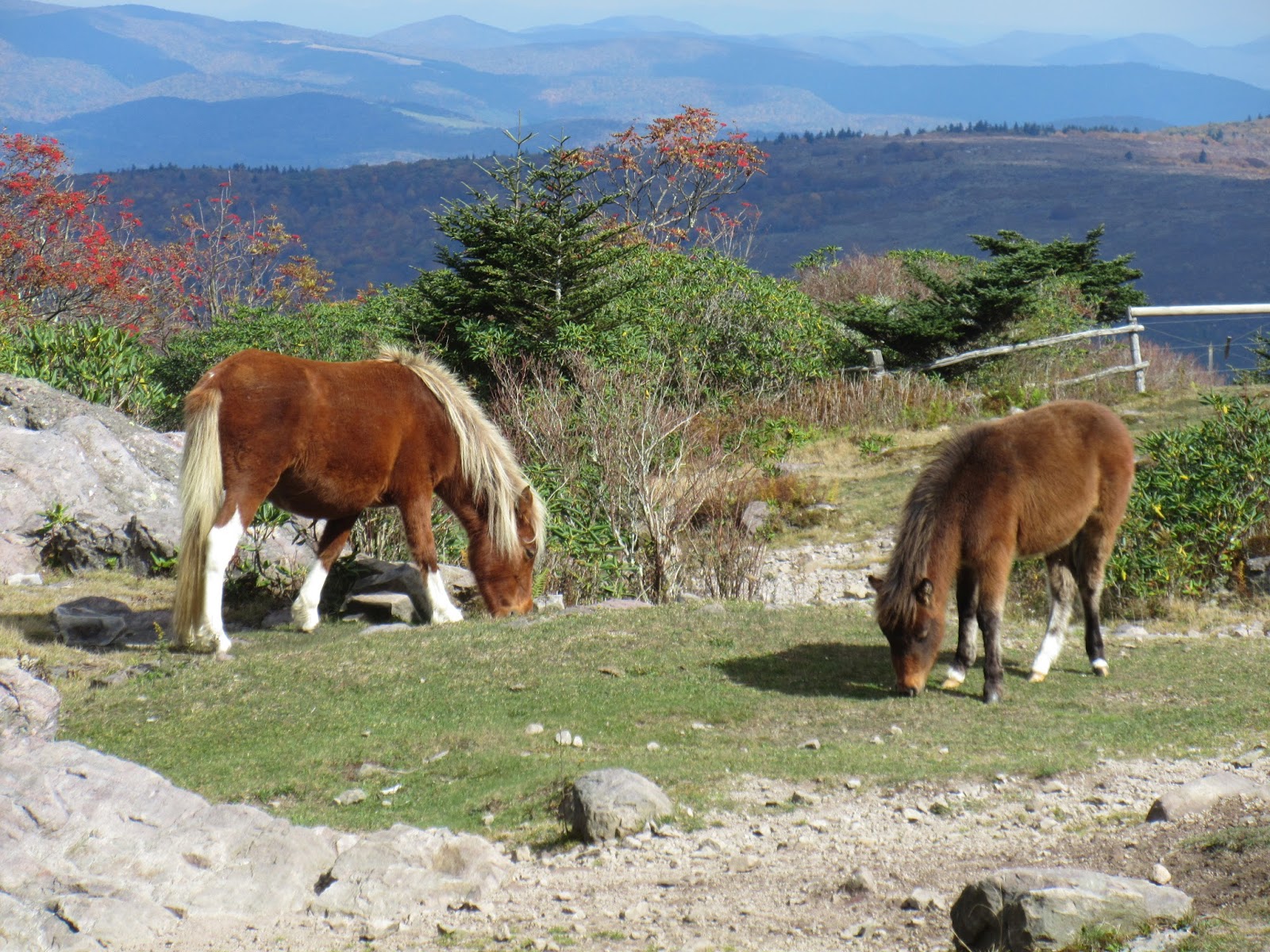
The Thomas Knob shelter was more impressive with the fancy logs and upstair sleeping room. Right after that you get to some great views as the trail follows along the rocky peaks and the wild ponies are everywhere. We squoze through the Fat Man's Squeeze and saw a couple flying a kite. They had a camera attached lower on the string to get some good views.

We crossed through the Grayson Highlands State Park which was uneventful. There is plenty of water sources and camping area's before the Wise Shelter. We went beyond the shelter to the campground beyond Big Wilson Creek. We had another hiker to visit with that night around the campfire. Sometime in the night we woke up to light rain from an absolutely clear starry night. Not sure how that happened, but it didn't last long. We heard coyotes and owls through the night.

Day Four:

Windy this morning. Very windy! Lora had a hard time staying on the trail across the Scales with the wind blowing her. We saw some bear scat and cows on the way across. As we approached the corral, we saw a cow butt in the trail. We hollered to get it's attention and it turned and looked with it's long horns. As we got closer it started walking down the trail and later followed us through the gate at the corral so we could close it in with the other longhorns.

We continued to the Hurricane Mt. Shelter where we made camp across the trail next to the creek. We heard a Screech Owl that evening and we had a noise that sounded like limbs breaking all night long. Never could find what that was.

Day Five:

We woke to the call of a crow. He didn't want us to sleep in today. We continued on the trail to VA16. We got to see the Comers Falls which is pretty much a small cascade on the way. Dad and Mom picked us up and took us back to Damascus to the car.

Pictures:

Sunday, March 27, 2016

AT - US 321 to Damascus, VA


Day One: 7.1 miles
U.S. 321 to spring after Wilbur Dam road

Day Two: 9.9
Spring to Spring after Monument

Day Three: 11.6
Spring to Double Springs Gap

Day Four: 11.4
Double Springs to Spring before Damascus

Day Five: 1.9
Spring to downtown Damascus.
Total Miles: 41.9

We met Mom and Dad in Damascus Virginia and got our car registered to leave in the parking lot by the old Mill. We took the extended trip to the trailhead on U.S. 321 because I missed a turn. With Love and brownies we headed off.

We walked around the lake and across the dam seeing lots of wildflowers and a few day hikers. We noticed a sailboat out on the lake and thought about my brother in Michigan. He should have his out by now (Smile).

We climbed up the ridge and got some good views from above of the lake. We camped at the first spring after Wilbur Dam road for the night. Lora stumbled and fell over a rock while looking at the spring. No damage other than hurt pride. We got to listen to owls during the night while we sat around the fire.

Day Two:
Lots of views from the ridge line that we hiked. We passed two more shelters and checked out the Nick Grindstaff Monument, which was for a famous hermit. I don't know how he got famous, but I guess he pulled it off. We camped at the spring just past it. It started to rain just as we were ready to make dinner, so we cooked and ate under the shelter. We had already started the fire, so after dinner when the rain stopped, we got to spend some time enjoying the fire.

Day Three:
The rain had quit by the time we got out of bed. We got packed up and hiked in the fog for awhile and then it cleared up for some more sights. When we were taking a break at the Double Springs shelter, a thru hiker from Montana stopped in. We enjoyed a visit with him and learned that most of the thru hikers were well behind us. We saw him again at Double Springs Gap where we spent the night. He and six of his buddies went on to the next shelter.

Day Four:
Today we saw the foundation from where a fire tower stood on McQueens Knob. We also saw the oldest and smallest shelters just past there. We saw more thru hikers today and other backpackers heading south. Then the celebration for us at the Virginia State Line! Three states down....??? to go. We camped at the spring just out from Damascus.

Day Five:
Just a short hike today to down town Damascus. We visited the hiker supply store just because we could.

Pictures: 


Sunday, October 11, 2015

AT- Carvers Gap to Hwy 321


Lora and I headed back to the Appalachian Trail. We celebrated our fifth anniversary on the trail, we completed the four hundred mile mark on the AT, and we finished North Carolina. We would be farther on the AT, but we are too busy backpacking everywhere else.

Day One: 8.7 Miles
This time starting at Carvers Gap. The battle was on for a parking spot, but we found one in the back. This is a very popular area and with no parking then no hiking. The first two balds, Round and Jane, are very popular so you won't hike these alone. Once beyond Jane Bald you start to feel like you on the trail again. We took a quick break at Stan Murray shelter, but our goal was Bradley Gap for the first night. The sun was shining and it was hot for backpacking today, but the views were spectacular. We were pretty tired by the time we made camp. We met a few "Southbounders" today and would see more as we went.

We didn't spend long around the fire tonight, but were awakened all night long by wildlife heading through camp. Some were rabbits, deer, and coyotes. Got to listen to some owls and coyotes.

Day Two: 12.7 Miles
We started out today with the climb up Hump Mt. which is another grassy bald. We jumped up three deer on the way up to a wonderful 360 degree view of the mountains. We could look back at Roan Mt. and look over and see Grandfather Mt. From there we went down to Doll Flats where we left North Carolina for good. It was covered in Crab apples. The Apple House Shelter is no more, but we stopped at the site for lunch.

After crossing Hwy 19 we did lots of climbing. We ate apples as we went through old orchards. We saw another four point deer and more Southbounders. We had hiked to Jones falls in the past, so we didn't stop there. We continued on down to Elk River for the night and camped on the side of a field. We didn't stay up around the camp fire long tonight, as we were tired out again. Lora saw a deer in the field once when she got up and heard some owls.

Day Three: 12 Miles
Today was more a walk in the woods. We celebrated our fifth anniversary today and went over the 400 mile mark of the AT. We saw more Southbounders and one making 25 miles a day, stopped and showed us some pictures of the wild horses in Virginia. More apples and we scared up some grouse. There were lots of water crossings today and lots of campsites. When we ran out of campsites is when we realized we had passed ours. So we just kept on climbing and stayed by the Moreland Gap shelter. We met three great people from Virginia at the shelter. After we set up our camp and ate dinner, we joined them by the campfire. It was not too much longer before the rain set in for the night.

Day Four: 7.9 Miles
Today's big sight was Laurel Falls. It was a deep descent into the gorge on rock steps. Rough going for sure, but worth it to see the falls. The trail then curved around the rock walls on a very narrow trail along the river. After that was the climb out and up to the shelter which stood up on a rock ledge with drop offs all the way around it. Not a good place to camp, but had water. We stayed in the shelter as the rain started again and our friends from last night joined us.

Day Five: 6.8
Our walk out this morning started with a river walk and then the climb up Pine Mt. to Pond Flats. Three miles of up hill followed by the descent to Hwy 321. We did back and forth with our new friends on the way down. Our happy shuttle arrived with cookies. We enjoyed the ride back and dinner with Dad and Mom.

Total Miles: 48.1

Pictures:

Wednesday, October 8, 2014

AT - Devils Fork Gap to Carvers Gap


Appalachian Trail - Devils Fork Gap to Carvers Gap in six days 67.8 miles.

The trail head was a Stile over a farm fence and just on the other side was an apple tree with ripe apples.  What a way to get going.  Our packs were heavy with eight days worth of food including a foot long Subway hanging on the back of mine for tonight's dinner.

It didn't take long for us to get our rain gear on to start the hike right and off we went.  At 1.8 we were at 4000 feet at Sugarloaf Gap.  Fog had rolled in so no good views.  We hiked to the Hogback Ridge Shelter for the night.  We were thinking about maybe staying in the shelter, but Rare Breed from Louisiana and Mike from Chicago where already there. Rare Breed was a Southbound through hiker, which were just now coming through this area. We set up our tent, ate, and called it a night. 6.1 miles.

Day Two:

We got up to Mike telling us it was morning.  We got on the trail not long after him. Not too far until our first view of the mountains from a vista just off the trail. We went up to High Rock (4,460 ft) for another great view and then caught up to Mike coming out of Sam's Gap.  He hiked with us until lunch time. We climbed up from the trail and found ourselves standing in someones back yard.  As we ate, some bird tagging people came through and said that they would see us up on Big Bald.

After lunch, as usual, we climbed.  Went up to 5,516 feet to Big Bald.  We noticed icicles on the trees.  Lot's of great views from there.  The next hill was Big Stamp where they had nets set up to tag birds.  There was a group up there and they had already caught a few. The nets stay up there and they had had problems with the nets freezing in the closed position. On the way down we passed Bald Mountain Shelter where Mike was planning on staying. Never did see him again.

We hiked on to Whistling Gap to camp for the night.  When we went to the spring, we found it dry so we climbed down a little further, across an old roadbed, and into the Rhododendron to find water. We sat around a fire that night and listened to a Great Horned owl. I talked back to him and got him to come closer, Later that night we woke to a screech owl talking to us.  13.5 miles.

Day Three:

We decided to start the day with a climb as if we didn't every day.  We climbed up to High Rocks at 4,100 feet for a view. There was a car parked at Spivey Gap and we found it to belonged to some trail Maintainers who we met further up the mountain.  The were with the Tennessee Eastman Hiking and Canoe Club and were lopping some branches.

We have seen our first concrete block shelter.  No Business Knob shelter has a concrete foundation and block walls.  Now that took some work!  We ate lunch at the shelter and then headed to Erwin, TN.  You get some good high views of Erwin before you drop the 1500 feet over two and a quarter miles down to the Nolichucky River.  At the bridge we saw a few hikers at Uncle Johnny's Hostel. We continued the 1.2 miles to the Nolichucky Gorge Campground.  Here we were met with some very friendly people.  They even invited us to a potluck Spaghetti dinner that they do every Sunday.
After we showered and put on some fresh clothes, we spent the evening eating and visiting with a group including a great campfire. The campground is under new management which they say the old manager was against thru hikers.  14.7 miles.

Day Four:

The day started with a 2300 foot climb to get started.  We passed a doe that was just staring at us. She just stood there watching us as we went by.  Acorns were like marbles on the trail.  We passed Curley Maple Gap shelter, another block structure.   As we were going down to Indian Grave Gap four backpackers with very large grins on their faces told us that there was a trail angel at the road. We were served sweet tea, banana bread, and brownies.  He also had coffee and an a assortment of fruit. He said that this was his ministry and did it every weekday. It was SOOO good!

As we climbed from the road to the Beauty Spot, the bottom dropped out. The wind was strong and it was pretty miserable out for the climb.  We get a view from the top with the clouds coming over the mountains, but no pics.  You will have to look at our pics from our last visit to this area. We continued on scaring two more deer to Deep Gap for the night. Lora's rain jacket gave up and started leaking. Guess who's going shopping after this trip? We had a good piped spring here.  No fire as the rain continued through the night. Hunters drove the road through the evening and morning hours. 12.1 miles.

Day Five:

Today we started out with a climb.  Unaka Mountain is 5,180 feet. We passed Cherry Gap shelter and climbed Little Bald Knob where we had lunch and dried out our equipment.  We passed some other hikers and headed down to Iron Mountain Gap.  After the gap the rain began again.  We passed through the apple orchard and ate us some apples.  Yummy good!  The wind was crazy strong and we finally found a large rock to take shelter under.

The wind continued all the way to Greasy Creek Gap where we stayed the night. We were out of the strong wind, so we dried all our gear out and had a good campfire.  There was a piped spring for our water.  We heard owls as we went to sleep and then hear the rain all night long again. 12.2 miles.

Day Six:

After treating blisters, Lora was going to call it day today.  We hiked lots of ups and downs today. Roan High Bluff is at 6,200 feet. The closer we got to Roan Mountain the more people we saw.  We stopped on the climb for some lunch. Somewhere on the climb up Roan Mountain a buck passed us on the down hill side.  He was plumb getting it and got a good jump out of us. We had a few good startles from grouse as well.

When we got up to where the old Cloudland Hotel used to stand, we tried to get a phone signal out with no luck. A man came by and told us that the road was closed from Carver's Gap.  He had a book in his car with the phone number to the Mountain Harbour Hostel.  So we hiked down to Carver's Gap and went down the row of cars to find his.  He left the book in the window of his car for us to get the number.  As we were looking another couple asked if we needed anything.  Turns out they were staying at the Roan Mountain State Park and gave us a ride to the hostel.  The Owner of the B&B recognized us from our stay a few years ago. You have to do her breakfast there even if you are not hiking!  As we were signing in, a young man was trying to get a ride back to Uncle Johnny's.  So we shared the shuttle to Uncle Johnny's and then he gave us a ride back to our car at Devils Fork Gap. It is amazing how everything works out.  God is Good! We drove to Hot Springs and had dinner at Still Mountain Restaurant and Pub. Really good food. After dinner we asked the waitress where a good motel was and she said here. Really? yes out back they run the Creekside Court Motel. OK and good for us! 10.4 miles.

Pictures:


Wednesday, January 1, 2014

AT - Max Patch to Devil Fork Gap


Day One: 7.5 Miles

We met Dad and Mom in Knoxville and headed to Devil Fork Gap to drop off our car.  We dropped off the car and then headed back to Max Patch Road to drop us off at the trailhead there.  We got on the trail at 2:00 pm.

Our first people were at Max Patch 0.8 mile down the trail.  We met a lady hiker that is with the Nashville Meet Up Group who was up here celebrating her parents 50th anniversary with family from all over.  That was one of many, many day hikers up on the Bald.  We went over the bald and met a rabbit hunter in the woods.  They had gotten six rabbits so far that day.  After leaving him, it started sprinkling on us and we ended up hiking in rain gear.  The wind started blowing and we were thinking that we didn't really want to spend the night on top of a mountain in this weather.  By the time we got to the Walnut Mountain Shelter, the wind was about blowing us off the trail.

There was a couple of folks standing by the fire in front of the shelter and when we peeked inside there were eight beady eyes looking back at us.  There were two tents set up out back of the shelter.  We were invited to stand next to the fire to warm up or I guess get whatever heat you could in this wind.  We looked around and then down the side of the mountain at a flat spot by the spring.  It did not take us long to make up our mind and get out of the wind.  We set up our tent by the spring.  It was still raining and we could hear the wind howling over the mountain above our heads.  We ended up cooking and eating in the tent that night.

Day Two:  13.1 Miles

The wind had stopped and the rain was mostly over with lots dropping off the trees when we got up.  We ate breakfast in the tent and then packed up.  When we got up to the shelter, the guys were up and wet.  They said that the rain blew right into the shelter and through the sides.  They said that we were the smart ones, which came as no big surprise to us:)  They were going to Hot Springs.  They were planning on staying another night at Deer Park Mt. Shelter, but were just going to hike out with wet gear.

We stopped at Garenflo Gap for lunch and to dry equipment out.  As we were packing back up a group of Boy Scouts went by.  Later, we would find out that this was the same group that we met last night.  We visited with them numerous times as we leap frogged them on the trail.

As the day continued the sky cleared up and we had some better views.  Before long we were viewing Hot Springs from above.  We hiked into town, checking out the hiker's hostels.  We stopped at the Smoky Mountain Diner to find that they close at 4 pm on Sunday.  They we're very friendly and stayed open for us as it was 4 now.  We had the Hungry Hiker burgers and they were great!  We visited with one of the owners ,Genia, who has section hiked 800 miles of the AT.

After dinner we went down to the Hot Springs Resort and Spa to get a campsite.  We stopped at the store and they sent us across the street to the Spa where we saw our Boy Scouts again.  They were going in for a soak.  We got our site and then hiked back over to the campground.  We bought fire wood from the store and enjoyed the night.  The only draw back of the campground is the train that goes right by it.  Luckily for us we only got woke up one time through the night.

Day Three:  12.5 Miles

It had sprinkled through the night, so we had a wet tent again.  We got up, ate, and started hiking.  We crossed the French Broad river and then hiked along side it.  The trail turns and you get to climb a steep 1500 ft climb which has a lot of overlooks.  We managed to hike up into the clouds which lasted the rest of the day.  No views for us!  We knew we were in some beautiful area's too.  

At Pump Gap there is a concrete dam holding back a small pond.  There are benches around the pond area and some fields on the other side.  This is the Mill Ridge Wildlife Management Area.  Then you hike the gravel road before you hike the bridge over 70.  We stopped on this climb for lunch and Lora surprised me with a burrito.  It sure was good!  A couple hiked passed us while we were eating.  We saw them again as they were coming down from the tower on Rich Mountain.  We didn't bother to go to the tower as we were still in the clouds.  It was cool seeing all the trees covered with ice as we climbed and descended the mountains.

We stopped by the Spring Mountain shelter and decided to continue to Deep Gap for the night.  There is a blue blazed trail down to Little Paint Creek where I got our water.  It is a pretty good climb back up and after we set up our camp I found that I had lost my inflatable seat.  It was getting dark and everything was covered in ice.  We ate in the tent again and called it a night.

Day Four:  12.4 Miles

We got up to a very cold morning.  I hiked back down to the creek and found my seat about twenty feet from the creek.  It was a good morning warm up for me.  We headed out climbing Buzzard Roost Ridge then descended once again to cross 70 at Allen Gap.  Now we get to climb 2400 feet to Camp Creek Bald.  We stopped just short of the Little Laurel shelter for lunch.  We hung things out to refreeze while we ate.  A couple of ladies where hiking down and passed us by.

Camp Creek Bald has a tower on it, but you cannot climb it.  We just hiked on.  There is a good campsite just the other side with water.  Soon you can see Jones Meadow and the White Rocks which form a cliff wall.  There is a side trail to a good view off the top of the White Rocks.  There is a trail to the road to Jones Meadow where there were some hunters.  We checked out the Blackstack Cliffs too from another side trail with thick overgrowth.  You could see the bluff rocks the trail was going to climb up to Big Firescald Bald.  There is a side trail around Firescald to take in bad weather and I would suggest using it for that.  Firescald is a boulder ridgeline a mile and quarter long.  It is a challenge to maneuver over all the boulders and rocky climbs in good weather.  It is worth the work for the views.  You can see over many mountains from on top.  It was really challenging for us after a long day of hiking.  We decided to call it a night at the first campsite with water which ended up being Lick Log Gap.

I tried and tried to get something to burn for a fire, but ended up just eating in the tent and calling it a night.

Day Five:  10.1 Miles

We got up and hiked to the Jerry Cabin shelter for breakfast.  Yes, we had a snack before we left.  It gave us shelter and a good water source.  As we ate, some hunting dogs walked by.  We climbed Coldspring Mountain to find a very long grassy bald.  We walked through other fields and got to see "Big Rock".  There is a side trail to the rock, but it goes all the way around the rock and back to the main trail.  The Big rock is just a big rock and the views are not very much to see.  From there we started our road walking which is the longest road walk so far on the AT.  Its old gravel road, but it is road. It went up Big Butt which is our 300 miles on the AT mark.

The decent to Flint Gap is a major steep 1000 foot drop.  We ate lunch in the Gap and then climbed to the Flint Mountain shelter which is in the best shape of all the shelters in this section.

The rest of our hike was pretty and level walking.  We only saw birds for wildlife and probably four different memorials for thru hikers that have died.  Not sure why they are all on this section?

Total Miles:  55.6 Miles

Pictures:


Monday, December 2, 2013

AT - Newfound Gap to Max Patch


DAY ONE: 3 Miles

We pack up the Subaru and head over to Lora's parents house.  We pull in the driveway and the squealing starts.  The power steering is jerking the steering wheel.  Not a good sign.  Looks like a belt issue, so back to the house and transfer everything over to the Honda.  It's Thanksgiving day and after a wonderful meal with Lora's family we head out to the Smoky's.  This is the third day that Newfound Gap Road has been closed due to snow.  We are planning on them opening it up before we get there.  We call again and as of 2:30pm they have the road open and we finish our drive.  At 4:30pm we get on the trail in six inches of snow heading to Icewater Spring shelter.

We know that with the storm we will have the shelter to ourselves, but as we get there right at dark we can smell the smoke.  There are twelve people at the shelter before us.  Two of them set up a tent to make room.  All of them had been out at least one night and were heading out the next day, except two which were heading to Fontana Lake.  They had said that the night before it had gotten down to eight degrees and  the drifts were higher.  Two of them had come from Davenport Gap so we would have tracks to follow in the snow.

Lora and I had brought turkey, eggs, and rolls from our Thanksgiving lunch for our dinner.  Needless to say it was a noisy night.

DAY TWO: 12.6 Miles

We got up and headed out after a good breakfast.  Right at the start we came across a yearling deer who really didn't care that we were there.  The views were wonderful and everything was covered with snow.  When we got to Charlies Bunion the snow had refroze into ice and we had to very careful along the cliffs.  The views were spectacular and this is still my favorite part of the park.  We ran into the two that camped in the tent here and they were heading back towards Mt. LeConte where they started.  They changed their plans with the snow.

We continued on with Porters Gap, took in Bradley's View, climbed both Mt. Sequoyah and Mt. Chapman.  We kicked up Grouse three different times.   A few miles from Tri- Corner Knob we came across a thru hiker and then a French couple.  The French couple said that they had come across some bear tracks in the snow.

We had Tri-Corner Knob shelter to ourselves.  We had to search for our firewood and then when we got a flame going it just would not burn.  We did manage to dry out some socks before giving up and going to bed.

Something comes to mind here.  I know our government is not run by the brightest people.  I know our laws are not the smartest.  But why can they not use some common sense every now and then?  There are wheelchair accessible toilets at the shelters on the AT in the Smoky's.  Really people?  Why is our country broke?

DAY THREE: 14.8 Miles

Today we start out with Mt. Guyot.  Between Mt. Guyot and Old Black Mt. we come across the bear tracks in the snow.  Yep, they are still up high.  We stopped for lunch on Camel Hump Knob where there is a great view of Balsam Mountain.  We had missed the wreckage of the F-4 in the snow.  Here we also meet a proud "Peak Bagger" of the Smoky's.  He had peaked all the of mountain peaks over 6000ft in the Smoky's and was now doing all the ones over 5000ft.

The next people we saw was a couple coming down from the Mt. Cammerer tower as we were climbing up.  After Mt. Cammerer we headed on to Davenport Gap Shelter which is pretty much all down hill.  This shelter is the last one in the Smoky's that still has the cage on the front.  They had originally put cages on the front of all the shelters to keep the bears out.  So people do what people do and they were feeding the bears through the cages.  So the park had to remove them.  I assume that this shelter still has it because this is the only camping area in the Smoky's without bear hangers.

We got a good fire going tonight and dried all socks and boots out.  I did a little too good of a job on the socks and we had a couple of burns.  Well after dark a couple of thru hikers came to the shelter.  Delta and Sherpa were their trail names.  We visited on through the evening and then called it a night.

DAY FOUR:  10.5 Miles

Our goal for today was now Groundhog Creek Shelter since we made such good mileage yesterday.  This is the first time we have ever hiked out of the Smoky's and kept on hiking.  Usually we get in the car and drive home.

After you cross the State Line branch, the Pigeon River, and I-40 the climb is on.  You go from 1500 feet to topping Snowbird Mountain at 4263 feet.  We passed the thru hiker "Captain" and a dozen more today.  We also met a family of seven and their dog who were out on a nine day backpack.  The youngest was around seven years old.  It is so good to see families that still hike together on the trail.  We also got to watch a six point buck who was not afraid of us just grazing through the woods.

There is a FAA tower on top of Snowbird Mt. with a gravel road going all the way around it.  From the road you can see forever off all sides of the mountains.  It is so cool to look back at the Smoky's and See Max Patch off the other direction.  On our descent we passed a trail runner and some more thru hikers.

When we got to the bottom of Deep Gap, Lora took me on a tour of the springs off to the West which afterwards we had to go back and go East to the shelter.  She is always looking for an adventure.  We collected wood and ate dinner when "Sparks 2 Fire" came hiking in carrying firewood with her.  That's the type of hiker you like to see coming into camp.  She kept us entertained for the evening.  After we had gone to bed it rained a few times during the night.

DAY FIVE:  5.6 Miles              

After an entertaining morning with Sparks we headed out.  We got some steep climbs in and the temperature kept dropping.  A couple of more thru hikers and we climbed from 2850 feet to 4380 feet to Max Patch Road.  The last thru hiker we talked to said that there was someone looking for us up ahead.  He had talked to our good friend and shuttle man Ray.

We ate lunch with Ray in Gatlinburg and then he took us back to our car at Newfound Gap.  When we got back there we found that a mouse had spent some time in the car chewing up a Kleenex.  Another great hike!

TOTAL MILES:  46.5

Pictures:

Monday, November 4, 2013

AT - Fontana Lake to Newfound Gap


Fontana Dam to Mollies Ridge Shelter 9.9 miles
Mollies Ridge Shelter to Derrick Knob Shelter 11.7
Derrick Knob Shelter to Double Springs Shelter 7.2
Double Springs Shelter to Newfound Gap Road 10.8
Total Miles: 39.6

Well it was time for another section hike of the Appalachian trail.  We started off right with a homemade cookies from Lora's mom and a homemade caramel chocolate apple from my mom.  It was added weight, but it sure was worth it:)

My Dad and Mom took us to the trailhead at Fontana Lake.  We had a picnic lunch and then off we went.  Dad and Mom took our car and was going to drop it off at Newfound Gap.  It was a late start at 1:30pm and we had 9.9 miles to our first shelter on a short day.

The colors were beautiful as we headed up the mountain.  It was all uphill today.  We had to stop at Shuckstack tower to absorb the view.  We saw a couple of dayhikers at the tower and they were heading back out saying it was getting late.  Well, we still had 6.5 miles to do so we headed out soon afterwards.  The higher we got the less colors there were.

After Doe Knob we dropped into Ekaneetlee Gap so we could climb back up Mollies Ridge.  We got to Mollies Ridge Shelter right at dark.  A few minutes later we would have had to use our headlamps.  There were two guys from Alabama at the shelter and they had gotten a fire going in the fireplace.  Now that's a sign of a rookie.  Yes, we got to breath smoke all night long.  It was a first backpack for one of them and it was a first time in the Smoky's for both of them.  We had a good visit before time to call it a night.  We got to hear both a Barred Owl and a Screech Owl.

DAY TWO:

We got up and off to a early start today.  Today was going to be alot of uphill.  In between Russell Field and Spence Field we met a group of the Nashville Meet Up people doing a backpack.  They were taking a break when we went by.

We climbed to Russell Field and then Spence Field followed by a climb to Good ole Rocky Top, Rocky Top Tennessee.  Sorry, I just couldn't help myself.  Between Spence Field and Rocky Top the sleet started.  As continued our climb up Thunderhead Mountain it turned to a mix of snow.  We still got some great views all through this area.  The last time I was up here, with my dear old Dad and Brother, we spent the entire trip in a cloud and had no views.

We got to drop off the other side of Thunderhead so we could start our climb back up to Derricks Knob.  We got to the shelter and got camp set up.  It was getting colder, so we got a fire going.  Right at dark, three other backpackers showed up.  They were from North Carolina.  After everyone got fed, the guys went to bed and Lora and I stood around the fire until the snow got too bad.  It snowed with a good wind all night long.

DAY THREE:

A good and cold morning.  Today we were going to do some uphill.  We got enough snow to make some snow cones.  Yum Yum!  It was cool walking through the area's where the clouds had passed over and left ice on all the branches and weeds.  We climbed to Silers Bald Shelter for lunch.  From here we climbed to Silers Bald for all the wonderful views.  As far as you can see, beautiful mountains.  We met some women from New York and Boston at the peak.  While we were talking to them seven backpackers went by.  You could tell we were getting closer to Clingmans Dome.  Lora worked her magic and got to see a snake up here.  It was a little grass snake, but all the same to her.

The ridge hike between Silers Bald and Clingmans Dome is full of beautiful views.  It was our short day with the lay out of shelters in the Smoky's and you have to stay at the shelters.  We stopped at Double Springs shelter for the night.  We got in early so we got to find some firewood in this area.  That is quite the challenge in a popular area.  The women came back by on there hike back out to Clingmans Dome.

As it started to get dark the colder it got.  The wind picked up and was blowing from every direction.  We couldn't stay out of the smoke if we had too.  After a good smoke battle we called it quits for the night.

DAY FOUR:

We got up in the nice cold wind and made breakfast.  Today we had some uphill to do.  We climbed Clingmans Dome to the tower.  There were a lot of people out this morning and views to be seen.  Now alot of people think it is all down hill from here.  There are a lot of ups and downs over the next eight miles.  That is not even talking about Mt. Collins that you go over.

We saw a couple of other backpackers today.  There is also one section that has been fenced off to keep hogs out of for a study of the impact they have on the area.  You climb around the fence on a metal grate to keep the hogs out and hikers in.

At the parking lot at Newfound Gap you are always greeted by visitors and you are always a through hiker of the AT.  They are ready for the stories.  If you tell them anything else, you are a let down to them.  We stopped by the bathrooms to clean up only to find that they have removed the sinks here and you only have hand cleaner.  No hiker shower in the sink here!

204.7 miles done 1972 miles to go.

We stopped in Townsend for dinner and then we had the drive home.  The only wildlife other than birds, squirrels, and chipmunks we see was a Grey Fox on the way home that was on our mountain.

Pictures:

Tuesday, November 20, 2012

AT- Wayah Bald to Fontana Dam


Wayah Bald to Rocky Bald 8 Miles
Rocky Bald to Jump Up 14.2
Jump Up to Brown Fork Gap 11
Brown Fork Gap to Cable Gap 6.1
Cable Gap to Fontana Dam 6.9
Total Miles: 46.2

Well we finally got another five day section of the AT in.  We started back at Wayah Bald where we left off last time.  This time we actually had a view from the tower as last time we were clouded in.  It was around two o'clock when we headed out.  We stopped by the Wayah Bald shelter to check it out and then headed on down the mountain.  We crossed 1397 and started climbing Copper Ridge Bald.  The Cold Spring Shelter is right on the trail.  They have just finished remodeling it and it looks good.  We really appreciate the trail maintainers and volunteer workers.  We climbed up Rocky Bald and took the side trail up the rock to see the views.  Then we hiked down to the campsite just down and on the left with the spring at it.  This was night one right at eight miles in.  We saw some giant grasshoppers, a turkey, and one hiker in this section.  We heard owls that night as we set up camp and were sitting around the campfire.

DAY TWO
We got up in the morning knowing that we had 12 miles to make today.  When we got to Tellico Gap we found a couple of trucks with hunters and dogs.  They were hunting bear and as we started up the trail we heard the dogs doing there tracking.  We listened to them for quite some time as there path was heading the same as the trail.  We climbed up to Wesser Bald and climbed the lookout tower.  It was another beautiful 360 degree view.  We had to get a picture of all the moss growing on the trees by the tower.

We stopped for lunch and while we were visiting, I heard a noise in the leaves.  I asked Lora to be quite and we listened as it got closer.  A gray fox walked right up to within ten feet of us.  He stared at us for a while and did the head bob thing.  After he didn't get anything out of us, he turned around and went back down the side of the mountain.

After lunch we came to the "Jump up" or boulder outcropping that had a great view of the valley below.  We passed a father with two sons doing a backpack.  We continued the steep descent down to the NOC.  We saw a building that was right off the trail which we first thought was a shelter and then decided that maybe it was a fancy hunting blind.  Later on down the trail we found the Rufus Morgan Shelter.  When we got to the NOC we were tired of going downhill.  The NOC is seasonal so the store and restaurant is the only businesses open in the winter.  We were going to use the restroom facilities across the river but we found those locked as well.  We crossed the railroad tracks and start the climb out of the river gorge.  This is when we thought about the water that we were going to get at the NOC.  Well, we counted on the spring at the campground before Grassy Gap.

We passed another couple hiking the other direction.  The lady had sprained her ankle and was hopping slowly down the trail.  Not a good day for her.

When we got to the campground we realized that there was no water.  Our next choice was to keep going until we found some.  We finally found a spring coming out of a rock area across the trail.  We filled up and then the hunt was on for a flat spot with our headlamps on.  After we climbed the "Jump Up" there was a flat spot next to the trail and we called it a night.  Our twelve mile day had turned into a fourteen mile day.  No fire, just rest tonight.

DAY THREE
We slept in this morning.  We had cut our eight mile hike today down to six miles so we slowly got ready and climbed toward Cheoah Bald.  We stopped at the Sassafras Gap shelter and filled our water up.  Cheoah Bald, the last time I was up here with Dad and Steve was a beautiful cloud.  This time you could see for miles and miles.  The sun was shining and the views were wonderful.  We took us a good rest before we descended to Locust Cove Gap.  We passed some more bear hunters and their dogs.

It was lunch time now so we studied the map and trail descriptions.  We were feeling good and there was a piped spring at Stecoah Gap.  It would only be an eight mile day, nine if we went to the next level spot.  Off we went!

After the major descent into Stecoah Gap we were pretty much tired out.  We went in search of our piped spring.  We searched and searched to no avail.  Finally we broke out the map and found the 2.5 miles to Brown Fork Gap shelter the next water.  We started the climb and came across two backpackers coming down the trail drinking beer.  Wow, they are good!  After talking to them, they told us there was beer just ahead on the side of the trail.  No, I did not run Lora over......it was more of a push.  After my beautiful wonderful beer, I was in happy land hiking up the trail wondering why Lora was not so happy.

There is one hell of climb to get up to Brown Fork  from Sweetwater Gap.  It was killer after a long day.  We got into the shelter just as it got dark enough to use a headlamp.  Our short day had now been eleven miles.  We did a campfire and watched the shooting stars for a while before bed.  

DAY FOUR
We slept in and then enjoyed breakfast around the fire.  We packed up and hiked about three miles then took a break at Cody Gap.  After a short nap we continued our hike.  We stopped for lunch and if someone would have hiked by us he would have though that we were in a wreck.  Our shoes were off, our packs scattered, and we were laying by the trail fast asleep.  The last couple of days had caught up to us.  We only had six miles to do today to get back on our schedule so we took advantage of it.

Cable Gap shelter kind of sneaks up on you.  Your walking the side of a mountain and all of the sudden there it is.  We set up camp, gathered wood, and collected water.  It wasn't long before we had a fire going, dinner done, and watched the stars come out.  We slept well again, except for the one visitor that got my full attention in the middle of the night.  I heard it coming from the shelter and walk around the tent.  It walked away for a few steps and then nothing.  I listened and listened.  I knew I needed to use the bathroom now, but I waited.  Finally I unzipped the tent to find that it was gone and we were all alone.  It had to be a bear with as heavy and loud it was walking.

DAY FIVE
This was our final day.  We had 6.9 miles to Fontana Dam.  Another beautiful morning and a hiking we went.  I did have to make contact with our shuttle as there was no service last night.  After a few different attempts, I finally got to leave a message for them.

Somewhere before Walker Gap we came across a thru hiker.  As he was talking he said that he had got caught in the Smoky's in a snow storm.  Lora of course said that she had read in the news paper where a hiker had to be rescued by helicopter from the AT and he said yes, that was him.  Solo has a journal that you must read of his survival in the shelter.  He went to sleep in the shelter to wake up to over four feet of snow when hurricane Sandy went through.  Check out his link!  He was now finishing the trail with two very injured feet and with a very positive attitude.

We began the long decent down to Fontana Lake.  By the time we got to the bottom the knees and feet were hurting a bit.  Another mile and a half and we made it to the dam where Mom and Dad were waiting for us.

We did a late lunch at the NOC and then they took us to our car.  We walked back out to the tower so that they too could see the view that they missed the last trip.

Pictures:

Monday, June 11, 2012

Roan Mountain Trip


Lora and I set out to explore the Roan Mountain Area.  This is a week before the rhododendron festival, but everything has bloomed a week or two early this year.  We were just on time!  We got a room at Mountain Harbour B&B to stay at and used the appalachiantreks.blogspot.com for information on area sights.

We highly recommend the Mountain Harbour B&B to anyone that is going to stay in the area.  A very nice place with a wonderful cook and owner.  They are located just off the AT on Hwy 19 and have a hiker Hostel too.  Or you can just pitch your tent in their yard.  I recon it is already popular as we had about thirty people for breakfast on two different mornings. 

We started out at the Unicoi Cherokee National Forest station,  We bought all the maps we needed and got some more information on the area attractions.  One being a covered bridge just down from the station.

From there we headed out to see some water falls.  We started at Millstone Creek Falls. Well actually we started out on the wrong trail.  You know it's all about the miles.  We hiked a mile or so up a trail that came to a dead end.  When we got to the car and actually read through the directions all the way, we were about 100 yards from the trail. The falls is only 150 yards from the road.  Oh well, we needed to stretch out after the car ride anyways.

From there we went to the Cherokee National Forest and hiked to Sill Branch falls. Then we hiked to Pine Ridge Falls.  Both of these hikes were about a half mile each. When we parked the car to hike to the Pine Ridge Falls, we found some black raspberries at the trailhead.  We had to take a break for some refreshments.  The falls were wonderful.  After the falls we checked into our B&B and went for dinner at the recommended Smoky Mountain Bakery.  We had a great pizza cooked in a stone oven right in the same room.  We ate out on the picnic table next to the garden where they grow their own ingredients.

The next morning we and 27 other hikers enjoyed a wonderful spread for breakfast.  It was beautiful!  All home made.  We also found that there were alot of thru hikers heading to Maine this time of year.  We packed up and rolled out the door.

We headed out to Roan Mountain (6285ft).  We parked at Carvers Gap and hiked the AT 2.2 miles up to the  Old Cloudland Hotel spot.  It is no longer there except for a small porch.  From here we took the 1.2 mile Cloudland trail to the sunset overlook, the gardens, and then to the Roan High Knob.  Sunset overlook had a beautiful view over the mountains.  The gardens had paved walkways through the rhododendron and a viewing deck built overlooking the flowers.  Roan High Knob was another great overlook.  

We stopped at the Roan High Knob shelter on the way back and also stopped for a lunch break. Once at Carvers Gap we hiked the AT 2 miles to Round Bald, Jane Bald, Grassy Bald, and another .6 miles to Grassy Ridge.  The balds were covered with rhododendron and the back side of Jane Bald with azalea.  This part of the AT had more flowers than the gardens on Roan Mountain.  It is also very popular as we meet many hikers. 

We got in atleast 12.7 miles today.  We headed to town and ate dinner at Highlander BBQ (recommended).  Very good food here.  Afterwards we drove to the trailhead of the AT on Hwy 19 to see how far it was from the B&B.  Three quarters of a mile and we found our fellow resident standing at the trailhead.  He had hiked from Carvers Gap to Hwy 19.  So we gave him a ride back.  That night we headed back into town to have ice cream at Bob's Dairyland.  WOW!

Saturday morning we had breakfast with 17 other hikers.  Then we headed out to Unaka Mountain Wilderness Area.  We started out with a short hike and big climb to Red Fork Falls.  Very beautiful and well worth the hike.  Then we headed up to Stomping Ground Ridge for a short mile long hike to what we thought was a bald.  The actual bald advertised was right at the beginning of the trail with a small campsite.  We found out that it was also home to a very large rattlesnake.  As Lora was about to step on it there was an ear piercing scream.  No, not from the snake, from Lora.  Lora jumped,I jumped, the snake jumped.  Lora panicked, I panicked, the snake panicked.  We did get some pictures after the snakes heart calmed down and he slid off the trail.

From here we drove to the Mountain overlook and then to the AT trailhead at 230.  We climbed to the summit of Unaka Mountain (5180ft) and ate lunch.  Then we hiked back down and hiked out to the Beauty Spot to check out the view.  Lots and lots of wild flowers everywhere.  After we got back to the car we drove to Rock Creek campground and hiked 2.3 miles to the Rock Creek Falls upper and lower.  Another great day of hiking.  12.8 miles.

We drove to Erwin and had dinner at Dari-Ace cafe.  Really good food there too.  We headed back to the B&B.

Sunday we got up and ate breakfast with 30 hikers.  We checked out and headed to Elk Falls which was just past the North Carolina boarder.   A 0.2 mile hike and there it is. Afterwards we headed to Hampton and hiked 1.3 miles to Laurel Falls.  Strenuous climb, but worth it.  After that we headed into Elizabethton to see the covered bridge on 3rd street.  We also walked around the block looking at historic houses.  Then we ate lunch at Dino's.  After lunch these happy hikers headed home.

Pictures:

More Pictures:

Thursday, March 22, 2012

AT- Blue Ridge Gap to Wayah Bald


Day One: 8 Miles
Day Two: 11.9 Miles
Day Three: 12.2 Miles
Day Four: 12.4 Miles
Day Five: 1.9 Miles
Total:46.4 Miles

Our adventure started this time on the way to our trailhead. Charlies Creek Road (USFS 72) is listed as usually requires four-wheel-drive vehicles. We hiked down it last time to meet our shuttle.

It was bad then, but is worse now. A good test for the Outback. There was a large truck towards the bottom where he quit and walked up. When we got to the trail, there was another four wheel drive truck there. We talked to the guy that parked at the bottom. He was out for a day hike.

Shortly after we met Heading Out and Tagging-along. They were thru hikers, an older couple from Grand Rapids MI., we saw them a few times along the trail. They had registered in as number 197 and 198 leaving from Amicalola Falls. They figured that around 500 hikers have headed out for Maine so far this year. Some starting in Janurary because of the warmer weather. We never even thought about the thru hikers. We had alot of company on this hike!

Three miles in we crossed the Georgia / North Carolina boarder. There is a tree there with a piece of pipe nailed to it. I guess it used to hold a journal at one time. Now there is a simple sign there. From there you go to Bly Gap and we got our picture with the famous gnarled oak tree. Our first views were from Courthouse Bald. The climb from Blue Ridge Gap to Courthouse bluff was strenous.

We did the side trip to Ravenrock Cliff which adds 1.2 miles on and is well worth it. On the way to the cliff you pass an old plane crash site from the 1970's off the side of the trail.

When we got to the Muskrat Creek Shelter there were numerous tents plus four people sitting in the shelter. According to our description this is a better water source so we collected water and then moved on to Whiteoak Stamp where we camped in peace by ourselves. We were entertained by two owls talking back and forth with each other early in the evening. Sometime in the early morning we got some heavy rain but it cleared up by the time we got up.

The next morning we got up and headed out. We stopped at Deep Gap for a snack before the climb up Standing Indian Mt. Standing Indian Mountain is the highest point south of the Smokies and the southern most mile-high peak on the AT. Heading Out and Tagging-along stopped and visited with us for a while. Then we started the climb up Standing Indian Moutain. As we passed the Standing Indian shelter we could hear voices of other hikers taking a break there. We did the side trail up to the summit of 5498 feet. Here we took in the great view while we ate lunch and dried out the equipment.

After lunch we headed back down the mountain. We passed Heading Out and Tagging-along who were just stopping for lunch. We stopped for the night at Carter Gap Shelter. Here we set up our tent at the old shelter location where only a floor remains. We met Virgina who was hiking alone and had his wife resupplying him every three days. We also met Joe who was hiking 18 mile days.

Virgina owns a Bed and Breakfast in Virgina. We will cross him several more times. That night as we sat by the fire another thru hiker, an 18 year old from Knoxville, came to visit with us. He didn't really have any plan. Just gonna hike to Maine. We got to hear some coyotes that night.

We got up and headed out the next morning. Our 18 year old was still fast asleep. We stopped at Betty Creek Gap for a snack. The big feature of the day was Albert Moutain and the tower. You get some great views from Big Butt Mountain as you walk along the cliffs before you get there. We passed the barefoot hiker. Yep, there are some out there! As the book says "The trail becomes nearly vertical in spots, but log steps and well-placed rocks make good foot and handholds. (Fortunately the trail twists through the rhododendron thickets, so you never have to look at the whole climb all at once. It will seem like a long 0.3 miles." You gain 400 feet in that 0.3 mile. We passed Virginia on the way up. Once on top you can climb the stairs to the tower, but the observation deck was locked. You still get wonderful views all the way around.

We hiked on. We stopped at a campsite on the ridge and walked through to see the view on the other side. After we walked on a mile we realized that that was supposed to be our campsite. Oops. We decided to go ahead on to the Rock Gap shelter. We passed a couple coming up the mountain carrying duffle bags in front of them and heavy sleeping bags on their backs. They were wearing blue jeans and said between the teeth that they had left "we heading to pringer." Not sure that is going to happen?

Further down the trail we came across a tote hanging in a bag on a tree. A trail angel left food in it and a sign telling her story of hiking last year and that she was trying to give back. She was congratulating hikers on passing the 100 mile mark on the AT. Another switch back and we came across the angel coming up with a couple of Kroger sacks to refill her tote. She had hiked the trail last year and was now going to Park Ranger school. Thank you Gingersnap.

At Rock Gap shelter the folks started pouring in. We ended up with two girls that had hiked 24 miles that day, four guys, our 18 year old stopped by and then hiked on, and two older guys that walked in late from the road carring beer. More trail angels. They just came for the stories and left. One girl was from California, one from Wisconsin, one guy from Pennsylvania, one from Atlanta, one from Florida.

At the bottom of Rock Gap at the edge of the woods is an old AT sign that lists Mt. Oglethorpe as the final AT destination to the South. The present southern terminus is Springer Mt. and has been since 1958.

The next day we hiked down to Winding Stair Gap. A black man looking like Rambo walked up from the road and asked if anyone else was coming. I was thinking "Here we go!" Luckily he was just needing to use the privy. He had been dropped off with two girls and they were heading North too. We stopped at the water fall to cool down before the steep climb up Siler Bald. Hawk, a man with a mohawk, who had passed us at Albert Mt passed us again. He had gone to Franklin for supplies and a cold hotel room. During a rest period another heavy set couple went by. After passing I look and yes, he was wearing a skirt! Lora said it was a kilt, but to me it was a skirt. We saw them again at the top of Siler Bald. Not the summit. They said that it was not on the trail.

Another Michigan man stopped by for a visit before we left. He said he hadn't been serious about hiking the whole trail until his family and his church threw him big send off parties. Now the pressure was on.

We left skirt man and his girl on the trail and began the 0.2 climb to the summit. Siler Bald sits at 4900 feet. Another couple doing a day hike, Rebecca and Paul, joined us after we had everything spread out for lunch. 360 degree view at the top.

We hiked down to Wayah Gap and started the steep climb up to Wayah Bald. There was a tent and a hammock set up about half way. I think they gave up in the heat and finished later that evening.

We made camp at the Bartram Trail intersection where there is a nice campsite and a good spring at the bottom of a hill. As soon as we got the tent out, in came the other folks. Four more tents went up. One lady who quit her job, sold her house and furniture to hike the trail, two guys from California, and one sick guy who had been to the walk in clinic in town for antibiotics. Feel better dude. One guy started to bed before dark and we told him he had to wait for the stars to come out. He looked around for a couple minutes, said I see a star, goodnight.

Last morning on the trail. Fog had rolled in during the early morning hours and we were worried about Mom and Dad driving up the mountain to pick us up. We had a small descent then the rest was uphill in the fog. You come out of the woods onto pavement??? The parking area for Wayah Tower is to the right and the tower is to the left. There is an upscale privy in the parking area, block walls and skylights! The observation tower was built in 1935 at the 5342 foot summit. We climbed the tower so we could see the fog from a higher location. After a short wait Mom and Dad showed up at the parking lot and walked back to the tower with us. The fog had lifted a little and we could see some of the mountains in the distance. They told us it was bright and sunny all the way there until they got to the top of the mountain.

We loaded up and headed down the mountain to the sunshine and a picnic table. Mom had fixed a WONDERFUL picnic lunch, sandwiches, potato salad, brownies, and strawberries. They are the best shuttle service ever!

After we got back to Blue Ridge Gap, we took Mom and Dad for a hike up the mountain to our car. Then we gave them a joy ride down. Weeeee! A turkey crossed the road as we were loading from one car to the other.

Pictures:

Saturday, December 31, 2011

AT- Neels Gap to Blue Ridge Gap


Day One: Neels Gap to Whitley Gap Shelter 6.7 Miles
Parking to Neels Gap 0.5
Day Two: Whitley Gap Shelter to Blue Mt. Shelter 11.8
Low Gap Shelter 0.2 Miles
Day Three: Blue Mt. Shelter to Swag of the Blue Ridge 11.1
Tray Mt. Shelter 0.4 Miles
Day Four: Swag of the Blue Ridge to Plumorchard Gap 11.6
Deep Creek Shelter 0.6
Day Five: Plumorchard Gap to Blue Ridge Gap 1.2
Road walk 72 and down Upper Hightower Road 2.0
Total Miles: 46.1

Lora and I headed down to Georgia to Neels Gap where we left off our last AT hike. The trailhead parking is 0.5 miles before you get to Neels Gap. We had a light mist going on which turned into sleet the higher we climbed up Levelland Mountain 3900 ft. It is good to have a warm up at the beginning of the trail.

Day One:
Cowrock Mountain has a beautiful view, but no pictures due to the moisture. The views are wonderful as you descend down to Tesnatee Gap. The climb up Wildcat Mountain is tough, especially at the end of the day. There is a great view from the top as well. It was getting dark and we set up camp at the trailhead leading to Whitley Gap Shelter. The sleet and wind were both getting stronger. We cooked from the tent and ate in bed.

Day Two:
The wind blew like a Banshee according to Lora that night. We woke up to a white winter wonderland. It snowed during the night. We had breakfast in bed with the wind still blowing at gale force. We packed quickly and headed down to Hogpen Gap. We were surprised to see the amount of cars at every trailhead that we came to. Lot's of hikers out.

We saw our first person, who was packing up, on our climb out of Hogpen Gap. During our hike today there are wonderful views of the the surrounding mountains through the trees. You could see Mt. Yonah all day, which pokes up with a rock face.

We stopped at Low Gap shelter and visited with Keeps and his brother who were thru hikers coming South. We didn't even think about the Southbounders, but this is the time of year that they finish their six month hike.

From Low Gap you follow an old road bed up to Poplar Stamp Gap. We stopped and ate our lunch here. We passed another thru hiker who was hiking with Keeps and passed a message on for him. We saw another couple who were backpacking and a family group that were backpacking.

We saw a few more backpackers at Chattahoochee Gap, where the spring is actually the head waters for for the Chattahoochee River.

It felt like a twenty degree difference between the sunny side and shady side of the mountains. The snow has started melting on the sunny side. We continued the climb up Blue Mountain and stayed at the Blue Mountain Shelter. We had time to dry out the tent before we set it up and gathered firewood. There was a young couple that stopped by that were day hiking in from Unicoi Gap.

We sat by the fire and enjoyed a beautiful star filled sky.

Day Three:
The wind was blowing strong and cold when we got up. We pulled everything into the shelter and packed in there. As we ate breakfast a couple of backpackers came into camp. One had actually built the shelter that we were standing in. We finished the climb of Blue Mountain and started the long descent into Unicoi Gap.

Again there were many cars in the parking lot. From there we did the steep climb up Rocky Mountain. We met two more thru hikers that were hiking with the previous group. When we got to the top we stopped for a break. There were two young boys from Atlanta that had stayed out overnight here and froze. They found out that they were not prepared for this temperature. I had to take a picture of the fire ring here. It came up to Lora's knees. Why do people build such big fire rings? There were some great views from on top.

From Rocky Mountain you have a very long and steep decent into Indian Grave Gap. Here we met a couple of day hikers. One was from Appleton, Wisconsin, where my sister had lived. We ate lunch on our way up Tray Mountain. We met alot of people on our way up. We got to the clearing where a Cheese Factory had been located in 1840. NO cheese!

After a strenuous climb up Tray Mountain, we got some wonderful views. There were two guys and a dog hanging out at the top. We had lots of ice on the rocks during the climb. There are alot of blackberry briers all over this mountain. We saw alot of Galax growing all along this section of the trail.

We stopped at the Tray Mountain Shelter for water. There was an old man and a grandson staying here. From here we started the long descent down Tray mountain. There is a marked water source at Steeltrap Gap that is not noted on the map. The two guys and their dog from the top of the mountain were setting up camp here. We went on to Swag of the Blue Ridge to make camp.

The wood was wet and we had a cold fire. We were tired anyway and didn't stay by the fire long.

Day Four:
Kelly Knob was rough. They didn't waste any time making switchbacks here. Straight up. Good views and you could see Chatuge Lake to the East. After another deep descent we stopped at Deep Gap Shelter for some water. This is an old well built shelter that actually has windows in the loft.

We got spooked twice. Once by a Grouse and the other time by some day hikers as we were stopped for lunch at Wolf Stake Knob. They came up behind us and we never heard them till they were on us. We then spent the afternoon descending from Powell Mountain to Dicks Creek Gap. Another pile of cars here. We got out of site from the road and stopped for a nap in the sun.

There is a steep decent into and climbing out of Cowart Gap. It seemed like we climbed Buzzard Knob forever. Finally we started down to Plumorchard Gap were we spent the night. Another peaceful night by the fire with the stars shining from above.

The wind picked up that night. It woke us a couple of times hollowing through the night.

Day Five:
We got up and ate breakfast. We got our water from the spring and then headed up AS Knob. We got off the trail at Blue Ridge Gap and hiked down Forest service road 72 to meet our ride. We were early so hiked another mile down Upper Hightower Creek road to get to a phone service. We used Sam Duke 706-994-6633 again for our ride.

Pictures:

Friday, October 21, 2011

North Carolina AT- Fontana Lake to Nantahala OC


Day one: Hwy 28 to Cody Gap 8.8 Miles
Day two: Cody Gap to Locust Cove Gap 8.8 Miles
Day three: Locust Cove Gap to NOC 10 Miles
Total 27.6 Miles

Time for the annual Father-Son outing. We all threw out ideas and it came out to a vote to do some more of the Appalachian trail. North Carolina here we come. Steve came in and we all met at the ponderosa. We got to do the dragon twice as we dropped off the car at the Nantahala Outdoor Center in Wesser, NC. It is always fun to watch the motorcycles try to keep up to Dad's van. I think we even passed some in the curves.

The next morning we did it again as we headed off to do some hiking. We started at the Hwy 28 trailhead by Fontana Lake. As is family tradition we start out uphill. So we climbed for three miles at a heart busting incline to the top of High Top mountain. We were counting on the Yellow Creek Mountain Trail as a sign that we were almost at the top. Well, they don't mark any of the trails off the AT in North Carolina so we just got to the top. If you take a side trail, you better know where it is at.

We learned another family trait. We would pull out the map and study on the hike for the day. In a matter of twenty steps, non of us could remember what we were going to come upon next. So out comes the map, a study of just the next bench mark. Twenty steps.....nothing!

We stopped at the Cable Gap Shelter to do a water resupply. It is an older shelter made with some major sized logs. The spring runs right next to it which is nice. From there we hiked across Hwy 1242 and on to Cody Gap. The Gaps are all signed so you do know where they are.

Cody Gap has a campsite right on the trail. The Wauchecha Bald Trail heads out from there, which you also follow to get to the spring. The main spring was dry, but water was about twenty feet down from it. There is also a campsite right there so that is where we stayed.

Entertainment for the night was Dad hanging the bear bag. We watched as he tied a softball sized rock to the end of the rope. He wound up and pitched to see the rock sail through the air, with no rope attached. This was going to get good! Again the wind up, the pitch, the rock sailing through the air. We pictured either the rock going through one of the hammocks, or the rope actually staying attached to swing back and nail him in the **##@@. Through our tear filled eyes, we see him finally tying to a stick and scoring.

It was a peaceful night with stars shining while we sat next to the fire. We heard an owl and a tree falling through the night. Luckily not one that the hammock was tied to.

The next morning we got up and headed out. We started out with an uphill climb. When you get to Hogback Gap, there are two fancy benches made of logs. There is no view or anything else here, but there are two fancy benches. After some serious climbing, we earned our first clear views of the mountains just before you go down into Brown Fork Gap.

Brown Fork Gap is a steep down hill and steep uphill. We stopped at the Shelter here for a rest and some water. This is the first shelter that I have seen with a mote around it. Not sure why, but the floor does not come all the way out to the front of the shelter. There are boards here to lay down so you can get across. There is also a shelter machete for what? We got our water from the spring and met the first two hikers on the trail. The man and wife had stopped for lunch. They were from Florida.

We finished the strenuous climb and then took a serious down hill to Sweetwater Gap. We took a break at Stecoah Gap at Hwy 143 where they have some picnic tables next to the road. Then is is time to climb again. 600 foot a mile climb. By the time we got to Locust Cove Gap, we were ready to stop for the night.

At camp there were three bear hunters. They had been chasing bears all over this mountain with the dogs all day. They were ready to go home......Great! Tired, hungry, and mad bears to sleep with tonight. Just our luck. We left Dad in charge of camp and went in search of the spring. DRY! Down the creek bed we go. Climbing through the Rodedemdrum thinking about those mad bears. Finally finding a puddle of water. We filled our containers and headed back to camp. Coming into camp thinking about the hunters, so we were whistling and singing "We are not bears, we are not bears."

Dad did a great job. He hadn't moved at all. We set up camp and then we left him in charge again as we climbed back down to the water whole for more.

We got a fire going and watched the stars. Life was good. Early to bed tonight.

Rain woke us up in the middle of the night and it poured. It rained into the morning.

In the morning we started out with a good climb. Up 1500 feet in two miles. Up to the best view on top of Cheoah Bald. OK, it was in the clouds and the rain poured down on us. We thought "cool" and then started the eight miles down.

We stopped at Sassafras Gap Shelter for lunch. A dry spot. This is where I found out that the Friends of the Smoky's take care of the Appalachian trail in North Carolina. A little note in the privy told me so.

The Jump-up is a serious climb section of the trail or for us South bound folks a serious down. It will work your everything if you were wondering. At the NOC there is a restaurant that serves ice cream. There is one big scoop covered with granola, cranberries, butterscotch, chocolate, and powered sugar. SWEET!

The NOC also has a train stop, a rafting place, stores, and a bunch more.

This section is a very strenuous section of the AT. There are alot of major ups and downs along with rocky sections, with loose rocks. A very good challenge.

Pictures:

Steve's Report and pics:

Wednesday, October 12, 2011

Georgia AT- Springer Mt to Neals Gap


Day One: 4.9
Parking to Shelter and back 1.7 miles
Parking to Three Forks 3.2
Day Two: 11.3
Three Forks to Gooch Mt. Shelter 10.8
Hawk Mt. Shelter 0.4
Gooch Mt. Shelter 0.1
Day Three: 12.75
Gooch Mt. Shelter 0.1
Gooch Mt. Shelter to Slaughter Creek Camp 12.4
Slaughter Creek to water 0.25
Day Four: 3.55
Slaughter Creek to AT 0.25
Slaughter Creek to Neels Gap 3.3
Total Miles: 32.5

Lora and I headed out to Springer Mountain for a few days. We were going to celebrate our anniversary with an Appalachian Trail hike to Neels Gap. We got to Springer Mountain at 2pm. We hiked to the Springer Mountain shelter from the parking lot because we didn't want to miss any miles from our last hike doing the approach trail.

We got to visit with some friendly folks at the parking lot before we headed back out to the Three Forks campsite. The trail was easy and the Benton MacKaye trail crosses over numerous times. We stopped and checked out the Stover Creek Shelter.

The Three Forks campsite is a very open campsite along the Noontootla Creek. Across the creek is USFS Road #58. We set up camp and collected fire wood. There were two men that set up camp in this area as well. We had a quiet night beside the campfire. The stars were out and we got to hear the owl.

The next morning we got up and headed out. We had ten miles to put in and wanted to enjoy it. Just up from camp we came across the first two water falls along the trail. Shortly afterwards we came to the blue blazed side trail to Long Creek Falls which is pretty. There was a man that had camped there overnight. We headed back to the AT and soon passed a few other folks heading the other way. The Benton MacKaye headed out for the last time off to our left.

We stopped at the Hawk Mt. Shelter for a snack and just to see it. There are not a lot of views from the AT until you get around Woody Gap. Just a lot of up and downs. Everybody hears about Springer Mt. and Blood Mt. I have never heard of Sassafrass Mt., but I know about it now! It is the hardest part of the 32.5 miles that we did. Both up and down! Talk about feeling out of shape. We did it, but it hurt. If you ever talk to anyone that has hiked this part, just ask them. They will remember. While we were taking a break on the way up Sassafrass, a father and son passed us. Craig and Noah. We met them again at Gooch Mt. Shelter. When we got to the top of the mountain, I finally gave in and wrapped the sore ankle that started bothering me the day before we left. We ate lunch here too.

We climbed two more mountains and then stopped at Justis Creek to fill up water bladders. We were tired and ready to camp, but decided that we would go on. While we were filling another guy stopped and said that this was the last water source for a while. On day one we passed some hikers that told us that water was low everywhere and we needed to fill up every chance we got. The next creek, Blackwell Creek had water as did the spring at Gooch Mt. shelter.

We set up camp, got water, and ate. After dinner we went up to the shelter and visited with Craig and Noah along with another hiker from North Carolina, Don. Craig and Noah were from Florida. We got to hear some owls that night as well.

The next morning we slept in a little then headed out. We started out with a climb like we like to do. Then another and another. The wind was blowing in Gale force today. Just before we got to Woody Gap we came across the first rock overlook of the trail. A man was camping just the other side of the trail from it. It was windy, but gave us a beautiful sight.

Woody Gap reminded me of Newfound Gap as far as the parking lots, paved road, and a million cars. This is where Hwy 60 crosses. After you get across the road and other parking lot you start a good climb up Big Cedar Mt. There is a large rock overlook just up from Woody Gap and then another overlook off the right side of the trail on a short blue blazed trail.

After coming down Big Cedar, we ate lunch in Dan Gap. A trail runner passed us while we ate. By the time we got to Jarrard Gap where there is a campsite, we had decided to stay at Woods Hole Shelter instead of going to Slaughter Creek campsite. We were running out of energy.

Well, when we got to Woods Hole shelter, there were two guys camping there. They said that they walked towards the shelter and found the creek dry which was supposed to be the water source, and never came across the shelter. They also told us that Slaughter Creek was dry as a well. Not good because we needed water. We decided to move on and camp at Slaughter Creek. We passed the trail runner again and she said there was water up ahead. So when we got to Slaughter Creek it was dry. We checked out the camping area, then headed down Slaughter Creek trail looking for water. About a quarter mile down, we came across a campsite next to the creek. There was a small amount of water there so we set up camp and had us a campfire.

Mr. Owl woke us up the next morning. My sore ankle was swollen this morning too. Not good! We packed up and headed back to the AT, then began our hike up Blood Mountain. The trail is good to us on the way up. A steady but easy climb. We came across the privy first then the rock shelter on top. The shelter is surrounded by boulders, which protect it from the wind. Good idea I must say. There were a few people there and more coming up from the Neel Gap side all the time we were up there.

Beautiful sights to see from the mountain top. After you pass the Shelter and head across the top of Blood Mountain there are rocky overlooks everywhere. We talked to a group of boys that said there was rain coming in this afternoon so we head down the mountain to Neels Gap.

The AT goes between the Store and Hostel at Neels Gap. We stopped and looked through the store. We called our shuttle and ate lunch while we waited. They have a bunch of hiking shoes that through hikers send back after they complete the trail. They hang them in the trees outside and all across the ceiling in the store.

Our shuttle ride picked us up and took us back to Springer where we picked up our truck and headed home. We used Sam Duke 706-994-6633
Pictures: