Sunday, December 31, 2017

Peters Mountain


My hiking partner was working a double for New Years Eve weekend, Nashville Meetup was backpacking in the Big South Fork. Guess what I did? Sarah scheduled a 2 night coldest weekend of the year outing on the Sheltowee Trace/Rock Creek area. We met up at the Rock Creek Loop and shuttled cars to Peter's Mountain trailhead. It was 33 when we started out after lunch.

It was kind of challenging to look at all the icicles hanging from the rocks and watch your feet, and cross the streams. Molly our four legged hiker got her coat wet but Sarah kept her warm, tucking her inside her jacket for a while. 

We passed by Great Meadows, our designated camp, it was too early to stop. We saw a picnic area across the river but didn't want to cross to it. Walked a little further then made camp below the ridge line.Got a lot of firewood collected, Sarah's and Steve's saws came in handy for cedar limbs. Had to stay warm in the artic air of the BSF. I double bagged with my 0 degree bag and Craig's 45 degree bag along with toe warmers and stayed toasty warm. RW got our morning fire going. A little pow wow around the fire resulting in Plan B. Hike out due to short mileage to the campsite on Rock Creek loop. So our two night outing became an overnight. 

Sarah, Molly, Smith and I stopped at Wildwood for a greasy cheeseburger and corn nuts then headed home for to ring in the New Year.

Pictures:

Saturday, December 23, 2017

Cumberland Cove


Cumberland Cove is a private residential area on the Plateau. They have beautiful hiking trails that can be seen by invitation only. The Plateau TTA has two members that own property and I got to go with them to hike there.

Butch was our guide for the day in the Eagle Flight Park area, leading us to the Sinks, Fork Mountain Cave and Arch Cave. Fort Mountain Cave had cave temperature steam coming out of it, and I took advantage of that warm air. The Sinks had some critter prints in the sand around the stream. We had to do some boulder hopping to get to stream level. Arch cave geology is much like the Walls of Jericho. And above the arch, it loos like another arch is forming.

According to their website there are three areas in the Cove with hiking trails, maps are there. Butch was a great guide, but they are serious about no trespassing. Make sure you get an invite to this beautiful place.


Pictures:

Wednesday, December 13, 2017

Fiery Gizzard TTA


Craig was backpacking on the AT and I had an extra vacation day to burn so I went hiking. Met the Plateau folks at the Fiery Gizzard Trailhead. Got on the trail around 10:30 EST.

The trailhead has been moved, there are signs that say area closed for restoration.  Kiosk is behind the picnic shelter and bathrooms. Another sign there says the CCC camp is now permanently closed. Too much trampling around the three campsites has made it into one big area and needs to rehab. You still get to walk past the 500 year old hemlock. The six of us had fun with all the rocks and I remembered to point out the arch at the top of the big climb to the trail junction. We didn’t go to Raven’s Point, we had enough miles to hike before dark without adding another mile. The  rerouted trail is beautiful and strenuous, but the waterfalls make it all worthwhile. On the woods walk the sun was setting and turning the horizon orange. We hiked into the last creek gorge and climbed up to the top of the ridge and got our headlamps out. Deb called the Ranger to ask them to not lock the gate on our cars at the other trailhead, that we were coming but still had a couple of miles to hike. We could hear Foster Falls but couldn’t see it in the dark. Louise gave the drivers a ride back to the other trailhead and then Deb drove back to pick up the other two hikers.

Beautiful hike for a day off during the week. 


Saturday, December 9, 2017

Black Mountain - TTA


Soddy Daisy TTA had a Christmas dinner at Olive Garden on Friday night. You would have thought we had all hiked to get there the way we scarfed down the breadsticks. John reminded me about a hike scheduled for the next morning so I thought I would go and try to burn off all that wonderful food.

I met the group that included Carolyn and Cheryl from the Plateau chapter, at the Black Mountain trailhead on Hwy 68. There’s a big parking area on the side of the highway now, you cross the road in a safer spot, and the State extended the trail entrance to there. We could see some more recent trail building along the road that still has a little way to go. 

We got to Windless Cave and our leader Boody wanted to hike a little further so the Plateau ladies had a party to attend and said their goodbyes. We hiked almost to the big rocks on the ridge and stopped for lunch.
We returned to our cars in the now thawed muddy entrance trail and stomped off most of the mud from our boots.


Pictures:

Friday, November 24, 2017

Noland Divide


Day One: 8.8
Noland Divide 7.8
Noland Creek to #61 1.0


Day Two: 8.9
Noland Creek 1.0
Pole Road Creek 3.3
Deep Creek 0.5
Martin's Gap 3.0
Indian Creek 0.7
Deeplow Gap to # 51 0.4

Day Three: 11.2
Deeplow Gap 1.1
Thomas Divide 4.6
Stone Pile Gap 0.9
Indian Creek 0.5
Deep Creek 0.1
Deep Creek Horse 2.0
Tunnel to Noland Creek 1.0
Noland Creek to #65 1.0

Day Four: 10.1
Noland Creek 3.1
Springhouse Branch 7.0

Day Five: 5.1
Forney Creek 1.3
Whiteoak Branch 1.8
Lakeshore 2.0

Total Miles: 44.1

Thanksgiving break, time to get some more trails in the Smokies marked off my map. I planned a 5 day backpack, waiting for Craig to come home from a five day trip with the Outcasts. The NP sent an email two days before our trip warning COLD TEMPS for the higher elevations. Never got that before!

We got to the Noland Divide trailhead in Deep Creek about 1:30. This part of the trail was new for me. Only 8.8 miles to our first campsite, all uphill and it gets dark fast. There was light snow on the shady sides of the mountain and we could see the heavier snow on the peaks. We know that Mt. LeConte had gotten two inches last night. We had to hunt firewood with our headlamps. It was supposed to get downright cold tonight, 19 degrees they said. We got a good fire going for the night and watched the bright stars.

Day Two:
We had ice in our water bottle and bladder hoses. I guess it got cold last night. We got a fire going first thing before trying to pack up. After breakfast we headed out on our steep climb back to the ridge.

New trail today was Martins Gap. No hikers seen today at all. Beautiful clear skies as the temps kept climbing. Lot's of rock hopping today. When we got to camp we had time to collect firewood, filter water, and still had daylight. The temps started dropping so we got the fire going. We heard some big animal coming up from the creek raking the leaves as they walked toward us. We couldn't see it through the rhododendron, and then we heard no more. Not sure what it was. We enjoyed another night around the campfire looking at the stars. We got to see a sliver of moon for a short period tonight.

Day Three:
Not too cold this morning. We still got a fire going for breakfast and breaking camp. Headed up to Thomas Divide so that we could climb some more. We saw our first hiker, Sweaty, when we started downhill. As we got closer to Deep Creek campground we saw more and more people. We took a side hike to Juney Whank Falls which was popular today. Just above the falls we saw a doe and fawn who were checking us out. A segment of Thomas Divide and the Deep Creek Horse Trail were the new trails today.

When we got back to the car, instead of camping at Deep Creek campground, we decided to head over to the tunnel and camp at the closest campsite. We had to drive past an ice cream store so of course we had to stop. From there we drove to the tunnel, hiked down the road to Noland Creek and then to campsite #65. This campsite is a horse camp so it had a few picnic tables. Had to do some climbing of the hill side to get firewood. We had enough to keep us warm all night. Another beautiful night.

Day Four:
Springhouse Branch is a pretty trail and a good climb. When we got to the trail junction with Forney Ridge, we actually saw another backpacker. We asked him what he was doing out here and he didn't know either. Foreign guy it was. First half of Springhouse Branch was new trail.

When we got to campsite #71 it had been completely plowed by hogs. Dirt was turned everywhere covering all the area that was flat. We were wondering if they would be back and before dinner we found out. There was a funny noise coming down the side of the mountain. When we saw black we thought bear, but when he slowed down we saw hog. This one kept on going by and stopped for a drink at the creek. A few minutes later and some more noise coming down the mountain. The next thing we know we have "Pumba" staring at us. We stared back. Until Craig reached for the camera and then it was hog heading straight back up the mountain side. He must have told his friends because we saw no more hogs.

We had a working fire tonight. The wood was damp and we had to keep working it to keep it burning. Another good evening.

Day Five:
Frost on the tarps this morning. I guess it dropped a bit last night. We got the fire going for warming and eating around. Today we were heading out. We saw our first hikers about a mile from the tunnel.

Five days, five new trails marked off on my map!

Pictures:

Monday, November 6, 2017

Nathan Bedford Forrest SP


Day One: 7.75
Day Two: 6.25


After a slight change of plans this weekend, Lora and I decided to overnight at Nathan Bedford Forrest State Park. I had hiked here in 2007 with the Outcasts.

We started with a visit to there museum. I wanted to show Lora the boats they had in there.

We started at the trailhead behind the Interpretive Center and followed the markings for the ten mile trail. We then followed the blazing for the twenty mile trail. They are working on their markers right now so they are a little confusing. They have not marked the 20 mile trail and it is in need of repair as well. Once you pass the old CCC buildings on the upper Northeast corner and drop down to the river, the trail becomes impassible. Flooding and overgrowth have over taken the trail. We reverted to the trail map and by using the topo, we crossed the creek and turned West to find the trail. This is where we spent the night. It is a good water source and this is where the Outcasts camped as well.

We got to see deer, an owl, a turkey, and a whole mess of little lizards on the trail. That night the coyotes sung to us, one being very close. We enjoyed the campfire into the night.

The next morning after packing up, I checked the topo again to make sure before we headed out. The map shows you heading back down to the river after climbing the ridge. The trail actually climbs the ridge and then follows an old roadbed West before dropping down into a creek valley. Must be a reroute they never changed on the map.

We got to see more deer and turkey today. We were also trying to keep up to the markers when they were available. The signage on the way back is a little misleading as well. You need to follow the signs for the "cabin" to get back to the trailhead. We miss read their map and ended up at a gate leaving the park. Now they have a better map on the webpage which I suggest printing off and taking with you.

The shorter trails are flater. I would rate the longer trails moderate because there are no switchbacks on any of the hills.

We talked to the ranger after we got off the trail and hopefully they will continue to work on their trails.

Pictures:

Sunday, October 22, 2017

Foster Falls / Denny Cove


After work, Lora and I headed to Foster Falls Natural Area to campout for the night. We stayed at the Father Adamz campground. All the sites where booked so it was easy to pick the one that was not. This is a nice campground with some space between the sights. We even found firewood. We enjoyed the night around the campfire before retiring to our hammocks for the night.

The next morning, after hiking out, we headed to Denny cove to hike their new trails. We saw deer from the parking lot. We started out at the overlook and then hiked to the Buffet wall that the climbers use. From there we hiked on to the waterfall. Beautiful falls! On the way back we rescued a box turtle that had gotten himself stuck in a whole under a rock. Took some prying, but we got him out.

When we got to the trail split we hiked around the bluff on the Denny West trail and had lunch at the base of the bluff. We then headed back and hiked along the Denny East trail along the other bluff wall. We got to see a large black snake which luckily I got to spot before Lora. The snake and I still have our hearing. After that we got to see a lizard. Then we headed back to the car.

When we got to Dunlap we stopped to see the antique cars and tractors at their Days of Yesterville.

Pictures:

Wednesday, October 11, 2017

Father / Son Trip 2017


Day one: 8.1
Lead Cove Trail 1.8
Bote Mtn Trail 1.2
Anthony Creek Trail 3.5
Crib Gap Trail 1.6
Day two: 8.9
Parking Trail 0.5
Rich Mtn Loop 2.9
Indian Grave Gap 2.8
Crooked Arm Ridge 2.2
Parking Trail 0.5
Day three: 8.7
Meigs Creek Trail 3.5
Meigs Mtn trail 1.9
Curry Mtn trail 3.3
Total Miles: 25.7

This years trip was affected by hurricane Nate. I arrived driving through the heavy rains of the storm. Of course the weathermen were saying heavy rains for all the days we were going to be out. The wait and see game began.

The ladies seemed unaffected by what the news people were saying. They were laying out plans left and right. By the time dinner was over they had a plan and ours was wait and see.

The next morning the ladies were off and the weather was sounding better. On the road we went. Lead Cove was where we were heading. Not giving up totally on the backpack, but dropping it to an overnighter. We had a couple of light sprinkles, but the main problem was humidity and heat. We had a great day on the trail and Dad even showed us a cove bear. The bear didn't care that we were in his woods, but did keep peeking at us. If I were an action photographer, I would have gotten some good pics. I am not.

Mom scored some tickets to the Dixie Stampede for the night. So we went and enjoyed a dinner and show. I highly recommend this to everyone. Great entertainment!

Day Two:

The weather cleared out for our second day and looking good for the next as well. It was going to be steamy and hot, but let's go! Plan B. Dad was wore out from the night before so.......day hiking we go!

Rich mountain loop was today's plan. We got our bear sighting in, first thing after Oliver's cabin. Then we began the steep climb up Rich mountain. It only sprinkled while we were eating our lunch. It was a bit tougher trail, but we enjoyed it all the same. Earlier to bed tonight.

Day Three:

Today was looking the same temp and humidity. We brought both cars and did another loop off Meigs mountain. We left a car at Metcalf bottoms and then drove to the sinks to start our hike. Meigs Creek has around 13 creek crossings all being rock hopping. We ate our lunch at the Meigs mountain connection. Another great day of hiking.

Pictures:

Wednesday, October 4, 2017

AT - Dicky Gap to VA 625


Day One: 10 Miles
Dicky Gap to VA 601
Day Two: 10.9
VA 601 to Chatfield Shelter
Day Three: 11.4
Chatfield Shelter to Reed Creek
Day Four: 11.3
Reek Creek to Lick Creek
Day Five: 1.4
Lick Creek to VA 625
Total Miles: 45

When Lora got off work Friday we drove to Hungry Mother State Park so we would be able to start our backpack earlier on Saturday. This is a beautiful park in Marion, Virginia. Three different camping areas and a pretty lake. We had supper at the restaurant there, outside with a view of the lake. Good food. We joined the interpretive Ranger at the group campfire, she had marshmallows to roast and a story of how the park got it's name.

Saturday we drove the Back of the Dragon to meet our shuttle driver Bubba. We blew pass our unmarked VA 625 and had to turn around and drive back to find it. VA 625 is a long rough gravel road. Bubby was waiting for us at the trail head. We left our trusty Subaru and headed to Dickey Gap with Bubba. He had lot's of stories to tell. We spotted a groundhog and some deer on the drive.

We hiked to just before VA 601 and started to set up camp when a hiker came through. We asked how close the next road was. He pointed behind us and said "Right there" hmmmm. We picked up the packs and moved on past the road up on the ridge.

DAY TWO:

Sunday we saw lots of deer and chipmunks, and heard a bear crash thru the woods by the creek. We went up and over lots of ridges with only one view all day on Glade Mountain. Lots of South bounders, all of them telling us there was no water going North. It made us nervous about having water until we kept crossing water.  One guy finally told us, North of where our car was, water was scarce, about 15 to 19 miles between water sources.

The Partnership Shelter was impressive; Built with logs, and a SHOWER! That was a first for us. To bad it was too early to camp. We went into Mt Rogers Ranger Station/visitor Center and saw a huge stuffed Hellbender salamander. They had a live one too in an aquarium.

Chatfield Shelter was our camp spot for the night. We hung our hammocks and gathered wood, Two guys showed up and hung their hammocks on the other side of the shelter. We swapped blog addresses.

DAY THREE:

Monday we crossed lots of water. Saw deer, chipmunks, and two grouse startled us. We crossed train tracks, cow pastures, boardwalks, and I 81 where we stopped for chips and tea to go with our PB/J sandwiches. We ate lunch on the wooded hillside overlooking the ducks swimming in the creek.

We stopped at the Old Settlers Museum and looked at the school. Three apple trees in the back got our attention, Yumm!, and then Lora spotted the grape vine growing up the back of the school house and they were ripe. We traveled on munching apples and grapes. We passed through more farmland, and old apple orchards, and saw wild cherry trees. Found a crooked style, but no crooked man walking a crooked mile.

Got to Reed Creek in Crawfish Valley and found a sweet campsite. The water was in different pockets, we found one that had enough for taking a bath. While I was scooping water I saw a Hellbender salamander in the creek. I was so excited being the first one I have ever seen in the wild. Lora saw it's tail, but it hid under a big rock. We went back to the creek after dark and she saw its head but it was still too far under the rock. I told her to look around in the creek for more. She was real excited until a spider bigger than the salamander scared her out of the creek.

That night by the fire we had owls and coyotes talking to us for a long time, then one owl that came into camp way in the night to see who was hooting earlier.

DAY FOUR:

Tuesday we hiked in all sorts of ecosystems. Open fields, farmland, new forests, old forests, cedar forest, and lots of fences. We became experts at style climbing. Lora stepped in a cow patty after crossing VA 610, but got over it after the climb and view back at the valley.

We passed by the Historical Tilson Mill which ground wheat and corn in the 1860's for the residents in North Fork Holston River valley. Another good water source.

We then stopped at the Knot Maul Branch shelter for a break. It stunk of moth balls and does not have a reliable water source.

Lynn Camp mountain was a good climb for late in the afternoon. Lora saw a yellow jacket fly into a hole on the side of the trail. When she walked by about twelve flew out. I gave the command "RUN" and we took off up the mountain. Luckily not stings. On the way down the other side we had a massive tree across the trail that we had to climb through.

We continued on to Lick Creek where we spent our last night. Lots of owl talk again during the evening.

DAY FIVE:

We hiked the last mile to our car. We could hear the beagles from the bear hunters. Hunting season started two days ago. We found our car under a heavy dust from the road and leaves. On our way back to town, we picked up a backpacker. Took him to town and then dropped him off at Mt. Rogers headquarters.

The weather was great for our whole trip. We never used our tarps at all. A bright moon every night and lots of stars in the clear sky. Overall we saw right at one million chipmunks, lots of deer, grouse, ducks, squirrels, and the Hellbender. Our flowers were Gentain, Asters, Queen Anne Lace, Golden Rod, Thistle, Daisy, and lots of unnamed ones.
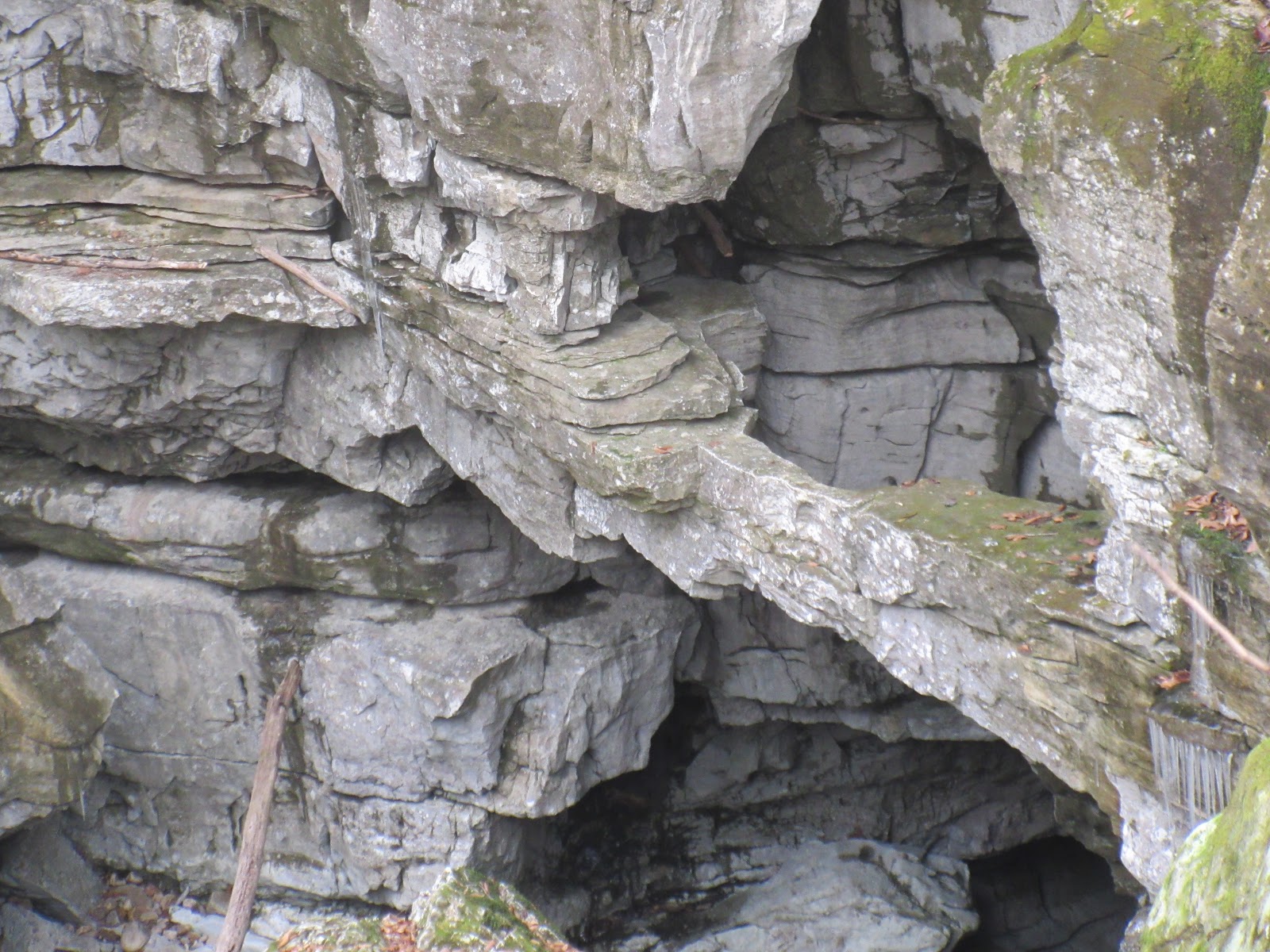
Pictures:


Sunday, September 24, 2017

Harbor Light Boat ramp - TN River


Lora and I put in at the Harbor Light Boat ramp off Dixon Pike in Soddy Daisy. The ramp fee was $7. We have never paid more than $5 to put in. The lady was worried about the parking lot filling up due to the Hamilton County Fair being at Chester Frost. The 3 trucks/trailers were evidently taking up a lot of space. After looking at the ramp, I hope the $7 fee is that high so they can resurface the ramp.

We paddled 4.7 miles out to the main river and hit the inlets up to the islands near the Sequoyah training center. Real nice area to paddle.

When we got back to the ramp, all the other boats must have gotten back ahead of us; we were still the only car/trailer in the parking lot.

Pictures:

Saturday, September 23, 2017

TTA Center Hill Dam


Saturday we put in at the Center Hill Dam. We floated 8.6 miles of the Caney Fork river down to the Betty's Island take out. There were lots of kayaks out as well as fishermen. We enjoyed the Eagles, Blue Herons, and Green Herons.  We even saw more fish than all the fishermen that we passed saw. There were 12 of us on the water. TTA Highland Rim, Sumner Trails and Murfreesboro float/camping weekend.

When we got to the take out, the boat ramp was nowhere near the water! One of the local outfitters was driving their van across the river bottom to the water's edge, so we did the same with the trusty Subaru and John's van.

The campers were going out to dinner so we met up with them at the Ragland Bottom Campground and negotiated with the campground host to not pay a day use fee. A storm coming in convinced us to hurry to the Sligo Marina, but we weren't fast enough to beat the rain. Wet, hungry, but welcomed anyway. Good catfish dinner.

Pictures:

Saturday, September 16, 2017

Savage Gulf TTA


Craig had to work on my birthday so I went hiking (happy birthday to me!) in Savage Gulf with Richard Savage as leader for the Upper Cumberland TTA. I met them at the trailhead by the Savage Gulf Ranger Station.

Lots of overlooks, wildflowers blooming in purple, and yellows. Savage Falls had plenty of water spilling over. Always so pretty to see. Hiked Savage Day Loop, North Rim, Mountain Oak, North Plateau back to day loop. 9 miles.

One lady had issues with her boots and had to slow down. Vicki and Mike went back to check on her, then Vicki found the snake of the day. COPPERHEAD!

Pictures:

Wednesday, August 30, 2017

Signal Point to Edwards Point


I met Sara at Signal Point for a Sunday hike. We managed to miss the Rainbow Falls path, so no waterfall today. We could hear it but didn't see it. There were lots of hikers and lots of four legged hikers, most of them unleashed. The dogs should try harder to keep their people on leash...

The views were beautiful looking into the creek gorge and the TN river gorge. I looked at the Outcast Hiker Blog to see the waterfall we missed.

We will have to go back.

Pictures:

Saturday, August 26, 2017

Gabe's Mountain TTA


Plateau TTA chapter arranged a hike in the Smoky Mountains, so I was excited about going to the mountains. Five of us rode together to Cosby Campground to start our in and out hike. Lots of mushrooms and other fungi on this trail, and some late summer wildflowers. We had lunch at Hen Wallow Falls, then hiked until we reached the 4 mile mark, then back to the parking lot.

Early supper at Carver's Applehouse and Restaurant. Good food, with starters on the table, apple fritters, apple butter, and apple cider. We had already been to the dessert, fried apple pies and ice cream. We all came home with some apples.

Pictures:

Sunday, August 13, 2017

Center Hill Lake Campout


After hiking with the TTA at Window Cliffs State Natural Area, Lora and I headed to the Cookeville Boat Dock to put in the canoe. We had reservations for campsite #5 on Davies Island. It is 4.7 miles on the water to the campsite. We found out that the maps shows it on the North side of the island, but the campsite is on the West side.

It is a busy waterway on the weekends, but we got out there late and stayed to the shoreline. We did have to cut across the big water, but the traffic was along the sides. We got to witness two water snakes doing the wild thing on the shoreline. Got to see other wildlife as well.

After setting up camp and eating dinner, we walked the shore line and watched the sun set. The lake quieted down after that and we had a peaceful night around the too hot campfire. 2 different owls talked to us during the night. 
At breakfast we heard a pack of coyotes barking and howling, must have found their breakfast.

The next morning we paddled back to the marina to dump off camping equipment. Then we headed East to see Fanchers Falls. It is actually Taylor Creek that flows off the falls. We went as far upstream as we could. You could see the falls from there, but you have to hike about three hundred and thirty yards upstream to get to the base of the falls. Fancher Falls and Mist Falls are right next to each other. They are listed at 80 foot tall, but Mist Falls is higher. There is another fall before you get to them on the left which is the same height, but little water. Beautiful area! Birds entertained us; a bald eagle, blue herons, green herons, osprey, ducks. Then we saw a critter that I called everything but what it was: a groundhog. Then a second groundhog. Never saw them along the river banks before.

We did us a little more exploring and then headed home. We got in about ten miles of paddling the second day.

Pictures:

Saturday, August 12, 2017

Window Cliffs State Natural Area


Lora and I joined the Murfreesboro Tennessee Trails Association on a hike at Window Cliffs State Natural Area in Cookeville. It is a 2.75 mile hike one way to a prominent geological clifftop feature that consists of a very narrow, elongated ridge that lies in the neck of an incised meander of Cane Creek. While it is about 150 feet wide at its base, it is only a few feet wide on the narrow clifftop 200 feet above Caney Creek. There are nine water crossings on the trail. They all have cables to cross with, but you wouldn't attempt these with high water.

Tony was our fearless leader. He not only led our hike, he also took the only fall for us. We had a great time visiting with everyone along the route.

Pictures:

Saturday, August 5, 2017

Greeter Falls TTA


Marietta scheduled a hike for waterfalls and swimming, I'm in! I had to drive thru the 127 Yard Sale to get to 111 and head far away from it. We met up at the Greeter Falls parking lot. I barely got there on time after having to follow flatlanders thru Altamont. Gotta love those winding roads. Boardtree Falls was dry and we wondered whether there would be any water at Greeter. Turned out there was plenty. Enough in the pool for a guy to somersault off the rocks. We had a snack there and then hiked to the Blue Hole for a swim. The other ladies didn't get hot enough to jump in but I had to. The water was so inviting and I knew Craig would be disappointed if I didn't.
Thanks to Marietta for a good hike, and nice to see Marcia back on the trails. And nice to meet Molly and Jean, more new hiking friends!

After our goodbyes, back to the valley and the Yard Sale. If you can't beat em, join em. Saw some interesting things, an old Studebaker with an old camping trailer attached, a plywood rowboat for $500, big deer horns, several bicycles built for two, and LOTS of people.

Pictures:

Wednesday, August 2, 2017

Ohio Family Vacation 2017


This year's adventure was in Logan Ohio. The majority of our time was spent exploring Hocking Hills State Park which is amazing. I guess every state has a beautiful area. Even in the midst of corn and soybeans.

The only downfall of our adventure was my sister Deanna and her family could not make the trip for medical reasons.

We rented a couple of houses at Cabins on Waters Edge. They turned out to be a wonderful place to stay. There is a small pond on the property and we got to watch a heron, kingfishers, and a snapping turtle play there. The deer wandered thru the fields between the pond and the river. And a hammock to stretch out in by the pond. It's good for napping.

On our second day we started out with a hike of Old Man's Cave. A beautiful river gorge with three waterfalls. That afternoon our family friends Ron and Carol came to visit. Afterwards we went to the Hocking Hills Winery for some music.

Sunday was the canoe trip down the Hocking River. We used Hocking Hills Adventures for our canoe rentals. We had an interesting drive over to the river in an old school bus. They had a canoe paddle for a stick shift. The river was about a foot high after all the rains they had and we had lot's of mud to go through to get our canoes to the river. We did trip #3. The water was flowing well so we only had to steer. Paddling was only necessary to stay out of the tree limbs in the bends along the way.

Once afloat all was well.Oreo cookies and Twizzlers. We stopped and did the short hike to the Natural Rock bridge armed with Deet to fight off the mosquitoes. And then we stopped at the train bridge for lunch. Nate and Garrett entertained us with a rope swing, along with Jim and Lynelle getting the rope to them. We had a great time on the river.

 After that we went back out and hiked Conkles Hollow and Rock House.
Conkles Hollow was a paved path that led into a rock walled hollow with a couple of waterfalls. We knew we could get Betty to come to this one.
Rock House is an amazing rock feature. It is a mixture of cave and rock house. It is like a rock house with pillars. Lots of names chiseled into the walls.

Monday Lynelle and family left that morning. After goodbyes, we went back to the Rock House and Conkels Hollow, this time with Mom, Kathy, and Betty. We followed that up with Cantwell Cliffs and Cedar Falls and Ash Cave.

Cantwell Cliffs is another hollow that you have to hike down into. Waterfalls and rock walls to check out. Lots of steps!

Cedar Falls was a large water fall and Ash Cave was another HUGE rockhouse and waterfall. Ash Cave was a paved trail as well.

Tuesday we went to Rockstall Nature Preserve, Cedar Falls, Hemlock Bridge and Whispering Cave, and then Corkscrew Falls.

Rockstall was located just behind our cabins. Another pretty hollow with two water falls, privately owned by Camp Atika, but open to the public. At Cedar Falls this time we hiked the trail towards Old Mans Cave which rewarded us with three more water falls. One being Whispering Falls which had lots of bikini action under it. I recommend this falls!

Hemlock Bridge turned out to be a swinging suspension bridge. Whispering Cave was another large rockhouse and waterfall.

On the way back just down from the cabins was Corkscrew Falls on a short unmarked trail.

Wednesday was departure day for everyone else. What a great time with family.

Pictures:

Monday, July 24, 2017

N. Chick Creek - TN River


Lora and I put in at Greenway Farm in Chattanooga off Hamill Road. There ramps aren't really ramps, they are more like stairs to load your boat. More difficult for a canoe, but we managed. We headed upstream and made it just about to the Longview Drive put in. About six miles there and back.

It was a good day and we got to see lots of wildlife including river otters and owls.

Pictures:

Saturday, July 22, 2017

Sewee Creek - TN River


Lora and I put in at the Sewee Creek boat ramp off 304. We headed upstream until we came across a newly fallen tree which blocked the whole creek. We then turned around and headed out to the TN River. About 6.5 miles all together.

Pretty place to paddle. We saw lots of wildlife.

Pictures:

Sunday, July 9, 2017

TTA Hiwassee River Campout


Joan set up another great trip for the TTA. We met at the Gee Creek campground on the Hiwassee River. We got camp set up and then headed up to Reliance to put in at the boat ramp next to Hiwassee Outfitters. We had thirteen kayaks and two canoes. It was a beautiful river ride with a few rapids to make it interesting. Paolo entertained us by flipping over after hitting a rock. It took a while to get him back in the boat with the strong current.  Later on Dick and Debbie entertained us getting caught up in the trees. Lost paddle and Maui Jim sunglasses sacrificed to the river. We got the paddle back. The boat ramp is hidden with a quick current that led to a fast paced ending to our trip.
We had quite the spread for a potluck dinner that night with more people arriving. Lots of visiting around the campfire that night.

Day Two:
We got up and prepped for our trip today. We were leaving the campground boat ramp and going to the Dentville road bridge. We were waiting on them to start generating power so the river would come up. It kept getting later and later. Finally we just went and it worked out OK. Another wonderful section to float. Our entertainment for today was the pop up thunderstorm. God blessed us with a boat house and a friendly home owner. There were boats in the house, under the dock, and along the river side. The storm dumped about three inches in twenty minutes knocking down limbs from trees all around us. After it stopped and we bailed out the water, we continued our trip. Another great day.

Day Three:

Today the plan was to paddle Parksville lake. We put in at the Parksville lake boat ramp, losing one of our people on the way there. Sorry Paolo! We paddled across the lake heading towards the inlets. A juvenile eagle perched in a tree got out attention for a few minutes. Joan led us to the church camp area that we found last summer, so we had a pretty shaded grassy area to eat our lunch and get a swim in. Today was sunny and hot, making up for the storm yesterday. We paddled back and loaded up our kayaks and headed home. What a great weekend!

Pictures:

Sunday, June 4, 2017

Tennessee River - TTA


Joan led a float today. We started at Raccoon Mountain boat ramp and paddled up river about 4 miles. We ate lunch at Pot Point trail. We got to see deer, eagles, herons, a loon, osprey, and heard a barred owl. Joan picked out some beautiful weather for us. After getting back, we drove up the mountain to the Visitor Center and got a beautiful view of the Tennessee River. There is a really cool map inside that shows the whole river system. Check it out sometime, it's worth the trip.

Pictures:

Saturday, June 3, 2017

National Trails Day 2017


Brandy let me know about the National Trails Day event on the Possum Creek segment of the Cumberland Trail. Ranger Steven Rhudy brought lots of tools for the hike/trail work. We clipped, lopped, chopped, and pulled our way to the Big Possum Creek bridge. Stopped where the tree had fell and pulled part of the trail away with the roots. Bob was there ahead of us, working hard. We gathered rocks to fill in. We found some ripe huckleberries too!

We had lunch at the creek, got cooled off and heard some history of the area from Ranger Steven.

Lots of hikers on the trail today. Families, couples, solo hikers and quite a few dogs.

And scored a cool t shirt!


Pictures:

Monday, May 29, 2017

Collins/Barren Fork Rivers


I met Craig in McMinnville at 127 boat ramp. It has a nice parking area, but you have to carry your boat a little way to the water. The current was too strong for paddling upstream. So plan B. We consulted the river map book and the TWRA site to find some other ramps. The VFW was the next one. It was crowded with kayaks and people that didn't know the rules of using the ramp. Craig did a great job maneuvering the trailer down between all the boats and gear.

We headed upstream fighting the current occasionally. Saw about a thousand turtles. We didn't see anyone until the confluence of the Barren Fork. We decided to paddle on the Barren Fork for a break in strenuous paddling. Found a shallow spot for lunch out of the sprinkles, then paddled as far as we could. Turned around and met the TWRA officers in their motorboat. They were cheating, anyone could go upstream with a motor. Started a faster trip back, no paddling, just steering, listening to the birds sing.

Got back to the VFW ramp and had the same issue with kayakers not knowing the rules of sharing a ramp, but they moved when the TWRA officers pulled in with their boat. We got out of the river just ahead of the rain.

About 6 miles round trip

Pictures:

Sunday, May 28, 2017

Sale Creek with Sara and Don


I met Don and Sara in Sale Creek for a kayak trip. We put in on Illes  Road boat ramp. This is directly across from Patterson road boat ramp. This was my first trip in the kayak this year, and had my new PFD too. The boat floated and I remembered how to paddle it. We went thru the marsh grass area to Rock Creek as far as we could go, then turned around and paddled to where you can see Brown's Bridge. We saw some ospreys and a few nests.


Pictures:

Saturday, May 20, 2017

Clear Creek - TN River


Finished exploring Clear Creek off  the Tennessee River North of the Hwy 30 Bridge. We put in on the East side of the bridge and paddled up stream to Clear Creek. Saw some baby ducks, they swam as fast as they could to hide while mama duck tried her best to distract us. Two different osprey nests were being fiercely guarded by the parents. They didn't like our canoe, As we paddled into a more shallow part of the creek we got to see lots of gar, and one swimming snake.
The waves in the river got higher on the way back to the boat ramp. Lora got some steering practice, a few close encounters with logs. More practice time needed...

Pictures:

Saturday, May 13, 2017

Hyatt Ridge


The Chattanooga Hiking Club planned this hike. I met Jamison and Ashley in Hixson and rode to the Oconoluftee Visitor's Center where we met Barbara our hike leader and the other 12 hikers. We loaded up and drove to Straight Fork Road and left a couple of cars at the Hyatt Ridge trailhead and drove on the the Beech Gap Trail. Four hikers took off for their 16 mile day, and the rest of us hiked uphill to campsite #44 where we had lunch. This campsite doesn't look as pretty as it did 6 years ago. Hogs have rooted up the area and the grass was high around the bear hangers. A couple hiked by and told us about a man-way that goes by the spring and continues on from here. Will have to check it out sometime.

Five of us left the campsite with all the car keys so we could collect all the cars and get them to the Hyatt Ridge trailhead. Joyce and I got to see a snake but it wiggled away too fast for me to get a pic. And no I didn't scream..... We saw lots of wildflowers; painted trillium, Southern red trillium, umbrella leaf,  wild ginger and more Solomon's seal than I have ever seen.

We moved all the cars and hung out until everyone came down the hill. I rode back to Chattanooga with Boe and Monty after a scenic trip around Big Cove and Cherokee.

It was a great hike and a fun time with CHC.

Pictures:

Saturday, May 6, 2017

Rainbow Falls - Benton Falls


Lora and I headed out to the Cherokee National Forest to find waterfalls on the Chilhowee Trail System. We went to the Tennessee Landforms website and located falls to search for.

We started out at the Clemmer Trailhead on Hwy 30. It was 1.7 miles out to the "Rainbow Falls" according to their map. On the trail sign it just said water falls. There were a couple of good water crossings to be done on the way out there going across Rock Creek.

The first fall you come to is the 20' Rock Creek Falls. Off to your left there is a path going up along the rock wall. Once up on the rock wall you continue hiking to the 40' Chestnut Mountain Falls. From there you will notice water coming in from the left. Climb up the bank through the rhododendron about fifty yards to the 25' Thornburg Ridge Falls Which flows from under a large rock bridge. Continue to work your way above the falls to find yourself facing the 16' Big Bluff Falls.

We hiked back to the car and then headed to the Benton Falls trailhead at McKamy Lake. We did the 0.5 mile hike around the lake first. You can just  go straight over the dam to get to the trail. As you head down to the base of Benton Falls you will notice a footpath to the right when the trail makes a left. This footpath ends shortly and you have to climb through the rhododendron to the 20' Silvermine Creek Falls. Straight ahead across the creek you can climb through the rhododendron to view the 20' Elora Falls. We headed back to the car and almost made it before the rain poured down on us.

Pictures:

Sunday, April 30, 2017

Beard Cane

Day One:6.8
Gold Mine Trail 0.8
Cooper Road Trail 2.4
Beard Cane Trail 3.6
Day Two:6.8
Beard Cane Trail 3.6
Cooper Road Trail 2.4
Gold Mine Trail 0.8
Total Miles: 13.6

A quick trip to the Smokys for an overnight trip. Lora needed to hike the Beard Cane trail to mark it off her list.

It was a warm weekend and there was a little sweating going on. The Gold Mine trail and Cooper Road trails are both old road beds. Beard Cane is a path which follows the Beard Cane creek even through the creek bed a few times. There is a section where campsite #11 used to be that the tornado had gone through. There is still a marker there, but you couldn't get off that section of trail for nothing. It is a bit grown up there as all the trees are down and lots of sun get to the trail.

These are great trails to hike if you want to see lots of wild flowers. Beard Cane is even good for picking up ticks. We saw white and yellow Trilliums, Dwarf Crested Iris, Wild Geraniums, Shuttleworth's Ginger, Tea Berry, Pink Lady Slippers, Pussytoes, Chickweed, Maple Leaf Viburnum, Galax, Foam Flower, Dog Hobble, Flame Azalea, Mountain Laurel, Magnolia, Tulip Poplar, Trumpet vine, and Honey suckle. Even got to eat a few berries off the Tea Berry.

Got to see a Turkey, Blue Heron, lots of lizards and butterflies. One lizard tried to hitch a ride on my pack. Luckily I saw him before I put it on my back. Saved a heart attack.

At campsite #3 we enjoyed getting into Hesse Creek to cool off. We had one day hiker come through that we visited with at camp an a couple we visited with on the way up Gold Mine.

Pictures:

Thursday, April 20, 2017

Ladies Spring Backpack 2017


We had a plan for 5 days in the Cataloochie area starting at Flat Creek but we heard the road was closed so, Plan B:


I met Diane and Linda at the Cataloochie Campground and left a car at the Caldwell Fork trailhead. Then drove to Cove Creek Gap to start our backpack. This is the trailhead for the Cataloochie Divide Trail. There were a lot of cars but most belonged to a group coming off the Asbury Trail. We headed out around 2 or so walking along the border of the park, with fences or pieces of fences. Views are good and old chestnut logs are on the ground. Old growth trees. Blackberry briers are here too so summertime will have treats here. We didn't see any mountain lions but did see lots of wildflowers. We found a shelter in a field. And the Swag, a private resort that had an ice cream cooler. But it wasn't time for an after hike treat yet. We got the junction with Hemphill Bald Trail, and started down the hill and then to Caldwell Fork where we startled a Junco and got to see its nest with 3 eggs. Campsite 41 was pretty full when we arrived, one cowboy camp with horses and mules. We found an empty site with no fire ring but our closest neighbors invited us to their campfire. Zac and Mark were super nice and let us check out their gear, a gravity filter, hammock and under quilt that Zac had made, and his lightweight chair that Linda kicked back in. Cigars and cough meds were shared.
Miles: 9.6


Day 2
We left our camping gear and started out with light packs to hike Rough Creek, Hemphill Bald, and Caldwell back to 41. Rough Creek was an uphill climb but we heard a lot of birds singing to us. When we got to Polls Gap there were vehicles parked there??? and a turkey walking around. So the road was open?? Oh well, Diane pointed out the Polls Gap Trail that has been temporarily closed for a long time, probably never will reopen. We headed out Hemphill Bald Trail up and down and dodging elk droppings. The bald was a steep climb but we got phone signals, but my baby was ignoring me. The rock table and benches were nice but the wind was whipping. We took a few pics and headed down down down back to campsite 41. Linda cooked Jiffy Pop popcorn, courtesy of Zac, over her cook stove and it was great!
Miles: 13.6


Day 3
Happy Easter, Resurrection Day! Back to full packs, we headed out saying goodbye to the cowboys, horses and pack mules. We went to Plan C and hiked Caldwell to McKee Branch and started climbing to the Divide. McKee Branch was heavily used by the mountain people traveling from Caldwell to the other side of the divide. We saw remnants of home sites, pieces of iron and glass, and did some rock hopping. At the top we took a break, and had phone signals again. This time I got to talk to Craig!  We saw a trail going down the other side of the divide, decided to check it out. We found a sign for the Ferguson Cabin, so Diane and I explored while Linda kicked back. The cabin is one that is being preserved by the Log Cabin Syrup company. There is a spring house with buttercups growing all around. We started back and Diane saw an owl, I missed it. Twice. We got back to the divide and found Linda stretched out enjoying the sunshine. We ate lunch and watched two young girls come down the trail with their dogs?? Hmmm evidently the dogs can't read. They informed us there was a much nicer place to sit at the Swag with chairs and a hammock. We flew back down the trail to Caldwell and found the 3 crossings with no bridges.  Refreshing for our feet. Out to the car and on to the campground, dropped Linda off to set up camp, drove to get the other car which was covered with dust. I drove out to the highway to get ice for the cooler. After supper we drove to the fields to see the elk and turkeys and talk with the volunteer. She was watching for a mama bear with two cubs that had been reported hanging out in the area. Didn't see them. Got to hear barred owls talking and heard a huge tree fall during the night.
Miles: 9.1


Day 4
We got up at daylight and drove to the Big Fork Ridge Trail, watching the wildlife. We were hiking up the trail and found elk in the woods, and then on the trail, then another and another. 14 elk! This trail is very well maintained by the volunteer we talked to yesterday. Lots of straight tall tulip poplars and lots of wildflowers. Linda found another Junco nest with 4 eggs. Then to the Boogerman Trail with old growth trees, needed 4 more hikers to hug these trees. We had to climb over a few blow downs. Had a few sprinkles. Back at camp we drove to the visitor center. Read about the area and looked at pictures and the big barn.
Campfire and a great horned owl talked to us.
Miles: 8.5


Day 5
We packed up and drove the winding curvy road out to Maggie Valley, got proper coffee, found the Blue Ridge Parkway and drove up into the clouds. Avoiding the wildlife we made it to the trailhead for Flat Creek Trail at Balsam Mountain Road where the gate was closed. Left a car then drove back to the other end of the trail. Hiked down to the creek then crossed it several times. It's a beautiful trail but wet and slick, moss covered everything, lots of ferns. At the other end there are benches to sit on to enjoy the view (in clear weather) and a picnic area on the hill side. Drove to get the other car then followed Diane and Linda who were following an elk down the mountain. Thru Cherokee, to Bryson City and the Cooper Creek Trail. The Trout Farm was open so we got to park .1 from the trailhead. Hiked around a long segment of creek/trail and along side the creek. Went our separate ways, them to possibly stay in Deep Creek, I headed home. Got news from Nancy that cancelled our next weekend at Joyce Kilmer so Diane and Linda headed back to Nashville.
Miles: 3.6
I marked off 8 trails on my map! Thanks Diane!

Total miles: 44.4

Wild flowers seen: Bluets, Robin Plantain, Showy Orchis, Chickweed, Painted Trillium, Southern Red Trillium, Stone crop, Dog Hobble, Buttercups, Foam Flower, Bishops Cap, Slender and Cut-leaf Toothwort, White fringed Phacelia, Larkspur, Bloodroot, Cinquefoil, Bellwort, Wild Oats, Spring Beauties, Blue Cohosh, Clinton's Lily, Hellebore, Canada Maylily, Solomon's Seal, and False, Anemone, Early Meadow Rue, Wild Ginger, Dutchman's Breeches, Squirrel Corn, Hepatica, Squaw Root, Brook Lettuce, Golden Alexander, Wild Phlox, and several violets of all colors. Spice bush was blooming and we found two Morel mushrooms.

Pictures:

Saturday, April 1, 2017

Honey Creek/Twin Arches


I drove to Big South Fork to meet up with the hikers from Highland Rim, Nashville and Murfreesboro. I was also looking for the road to the Double Arches I had heard about from the Nature Conservancy. I found the road, then drove to Honey Creek. 9 hikers today, most had been here before, some had not. We had a few creek crossings, with a couple of wet feet, but we never changed into our water shoes. We managed to rock hop and log hop, and maneuver our way thru and across. Lunch was at a rock house with entertainment from 3 young backpackers climbing and jumping and making us wonder if we would need Michael's big first aid kit. Trying to figure out meal times between two time zones could make a hiker hangry. But I made it.

When we got back to the parking lot we drove to the parking for the Double Arches. It's just a short walk in and you walk across the top of the arch then down and around to see the one underneath. Such a cool thing to see. Then 5 hikers headed for Nashville and Tullahoma, and 4 of us headed to Bandy Creek Campground. Marietta, Kathy and Jan had camped Friday night and had firewood and snacks ready. I set up my hammock and we started collecting firewood. Kathy got a good fire going and we kicked back and enjoyed our evening. We watched the stars put on a show and got to hear a whippoorwill sing.

Early Sunday morning I heard a Barred owl talk for a little while. It was a chilly morning so I got a fire started so we could warm our fingers while packing up. Kathy decided to head back toward home and sight see along the way, so Jan, Marietta and I drove up the Divide Road to the Twin Arches.

There were quite a few cars in the parking lot but we had room. We hiked the Twin Arches/Charit Creek Loop. We had a snack at the lodge while Jan checked out the facilities for a future stay. It was a beautiful hike with lots of wildflower sightings. Yellow and red Trilliums, Spring Beauties, Blood root, white, yellow and purple violets, Bishop's Cap, Cinuefoil Hepatica, Anemone, Columbine, Little Brown Jugs, Star Chickweed. If I missed some, someone remind me.

We said goodbye see you soon, I stayed and ate my lunch at the picnic tables in the parking area. I don't know when these were added but it looks fairly new. As I drove out I noticed a small shallow pond and stopped to check for salamander eggs, but found tadpoles instead.

Pictures:

Saturday, March 25, 2017

SMHC Backpack


I drove to Maryville to meet up with the SMHC for a backpack/trail maintenance day. We were ready for the drive to Newfound Gap and then to Smokemont to drop off a car. Steve and Tim brought tools for the four of us. Tim carried the loppers, Steve carried the weed whacker and a saw, Amanda had clippers and a folding saw, I had clippers. Ready for battle. We got stopped right away by a group wanting to take our pic and give us trail snacks. They were with the Tremont scavenger hunt team and thought we were thru hikers. There was a lot of traffic between Newfound Gap and Charlies Bunion. We started our maintenance after the Bunion, leaving the crowd behind. Clipping with stitches in my hand from a week ago was challenging (builds character) and sawing limbs left handed was not as easy as I hoped. We managed to wrestle some trees out of the trail but a few are going to have to wait for the chainsaw crew. We cleared trail all the way to Pecks Corner.

There were beautiful views all along the way and we had to stop and soak up as much as we could of all those gorgeous mountains. The Sawteeth always are impressive; Tim pinpointed Bradley's View.

It was supper time by the time we got the shelter. It was a full house with tents all around. I claimed my spot inside but was willing to go hang my hammock if necessary. Evidently hammocks are a no no around the shelters per the head Ranger. With all the thru hikers it's necessary for tents to be allowed. I don't understand how the hammocks would be worse.... The hiker next to the wall was already in his sleeping bag when I got there. Early midnight for him I guess.

I heard a lot of comments from some of the NOBOs about coming back to the Smokies after they finish the AT; they want to see more of this beautiful place. They were all in bed by 7. Thru hikers midnight. It poured down rain during the early morning. It was a good time to sleep in, but two hikers were up and ready to go before daylight, must have been the 23 miles per day pair.  By daylight most of the rain was gone. We cooked, packed, and then started cleaning up around the shelter. One of the thru hikers got a bag and started picking up trash, old socks and things people had left. We filled up the mulch buckets for the privy, and picked up everything but the tissue blooms, that's above and beyond what we do even with gloves on. Tim tied the trash onto his pack, the other guy must have carried the bag out with him (many thanks) after thanking us for all we were doing. This was my first work trip with the club. The rest of the AT maintainers are the hard workers. Read their work reports, you already see their efforts where you hike and sleep and get your water. Their work goes on all year long.

We left with our rain gear on and started up the hill, noticing a couple of hammocks hanging a little ways from the shelter. Then I heard the thump thump thump of a grouse, then a woodpecker laughing. and later another grouse thumping. There sure was a lot of uphill going down Hughes Ridge, getting the 2.6 miles segment I needed for my map :) The rain stopped and it got warm.

Then Chasteen Creek where we went straight down watching for a spur that we somehow missed, seeing beautiful cascades and enjoying the creek views. Stopped at campsite 48 for lunch and resting our feet from the rocky trail. Then to Bradley Fork and out to Smokemont. We piled into Tim's vehicle and started up the road climbing into the rain cloud. I rode back to Maryville with Amanda and managed to leave my shoes in her car. I didn't notice it until I was 30 minutes away. I sent her a message and she sent back one saying she also found my poles and water bottle. Oh my! She said she would mail them ASAP.

She did and the box was at my garage on Tuesday evening. I think she sent a drone to deliver so quickly :)

Pictures:

Sunday, March 12, 2017

Enterprise South Nature Park


Lora and I went to the Enterprise South Nature Park by the Volkswagen Plant in Chattanooga. This is where 100 old explosives bunkers are from the old TNT plant. They have converted in into a bike and hiking trail park. Four of the bunkers are open for tour and there is Hidden Lake on the property as well.

We hiked the Poe Run path, the Hidden lake trail, the Boulder Point trail, the Deer Hollow trail, the Poe Run Overlook, and the Poe Run path again, Making a 5.6 mile loop.

Pictures:

Saturday, March 11, 2017

Wolf Cove hike


I had heard about Joette Carter's hike that she leads on her family property but had never been there, so I called her Saturday morning to see if I could join her. She said come join us, and gave me directions to find the entry point. Not too far from Winchester and a pretty drive to get there.

We had 6 hikers. Some who had been here before, but got to see new places on this hike.  We counted 13 or 14 caves, most with water coming out of them or running into them. And two with HUGE entries. Too many waterfalls to count. Joette saved the best for last. I had to just stand there and absorb the beauty, water coming from so many openings in the rock wall and from above and seeing how high the ridgeline was above...so beautiful! If this one was the only waterfall we had seen all day, the hike to it would have been worth it.

 And the wildflowers were showing off. We saw trillium, hepatica, stone crop, yellow and purple violets, anemone. From there we hiked a different route from her usual route along the creek, looking for more caves or whatever we might find. And then the climb... you are in a cove and the only way out is UP. We had to think like mountain goats and switchback our way up to the top.  I was thankful for the trees to grab hold of. Sometimes they come in that way,says Joette , they slide down thru the leaves. Can't imagine. We saw some house sized boulders on the way along the horse trail.

If you ever get the opportunity to go with Joette, do it. It's worth every minute of it.

Pictures:

Saturday, March 4, 2017

Edgar Evins SP


Highland Rim trail 2 miles
Millennium/Merritt Ridge 8 miles

Lora and I headed of to Edgar Evins State Park. We camped out at the primitive campsites in the campground. After we got our camp set up, we headed to The Rose Garden 14622 Old Baxter Rd, Silver Point, TN 38582 for dinner. It was a great place to eat with really good prices.

After dinner we headed back to the campground and sat around a campfire. We got to hear owls that night.

The next morning we woke to an owl and then crows. Even got to hear a loon while we ate breakfast. We packed up and headed to the park visitor center. We did the Highland Rim trail for a warm up and then met the TTA for a hike on the Millennium/Merritt Ridge trail.

Pictures:

Sunday, February 26, 2017

Tim's Ford State Park


We headed out to Tim's Ford State Park. We were told by the lady working the front desk that there was a back country site, but it was not open yet. On the way out we met the ranger and talked to him about the site. He wrote up a permit for us and said that we would be the first to use it.

We started  at the welcome center and hiked the Lost Creek Overlook Trail to the Marble Plains Trail to the Ray Branch Trail out to the campsite. According to their signs is a 8.8 mile hike to the campsite. You can shorten this hike by starting at the Marble Plains Baptist Church on Marble Plains Road and hike 6.5 miles. Basically you hike the shoreline all the way to camp.

The campsite is located on the top of the finger on the West side of Ray Branch. You can walk a short ways down to the water on the Evens Loop. We set up camp and enjoyed the evening by the campfire under the bright stars above. All night we heard the Loon, geese, and owls.

The next morning we did the Evens Loop and then hiked back to the church. We took the Marble Plains ADA trail out. After lunch we took the 4.4 out and back hike on the Spann House trail which is another nice hiking trail.

Pictures:

Saturday, February 18, 2017

Twentymile Loop


I met Judi and Gene at the Motorcycle Pit Stop on 129 and then traveled with them on the Dragon Tail to the Twentymile Ranger Station. We only saw a couple of zippy cars as we started on the Dragon, no motorcycles today. No photographers either. Off season I guess. There were a few cars already in the parking lot when we arrived at the trailhead. We started up the trail and followed the Twentymile trail on the old railroad grade past the cascade. We smelled the campfire smoke before we got to campsite 93, several guys still around the campfire. We stopped for snack at the junction of Long Hungry Ridge and the Loop trail at the Proctor Field Gap. Then it was new trail for me! It's a pretty 2.9 mile trail with a small waterfall just before the junction of Wolf Ridge. We stopped for lunch at the junction and Gene made us some hot tea; he had carried his stove, fuel, cups and an assortment of tea and coffee. My cold hands were very happy to hold a  cup of hot tea. Gene demonstrated his fuel cannister and windscreen and pot. This stove can burn wood too.

We had all carried our water shoes for the crossings on Wolf Ridge but didn't have to wade any creeks because some really nice folks had built bridges and had cabeled the bridges to rocks and/or trees. Maybe now when the creek rises it won't wash the bridges away. One of the bridges was curved and pretty high above the creek. Impressive bridge building!

Thanks Judi and Gene for a great hike! I got home and got my pink highlighter out and marked off another trail!

Pictures:

Sunday, February 12, 2017

Fiery Gizzard Day Loop


The South Cumberland SP advertised a hike on Sunday with a Ranger to Sycamore Falls. I went for the hike but the Ranger had been called to the Stone Door for an emergency so I decided to hike the day loop while I was there. There were several vehicles in the parking lot and a few hikers coming off the trail. One couple started just ahead of me, so I took my time enjoying the beautiful day. I saw some valentines along the trail; a blue rock with a heart on it.

The couple ahead of me stopped to take pics at the Blue Hole so I stopped to say Hi and offer to take their pic for them. They were from Georgia and had come up the day before and were exploring the area. I told them about the trail and surrounding areas, and then hiked on. It sprinkled a little bit before I got back to the car. Even tho I didn't hike very long, I still made the required after hike stop at the Dutch Maid Bakery. One strawberry filled jelly roll, and a Tennessee Moonshine wedding cake. Mmmm good.

Pictures:

Saturday, February 11, 2017

McGill Creek


Lora and I hiked the McGill Creek segment of the Cumberland Trail from Downy View Road to McGill Creek. This segment is under construction. We parked by the fence and followed the flagging. There are two sections on the way to the creek that are built trail. You walk through the woods then follow a small stream down into the McGill Creek gorge. There is a waterfall just before you get to the creek. Beautiful area.

Pictures:

Saturday, February 4, 2017

Cumberland Trail - Arch Mt. Section


Lora and I headed out the hike the Arch Mt. section of the Cumberland trail. We dropped off a car at Frozen Head State Park where the ranger told us the story of rescuing some backpackers the night before.  They had gotten cold and couldn't get a fire started. It had gotten down to around 0 degrees.

We started the hour and a half journey over to Smoky Creek. We took the Southern route which traveled along 116, Shea Road, and then Smoky Creek Road. Lots of gravel and you feel like you are out in the middle of nowhere.

After finding the parking lot we started with our crossing of Smoky Creek. Cold and wide! Soon afterwards we found that you are going to really have to pay attention to the blazes. This trail is in need of hikers and volunteers to do some clearing. We cleared as much as we could along the way, but it needs lots of feet on the trail and it is going to need some chain saws as well.

The trail travels through some very pretty areas along the creek. The water runs out as you climb to the ridge for the rest of the hike to Frozen Head. In the description at mile 5 heading South (8 if heading North), it is a little misleading. There is no water or camping area once you start climbing and you get above the creek.

We camped just above the spring for the creek up on the hill side. We got a good fire going, but the wind picked up and gave us a challenge dodging the smoke. We had to get up a couple of times to restake our tarps.

Once you are on the ridge there are a lot of views especially this time of year. It was a little hazy for our hike, but you could see a long ways.

This trail is quite strenuous.

Pictures:

Sunday, January 29, 2017

Laurelbrook


Lora and I headed to Laurelbrook on our mountain so she could show me two trails that led to a fall and a point. She had found these a few days ago and wanted to hike them. So when we got there the first hike was 0.4 miles to the 20' Brush Creek Falls. Then we drove around to the point trail and hiked 0.5 miles out to an overlook of Roaring Creek Gorge.

After we got back we did a map search on the area to find where we were and what we were looking at. We found out that we had hiked to this fall before from the other side off of Rigsby road.

Pictures:

Saturday, January 28, 2017

SMHC Abrams Falls-Cooper Road


Billy and Steve from the SMHC organized a great hike with Jeremy Lloyd, Naturalist from Tremont Institute. We started in Cades Cove at the parking lot for Elijah Oliver cabin. There were more than 15, less than 20 hikers.The forest around here had been burned at some point and Jeremy was teaching us to look at the forest as we hiked. We saw some interesting things today. A bear paw print beside a deer hoof print in the dirt. Some old coyote scat with persimmon seeds in it. A pitch pine among a white pine forest, and learned to recognize it. And Abrams Creek is the lowest elevation in the Park. And you can see Look Rock tower from the trail.

We hiked from Abrams Falls to Hatcher Mountain; it was good to see the pines growing again after the tornado in 2011 ripped the forest apart here. The forest renews itself after fires and tornados, it just takes time. Some of the pines were 5 years old; we learned from Jeremy how to count the whorls of limbs to count the age of the pines. We found a sunny place on the trail to have lunch, and a few found a good spot to stretch out for a little while.

From Hatcher Mountain to Cooper Road, the 5.5 miles I needed for map marking! And back to the cars. 13-14 miles. Didn't get Wet Bottoms this time. Maybe next trip. We came out with more than 15 less than 20 hikers so I guess the 10% rule worked.

Thanks Jeremy, Billy and Steve for a great hike!

Pictures: