Kirkland Creek trail #85 6.7 miles
Benton MacKaye trail #2 6.3 miles
Brookshire Creek trail #180 5.7 miles
Road back to car 0.5 mile
Total Miles: 19.2
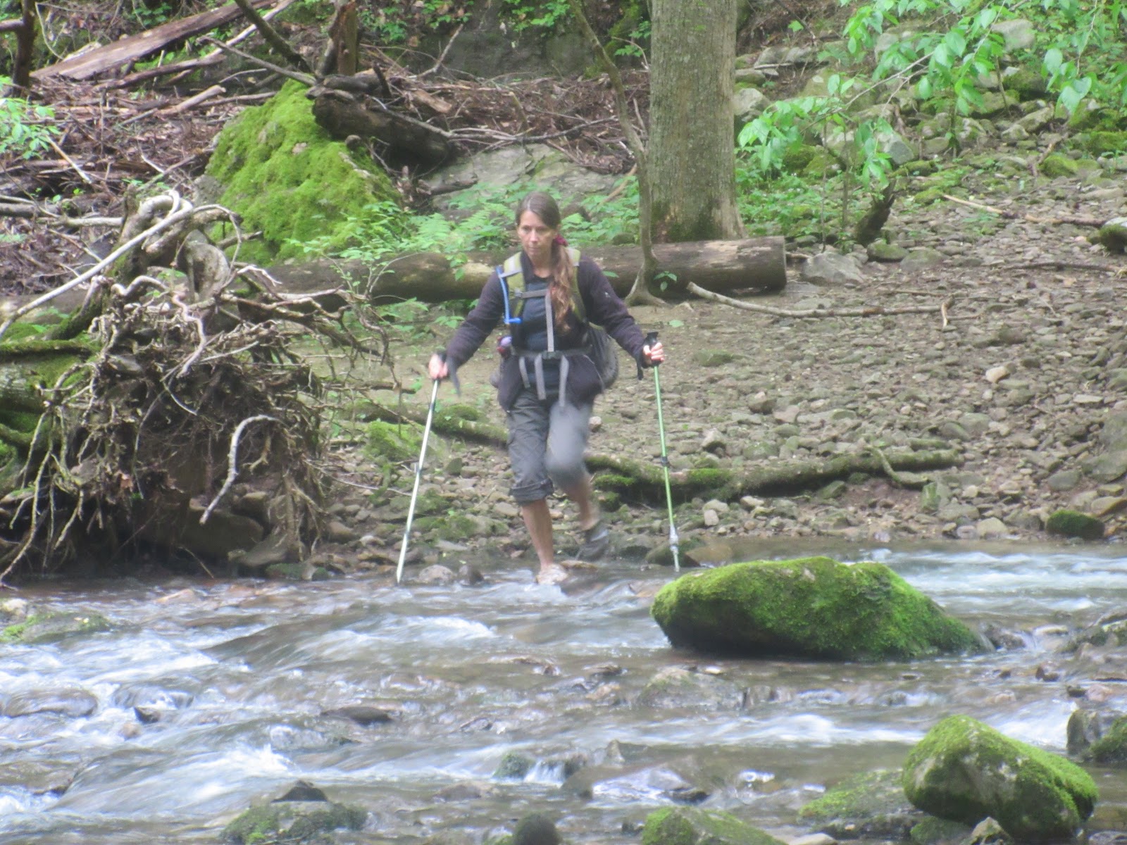
A virus shut down every State Park and National Park, but the National Forest was open as long as the trail did not lead to the AT which was also closed, so we escaped to the woods. Bald River Wilderness FSR 126 was rocky and rutted but the trusty Subaru made it to the Kirkland Creek trailhead. We started out and immediately changed to water shoes. I copied this description from the Cherokee Hiking Club:
Trail Description: From the Bald River Road Trailhead, immediately cross the Bald River (must use wading shoes, there is no possibility of crossing this river and keeping your boots dry unless you take them off). You will be following an old railroad grade along the left side of Kirkland Creek. After 0.9 miles, you will cross Kirkland Creek, which again may require wading shoes if the water is high. Then you will be following the right side of the creek. You will cross the creek, actually, several times until you reach the confluence of Kirkland Creek with Waucheesi Creek coming in from the right. At this point, you will cross Waucheesi Creek and with several more crossings will parallel Waucheesi Creek for almost a mile before finally cutting steeply left of the hillside and away from the creek bed. You will soon reach an old logging road at the crest of the ridge and and will cut right on this trail and follow it on up to Sandy Gap. Be careful at the 4‐way intersection at a gap. Go straight, not right or left. Please note this route is different from the route in the Skelton Book (Cherokee Nartional Forest Hiking Guide). The old route which stays along Kirkland Creek up to the gap, has been abandoned and is no longer maintained.
Camping: Several excellent campsites are along the trail next to the creek.
Water: Water is available all along Kirkland and Waucheesi Creeks and is also available just a short distance down from the Sandy Gap trailhead at a spring.
So we crossed several times changing our boots to water shoes almost every time sometime keeping our water shoes on. The trail was overgrown in places with dog hobble. Since we had our pants rolled up for the creek crossings the dog hobble was rough on us. Lots of wild flowers on the way, but nothing like what we were going to see. Just where the trail leaves the creek, we found a nice camping spot and had lots of downed trees for firewood. The water source was great. We left the tarps off to watch the stars. We tried calling in owls that night with no luck.
The next morning an owl woke us up. We saw it as we climbed up the side of the mountain leaving camp. We followed the trail to meet the Benton MacKaye at Sandy Gap. There is a gravel road FSR50 at the gap. The Benton was a constant up and down following the ridge line. The views were great without leaves on the trees. The wind was blowing like crazy. We were amazed at all the wildflowers we saw on this section. Not just the numbers of them, but by the amount of different flowers we saw.
We ate lunch on the trail and then after the final climb we came to the signed intersection of the Benton and Brookshire creek. The two trails actually follow each other for quite a few miles. We dropped down into the creek valley and started looking for a good camping area. There are lots of places to camp, just don't know about creek access with all the rhododendron. We found a spot with a previous campfire a couple of miles down. We were early enough for bath time. Lot's of fire wood to be had. A group from the Great Smokies Hiking and Adventure Group came by doing the same loop we were doing, but backwards. We visited with them for a while as Lora knew a couple of them. The rest of the night was peaceful. We put up the tarps expecting rain later in the night and we were not disappointed.
The next morning we had breakfast under tarp, but by the time we packed up the rain had stopped for the day. We continued down the creek. Just an amazing amount of wildflowers all along this trail. At the trail junction, the Benton crossed the creek at a couple of waterfalls. The rest of our trail was pretty much roadbed. Most of the tributaries were through culverts until they got really wide and deep. That is were we did our crossings. Just a couple and the last one before the road. We had lunch at the road and then walked on to our car.
With rain coming in for Sunday we decided to do some driving. We drove on through on FSR126 to Tellico River road. We stopped at Green Cove Pond to check it out. Surprising to see so many people in a backwoods area. It is a fishing pond for seniors and children. We scoped out campsites along Tellico River road to the border and back.
On a potty break on the way home, we found a trail on the side of Pumpkin Hollow road that lead to an old settlement. Can't find any information about it on the web.
List of flowers: 8 different Trilliums: Large Flowered White, Sweet White, Bent, Red, Sweet Betsy, Yellow, Painted, Catesby's. Showy Orchis, Mandarin, Dutchman's Breeches, Star Chickweed, Foam Flower, Squaw Root, Anemone, Mayapple, Canada Violets, Wood Violets, Yellow woodland and Halberdleaf, Sweet White, Marsh blue.
Dog Hobble, Wild Strawberry, Cohosh, Carpet Bugle, Canada Mayflower, Spring Beauties, Toothwort-cutleaf and fineleaf, Wild Geranium, Dolls Eyes, Yellow Stargrass, Dwarf Crested Iris, Sweet Shrub, Robin's Plantain,Phlox.
Pictures: