Lora and I headed down to the Roaring Creek segment of the Cumberland Trail. We just hiked along the creek checking out the flowers. We followed the roadbed to the end and headed back before the rain set in.
Friday, April 11, 2025
Monday, October 7, 2024
Roaring Creek Segment of the Cumberland Trail
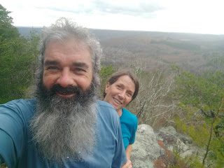
Lora and I headed down to Roaring Creek to hike the Cumberland trail to the fall. There are quite a few trees down on the trail. Another beautiful hike.
Tuesday, December 13, 2022
Saturday, January 1, 2022
New Years Day hike - CT Roaring Creek
New Years Day hike on the Roaring Creek segment. Spring is in the air with 75 degree weather. We saw two snakes, a butterfly, numerous grasshoppers, and a violet in bloom.
Wednesday, April 28, 2021
Roaring Creek Backpack
Lora and I decided to backpack the 9 mile Roaring Creek Segment of the Cumberland Trail. We left our car at the trailhead and headed in. We got to see the new bridge over Gilbreath Creek and from there on was new trail to us. There are some nice overlooks, rock outcroppings, and water sources all along here. We hiked to the end of the trail and then backed up to Sale Creek where we could hang two hammocks up just upstream from where the trail crosses. The next area back to camp would be around MM 8 where there is a flat Glade that has numerous creeks running through. This time of year the ticks were crazy and the trail was on it's way to being overgrown. Lot's of wildflowers.
Saturday, January 20, 2018
Graysville Mt. TTA
Crystal and I met the Upper Cumberland TTA hikers at Roaring Creek/McGill Creek Trailhead in Graysville. The sunshine must have followed them from Cookville. Lillian, Janet and Dr. Womac got there and so did the CT Volunteers; Don and Carol, TC and Judy and two furry friends, Bob, Mark and Teresa, and Jan and her friend, and two furry friends. They got started ahead of us. We stopped at what looks like a mine opening covered with icicles. Then uphill and across the road, to McGill Creek. We caught up with the other hikers and chatted with them, checking out all the new bridge parts waiting to be put together, cables strung across the creek, waiting on the workers to show up. Not sure what the schedule is to put the bridge together but it will be neat for this segment to be completed. As we were going back along the creek we saw bluebirds and some yellow ones too but not sure what they were. Maybe goldfinches.
We hiked back to the parking lot and then hiked up the roadbed to Polecat Falls. There was a lot of ice in the creeks, and on the walls and you could see where the other streams come just by all the ice on the hill sides. The rock overhang at Polecat Falls was covered with icicles and it was a cool view looking out from under at the falls.
Back to the parking lot and everyone headed home. It was a beautiful day with good friends.
Hiked about 7.5 miles.
Pictures:
Friday, April 3, 2015
Roaring Creek
Good Friday hike with Connie. We both had the day off, so we hooked up at the trailhead for a hike filled with wildflowers. It was a beautiful day.
Pictures:
Sunday, March 15, 2015
Roaring Fork Segment - CT
Lora and I did a hike on the Cumberland trail Roaring Fork Segment. We got in about 11 miles from the trailhead to the end and back. It was a beautiful day and we got to see two flocks of turkey and three Bald Eagles along with lots of buzzards.
Pictures:
Thursday, March 12, 2015
Cumberland Trail Maintenance - Graysville
Spent some time with Michigan State, Florida International, and Boston State, working on the Graysville Segment of the Cumberland trail. We had many Rangers and volunteers helping.
Pictures:
Saturday, June 7, 2014
TTA Roaring Creek
National Trails Day, lets go hiking!
I joined the Soddy Daisy group today led by Bob McGavock and his swing sickle. I met them at the Roaring Creek trailhead. We got an early start trying to beat the heat. 7 hikers and Violet the Great Dane.
The humidity was waiting for us on the climb to the ridge top. The view from the bluff was beautiful as always. We found a few wildflowers and a few ticks along the way. Bob stayed behind at the meadow to do some trail clearing with his swing sickle. The trail was looking good; the Breakaway kids did a great job this year. Across the creek the trail had been cleared to get to the section that had built on that side. It continues for about a mile where you find the End Of Trail sign. You can see the flagging continues into the woods. Ready for more trail builders to come out and play. We headed back to the creek for lunch. George had some jelly biscuits that were really good. I think Violet thought so too.
As we headed back toward the meadow, Bob was hiking to meet us. We walked back enjoying the overlook and the view into Cranmore Cove, and toward the distant mountains. You could see Watts Bar's towers, and the ones at Sequoia. We didn't see the goat, I haven't seen it yet. Maybe next trip. We did see two families hiking today as we hiked out. We wished them a Happy National Trails Day.
When we got back to the parking lot, my thermometer read 87 degrees. We should have jumped in the creek!
Good hike with great people.
Pictures:
Monday, March 25, 2013
Roaring Creek II
Roaring Creek Trail 1.8
New section of trail 1.87
Total Miles: 7.34
I wanted to show Lora the work that the college kids have been doing on the Cumberland trail. So after church we headed over for a short hike. We went to the trailhead off Brayton Road in Graysville. The Roaring Creek segment had already been built up to the overlook. Now there is roughly 1.87 miles more of it running along the bluff line going North towards HWY 30.
We got to see the water fall and numerous new overlooks. The trail is looking good, they just don't have it marked yet. It stops at a creek crossing and then we hiked back. It was really foggy on our way in, but cleared for some good views on the way back out. I was thinking it was a shorter section until I googled it afterwards and found out we did about 7.3 miles.
Pictures:
Saturday, March 2, 2013
Roaring Creek with Chattanooga Hiking Club
I met the CHC at the trailhead for Roaring Creek in Graysville. We had 1 to 2 inches of snow at home but there was none in the valley. I was hoping for a snowy hike. This trail is only 7.5 miles from home. Boodie Fox was leading the hike today. There were 7 of us. We hiked up the creek road and then up the trail to the bluff. Past the bluff the trail is flagged for future CT miles. We saw a hawk flying over the bluff area.
On the way back down, one of our hikers was missing a glove and 3 went back to the bluff to look for it. The rest of us started on down the trail. They caught up with us at the cascading waterfall on the trail. When we got back to the creek road we went up the creek another mile to a waterfall. It sure was pretty. I have lived on this mountain all my life and had never walked to this waterfall; had heard about it but never had walked to it. Boodie said there is another waterfall up the creek, but you have to cross the creek. to get to it. We didn't have water shoes and the creek was up. Maybe a future hike for Craig and me. Just down the creek from the falls was a really pretty open area that was flagged with orange flags. ??? Maybe part of the future trail?
It started snowing as we started back toward the trailhead and stopped for a snack. We didn't stay seated very long, it was cold. Then we headed back to our cars. As I drove up the mountain, I stopped to get a pic of the chimney rocks at the base of the bluff.
Pictures:
Sunday, November 11, 2012
Roaring Creek - Cumberland Trail
Lora and I headed out to hike the Roaring Creek segment of the Cumberland trail. This trailhead is in Graysville off Brayton Mountain Road and is a two mile section that has not been connected yet to any other section of the trail. We met the Plateau Chapter of the Tennessee Trails Association at the trailhead. They had just finished the hike. The trail follows Roaring Creek and then turns uphill and ends currently at an overlook of Graysville. From the overlook you can see the mountains of East Tennessee and the Soddy Nuclear Plant. We got to watch a hawk flying over while we were eating our lunch.
Pictures:
Map:


