Saturday, December 23, 2017
Cumberland Cove
Cumberland Cove is a private residential area on the Plateau. They have beautiful hiking trails that can be seen by invitation only. The Plateau TTA has two members that own property and I got to go with them to hike there.
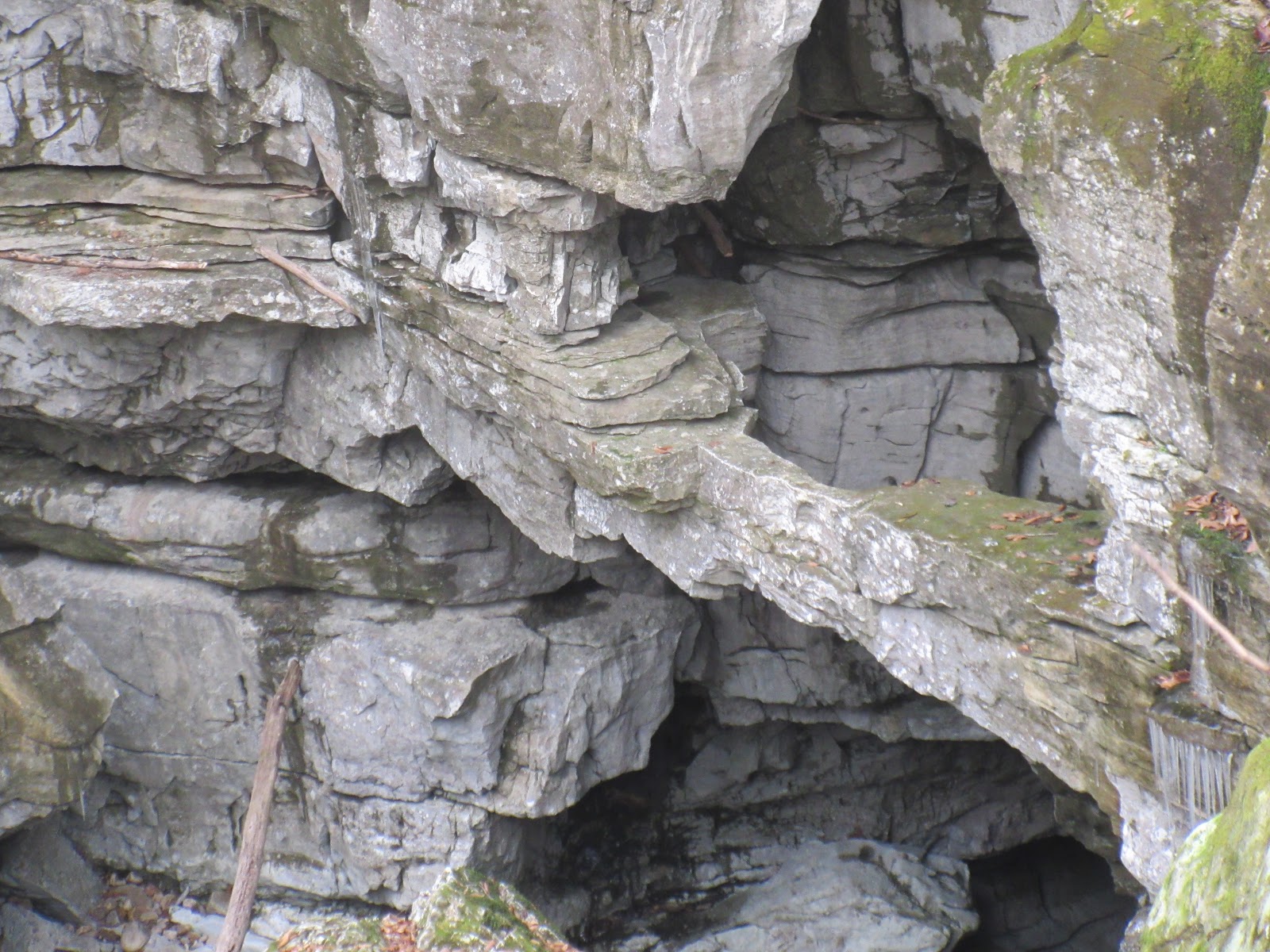
Butch was our guide for the day in the Eagle Flight Park area, leading us to the Sinks, Fork Mountain Cave and Arch Cave. Fort Mountain Cave had cave temperature steam coming out of it, and I took advantage of that warm air. The Sinks had some critter prints in the sand around the stream. We had to do some boulder hopping to get to stream level. Arch cave geology is much like the Walls of Jericho. And above the arch, it loos like another arch is forming.
According to their website there are three areas in the Cove with hiking trails, maps are there. Butch was a great guide, but they are serious about no trespassing. Make sure you get an invite to this beautiful place.
Pictures:
Wednesday, December 13, 2017
Fiery Gizzard TTA
Craig was backpacking on the AT and I had an extra vacation day to burn so I went hiking. Met the Plateau folks at the Fiery Gizzard Trailhead. Got on the trail around 10:30 EST.
The trailhead has been moved, there are signs that say area closed for restoration. Kiosk is behind the picnic shelter and bathrooms. Another sign there says the CCC camp is now permanently closed. Too much trampling around the three campsites has made it into one big area and needs to rehab. You still get to walk past the 500 year old hemlock. The six of us had fun with all the rocks and I remembered to point out the arch at the top of the big climb to the trail junction. We didn’t go to Raven’s Point, we had enough miles to hike before dark without adding another mile. The rerouted trail is beautiful and strenuous, but the waterfalls make it all worthwhile. On the woods walk the sun was setting and turning the horizon orange. We hiked into the last creek gorge and climbed up to the top of the ridge and got our headlamps out. Deb called the Ranger to ask them to not lock the gate on our cars at the other trailhead, that we were coming but still had a couple of miles to hike. We could hear Foster Falls but couldn’t see it in the dark. Louise gave the drivers a ride back to the other trailhead and then Deb drove back to pick up the other two hikers.
Saturday, December 9, 2017
Black Mountain - TTA
Soddy Daisy TTA had a Christmas dinner at Olive Garden on Friday night. You would have thought we had all hiked to get there the way we scarfed down the breadsticks. John reminded me about a hike scheduled for the next morning so I thought I would go and try to burn off all that wonderful food.
I met the group that included Carolyn and Cheryl from the Plateau chapter, at the Black Mountain trailhead on Hwy 68. There’s a big parking area on the side of the highway now, you cross the road in a safer spot, and the State extended the trail entrance to there. We could see some more recent trail building along the road that still has a little way to go.
We got to Windless Cave and our leader Boody wanted to hike a little further so the Plateau ladies had a party to attend and said their goodbyes. We hiked almost to the big rocks on the ridge and stopped for lunch.
We returned to our cars in the now thawed muddy entrance trail and stomped off most of the mud from our boots.
Pictures:
We returned to our cars in the now thawed muddy entrance trail and stomped off most of the mud from our boots.
Pictures:
Friday, November 24, 2017
Noland Divide
Day One: 8.8
Noland Divide 7.8
Noland Creek to #61 1.0
Day Two: 8.9
Noland Creek 1.0
Pole Road Creek 3.3
Deep Creek 0.5
Martin's Gap 3.0
Indian Creek 0.7
Deeplow Gap to # 51 0.4
Day Three: 11.2
Deeplow Gap 1.1
Thomas Divide 4.6
Stone Pile Gap 0.9
Indian Creek 0.5
Deep Creek 0.1
Deep Creek Horse 2.0
Tunnel to Noland Creek 1.0
Noland Creek to #65 1.0
Day Four: 10.1
Noland Creek 3.1
Springhouse Branch 7.0
Day Five: 5.1
Forney Creek 1.3
Whiteoak Branch 1.8
Lakeshore 2.0
Total Miles: 44.1
Thanksgiving break, time to get some more trails in the Smokies marked off my map. I planned a 5 day backpack, waiting for Craig to come home from a five day trip with the Outcasts. The NP sent an email two days before our trip warning COLD TEMPS for the higher elevations. Never got that before!
We got to the Noland Divide trailhead in Deep Creek about 1:30. This part of the trail was new for me. Only 8.8 miles to our first campsite, all uphill and it gets dark fast. There was light snow on the shady sides of the mountain and we could see the heavier snow on the peaks. We know that Mt. LeConte had gotten two inches last night. We had to hunt firewood with our headlamps. It was supposed to get downright cold tonight, 19 degrees they said. We got a good fire going for the night and watched the bright stars.
Day Two:
We had ice in our water bottle and bladder hoses. I guess it got cold last night. We got a fire going first thing before trying to pack up. After breakfast we headed out on our steep climb back to the ridge.
New trail today was Martins Gap. No hikers seen today at all. Beautiful clear skies as the temps kept climbing. Lot's of rock hopping today. When we got to camp we had time to collect firewood, filter water, and still had daylight. The temps started dropping so we got the fire going. We heard some big animal coming up from the creek raking the leaves as they walked toward us. We couldn't see it through the rhododendron, and then we heard no more. Not sure what it was. We enjoyed another night around the campfire looking at the stars. We got to see a sliver of moon for a short period tonight.
Day Three:
Not too cold this morning. We still got a fire going for breakfast and breaking camp. Headed up to Thomas Divide so that we could climb some more. We saw our first hiker, Sweaty, when we started downhill. As we got closer to Deep Creek campground we saw more and more people. We took a side hike to Juney Whank Falls which was popular today. Just above the falls we saw a doe and fawn who were checking us out. A segment of Thomas Divide and the Deep Creek Horse Trail were the new trails today.
When we got back to the car, instead of camping at Deep Creek campground, we decided to head over to the tunnel and camp at the closest campsite. We had to drive past an ice cream store so of course we had to stop. From there we drove to the tunnel, hiked down the road to Noland Creek and then to campsite #65. This campsite is a horse camp so it had a few picnic tables. Had to do some climbing of the hill side to get firewood. We had enough to keep us warm all night. Another beautiful night.
Day Four:
Springhouse Branch is a pretty trail and a good climb. When we got to the trail junction with Forney Ridge, we actually saw another backpacker. We asked him what he was doing out here and he didn't know either. Foreign guy it was. First half of Springhouse Branch was new trail.
When we got to campsite #71 it had been completely plowed by hogs. Dirt was turned everywhere covering all the area that was flat. We were wondering if they would be back and before dinner we found out. There was a funny noise coming down the side of the mountain. When we saw black we thought bear, but when he slowed down we saw hog. This one kept on going by and stopped for a drink at the creek. A few minutes later and some more noise coming down the mountain. The next thing we know we have "Pumba" staring at us. We stared back. Until Craig reached for the camera and then it was hog heading straight back up the mountain side. He must have told his friends because we saw no more hogs.
We had a working fire tonight. The wood was damp and we had to keep working it to keep it burning. Another good evening.
Day Five:
Frost on the tarps this morning. I guess it dropped a bit last night. We got the fire going for warming and eating around. Today we were heading out. We saw our first hikers about a mile from the tunnel.
Five days, five new trails marked off on my map!
Pictures:
Monday, November 6, 2017
Nathan Bedford Forrest SP
Day One: 7.75
Day Two: 6.25
After a slight change of plans this weekend, Lora and I decided to overnight at Nathan Bedford Forrest State Park. I had hiked here in 2007 with the Outcasts.
We started with a visit to there museum. I wanted to show Lora the boats they had in there.
We started at the trailhead behind the Interpretive Center and followed the markings for the ten mile trail. We then followed the blazing for the twenty mile trail. They are working on their markers right now so they are a little confusing. They have not marked the 20 mile trail and it is in need of repair as well. Once you pass the old CCC buildings on the upper Northeast corner and drop down to the river, the trail becomes impassible. Flooding and overgrowth have over taken the trail. We reverted to the trail map and by using the topo, we crossed the creek and turned West to find the trail. This is where we spent the night. It is a good water source and this is where the Outcasts camped as well.
We got to see deer, an owl, a turkey, and a whole mess of little lizards on the trail. That night the coyotes sung to us, one being very close. We enjoyed the campfire into the night.
The next morning after packing up, I checked the topo again to make sure before we headed out. The map shows you heading back down to the river after climbing the ridge. The trail actually climbs the ridge and then follows an old roadbed West before dropping down into a creek valley. Must be a reroute they never changed on the map.
We got to see more deer and turkey today. We were also trying to keep up to the markers when they were available. The signage on the way back is a little misleading as well. You need to follow the signs for the "cabin" to get back to the trailhead. We miss read their map and ended up at a gate leaving the park. Now they have a better map on the webpage which I suggest printing off and taking with you.
The shorter trails are flater. I would rate the longer trails moderate because there are no switchbacks on any of the hills.
We talked to the ranger after we got off the trail and hopefully they will continue to work on their trails.
Pictures:
Sunday, October 22, 2017
Foster Falls / Denny Cove
After work, Lora and I headed to Foster Falls Natural Area to campout for the night. We stayed at the Father Adamz campground. All the sites where booked so it was easy to pick the one that was not. This is a nice campground with some space between the sights. We even found firewood. We enjoyed the night around the campfire before retiring to our hammocks for the night.
The next morning, after hiking out, we headed to Denny cove to hike their new trails. We saw deer from the parking lot. We started out at the overlook and then hiked to the Buffet wall that the climbers use. From there we hiked on to the waterfall. Beautiful falls! On the way back we rescued a box turtle that had gotten himself stuck in a whole under a rock. Took some prying, but we got him out.
When we got to the trail split we hiked around the bluff on the Denny West trail and had lunch at the base of the bluff. We then headed back and hiked along the Denny East trail along the other bluff wall. We got to see a large black snake which luckily I got to spot before Lora. The snake and I still have our hearing. After that we got to see a lizard. Then we headed back to the car.
When we got to Dunlap we stopped to see the antique cars and tractors at their Days of Yesterville.
Pictures:
Labels:
Denny Cove,
Foster Falls,
Foster Falls / Denny Cove
Wednesday, October 11, 2017
Father / Son Trip 2017
Day one: 8.1
Lead Cove Trail 1.8
Bote Mtn Trail 1.2
Anthony Creek Trail 3.5
Crib Gap Trail 1.6
Day two: 8.9
Parking Trail 0.5
Rich Mtn Loop 2.9
Indian Grave Gap 2.8
Crooked Arm Ridge 2.2
Parking Trail 0.5
Day three: 8.7
Meigs Creek Trail 3.5
Meigs Mtn trail 1.9
Curry Mtn trail 3.3
Total Miles: 25.7
This years trip was affected by hurricane Nate. I arrived driving through the heavy rains of the storm. Of course the weathermen were saying heavy rains for all the days we were going to be out. The wait and see game began.
The ladies seemed unaffected by what the news people were saying. They were laying out plans left and right. By the time dinner was over they had a plan and ours was wait and see.
The next morning the ladies were off and the weather was sounding better. On the road we went. Lead Cove was where we were heading. Not giving up totally on the backpack, but dropping it to an overnighter. We had a couple of light sprinkles, but the main problem was humidity and heat. We had a great day on the trail and Dad even showed us a cove bear. The bear didn't care that we were in his woods, but did keep peeking at us. If I were an action photographer, I would have gotten some good pics. I am not.
Mom scored some tickets to the Dixie Stampede for the night. So we went and enjoyed a dinner and show. I highly recommend this to everyone. Great entertainment!
Day Two:
The weather cleared out for our second day and looking good for the next as well. It was going to be steamy and hot, but let's go! Plan B. Dad was wore out from the night before so.......day hiking we go!
Rich mountain loop was today's plan. We got our bear sighting in, first thing after Oliver's cabin. Then we began the steep climb up Rich mountain. It only sprinkled while we were eating our lunch. It was a bit tougher trail, but we enjoyed it all the same. Earlier to bed tonight.
Day Three:
Today was looking the same temp and humidity. We brought both cars and did another loop off Meigs mountain. We left a car at Metcalf bottoms and then drove to the sinks to start our hike. Meigs Creek has around 13 creek crossings all being rock hopping. We ate our lunch at the Meigs mountain connection. Another great day of hiking.
Pictures:
Wednesday, October 4, 2017
AT - Dicky Gap to VA 625
Day One: 10 Miles
Dicky Gap to VA 601
Day Two: 10.9
VA 601 to Chatfield Shelter
Day Three: 11.4
Chatfield Shelter to Reed Creek
Day Four: 11.3
Reek Creek to Lick Creek
Day Five: 1.4
Lick Creek to VA 625
Total Miles: 45
When Lora got off work Friday we drove to Hungry Mother State Park so we would be able to start our backpack earlier on Saturday. This is a beautiful park in Marion, Virginia. Three different camping areas and a pretty lake. We had supper at the restaurant there, outside with a view of the lake. Good food. We joined the interpretive Ranger at the group campfire, she had marshmallows to roast and a story of how the park got it's name.
Saturday we drove the Back of the Dragon to meet our shuttle driver Bubba. We blew pass our unmarked VA 625 and had to turn around and drive back to find it. VA 625 is a long rough gravel road. Bubby was waiting for us at the trail head. We left our trusty Subaru and headed to Dickey Gap with Bubba. He had lot's of stories to tell. We spotted a groundhog and some deer on the drive.
We hiked to just before VA 601 and started to set up camp when a hiker came through. We asked how close the next road was. He pointed behind us and said "Right there" hmmmm. We picked up the packs and moved on past the road up on the ridge.
DAY TWO:
Sunday we saw lots of deer and chipmunks, and heard a bear crash thru the woods by the creek. We went up and over lots of ridges with only one view all day on Glade Mountain. Lots of South bounders, all of them telling us there was no water going North. It made us nervous about having water until we kept crossing water. One guy finally told us, North of where our car was, water was scarce, about 15 to 19 miles between water sources.
The Partnership Shelter was impressive; Built with logs, and a SHOWER! That was a first for us. To bad it was too early to camp. We went into Mt Rogers Ranger Station/visitor Center and saw a huge stuffed Hellbender salamander. They had a live one too in an aquarium.
Chatfield Shelter was our camp spot for the night. We hung our hammocks and gathered wood, Two guys showed up and hung their hammocks on the other side of the shelter. We swapped blog addresses.
DAY THREE:
Monday we crossed lots of water. Saw deer, chipmunks, and two grouse startled us. We crossed train tracks, cow pastures, boardwalks, and I 81 where we stopped for chips and tea to go with our PB/J sandwiches. We ate lunch on the wooded hillside overlooking the ducks swimming in the creek.
We stopped at the Old Settlers Museum and looked at the school. Three apple trees in the back got our attention, Yumm!, and then Lora spotted the grape vine growing up the back of the school house and they were ripe. We traveled on munching apples and grapes. We passed through more farmland, and old apple orchards, and saw wild cherry trees. Found a crooked style, but no crooked man walking a crooked mile.
Got to Reed Creek in Crawfish Valley and found a sweet campsite. The water was in different pockets, we found one that had enough for taking a bath. While I was scooping water I saw a Hellbender salamander in the creek. I was so excited being the first one I have ever seen in the wild. Lora saw it's tail, but it hid under a big rock. We went back to the creek after dark and she saw its head but it was still too far under the rock. I told her to look around in the creek for more. She was real excited until a spider bigger than the salamander scared her out of the creek.
That night by the fire we had owls and coyotes talking to us for a long time, then one owl that came into camp way in the night to see who was hooting earlier.
DAY FOUR:
Tuesday we hiked in all sorts of ecosystems. Open fields, farmland, new forests, old forests, cedar forest, and lots of fences. We became experts at style climbing. Lora stepped in a cow patty after crossing VA 610, but got over it after the climb and view back at the valley.
We passed by the Historical Tilson Mill which ground wheat and corn in the 1860's for the residents in North Fork Holston River valley. Another good water source.
We then stopped at the Knot Maul Branch shelter for a break. It stunk of moth balls and does not have a reliable water source.
Lynn Camp mountain was a good climb for late in the afternoon. Lora saw a yellow jacket fly into a hole on the side of the trail. When she walked by about twelve flew out. I gave the command "RUN" and we took off up the mountain. Luckily not stings. On the way down the other side we had a massive tree across the trail that we had to climb through.
We continued on to Lick Creek where we spent our last night. Lots of owl talk again during the evening.
DAY FIVE:
We hiked the last mile to our car. We could hear the beagles from the bear hunters. Hunting season started two days ago. We found our car under a heavy dust from the road and leaves. On our way back to town, we picked up a backpacker. Took him to town and then dropped him off at Mt. Rogers headquarters.
The weather was great for our whole trip. We never used our tarps at all. A bright moon every night and lots of stars in the clear sky. Overall we saw right at one million chipmunks, lots of deer, grouse, ducks, squirrels, and the Hellbender. Our flowers were Gentain, Asters, Queen Anne Lace, Golden Rod, Thistle, Daisy, and lots of unnamed ones.
Pictures:
Sunday, September 24, 2017
Harbor Light Boat ramp - TN River
Lora and I put in at the Harbor Light Boat ramp off Dixon Pike in Soddy Daisy. The ramp fee was $7. We have never paid more than $5 to put in. The lady was worried about the parking lot filling up due to the Hamilton County Fair being at Chester Frost. The 3 trucks/trailers were evidently taking up a lot of space. After looking at the ramp, I hope the $7 fee is that high so they can resurface the ramp.
We paddled 4.7 miles out to the main river and hit the inlets up to the islands near the Sequoyah training center. Real nice area to paddle.
When we got back to the ramp, all the other boats must have gotten back ahead of us; we were still the only car/trailer in the parking lot.
Pictures:
Saturday, September 23, 2017
TTA Center Hill Dam
Saturday we put in at the Center Hill Dam. We floated 8.6 miles of the Caney Fork river down to the Betty's Island take out. There were lots of kayaks out as well as fishermen. We enjoyed the Eagles, Blue Herons, and Green Herons. We even saw more fish than all the fishermen that we passed saw. There were 12 of us on the water. TTA Highland Rim, Sumner Trails and Murfreesboro float/camping weekend.
When we got to the take out, the boat ramp was nowhere near the water! One of the local outfitters was driving their van across the river bottom to the water's edge, so we did the same with the trusty Subaru and John's van.
The campers were going out to dinner so we met up with them at the Ragland Bottom Campground and negotiated with the campground host to not pay a day use fee. A storm coming in convinced us to hurry to the Sligo Marina, but we weren't fast enough to beat the rain. Wet, hungry, but welcomed anyway. Good catfish dinner.
Pictures:
Subscribe to:
Posts (Atom)