Saturday, February 10, 2018

Savage Gulf TTA


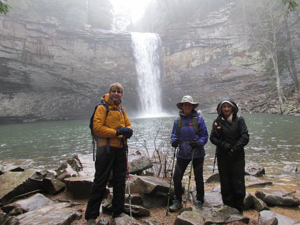
Another rainy weekend, but Joan didn't give up. I met her and Don Deakins at Savage Gulf Ranger Station. Calling for 3" by Sunday but we figured it couldn't come all at once, so we signed in at the new kiosk, and then on to Savage Falls which was really gushing.

The view along the South Rim trail were so pretty, we had expected them to be blocked by all the fog we drove thru to get here, but they were fairly clear. We stopped at 4 miles in, ate our lunch under hemlock cover, still in rain gear. The poncho I wore was great cover, except for my forearms, fleece jacket got soaked from forearms down. On the way out it rained. And then it rained harder in spells. The trail was full of water, nowhere to drain. My shoes were pretty wet by the time we got to the parking lot. I think Wayne made a good call cancelling the backpack we were going to do here this weekend. Might have needed our kayaks.

Pictures:


Sunday, February 4, 2018

Foster Falls TTA


Sunday hike with Joan leading, Michael, Sara and I didn't let a little rain keep us from hiking a beautiful trail. The trail was wet but the rain didn't last long. The view of the Foster Falls from the bottom is always breath taking. We had lunch at a campsite after climbing out of the gulf. Great day with great company. Thanks Michael for the pics.


Saturday, February 3, 2018

Ritchie Hollow and Rainbow Lake trails


The Ritchie Hollow trail is on River Canyon road in Chattanooga. It is a 2.5 mile one way trail from the Tennessee River to the Cumberland trail. It is a good climb up but you do get some views of the valley and you get to see Blowing Wind falls.

Rainbow Lake trail is in Signal Mountain on Ohio Avenue. It is a 2.3 mile loop trail around Rainbow Lake. You get to see an old spring, a chimney from an old cabin, and the lake.

Pictures:

Sunday, January 28, 2018

Fort Mountain State Park


Rain forecast for the weekend, so we loaded the camper instead of our backpacks. Headed South for Georgia, Fort Mountain State Park, just a two hour drive, and we had never been there.

When we got to the Park we blew past the camper check in, and found the campground, and the gate that required a code. The campground host gave us the code and said to pick our site, don't set up, you have to go back to the entrance and do the camper check in. We saw a lot of empty sites down by the lake and picked 3. Drove back to check in. They are site specific and our first choice was "taken" so we picked #47 with a lake view. We were hoping that our neighbors would not show up.

We got set up and had started our lunch when we heard a noise. After some investigating, we found water running out the side of our camper. Someone, when draining the water tank, forgot to close the blow off valve. I then noticed that the water heater was heating with gas. I had to turn the breaker back on for the electric water heater.

After lunch we took off to see what we could see. We hiked the trail around the lake first where we saw a kiosk with a sign saying "Tower open 1-4 on Saturday". Well, we had to check that out.

We drove to the Cool Springs Overlook for the view and then drove to the Tower trail which is also the Stone Wall Trail which has a lot of info about the "Moon Eyed People" that may have built the wall, and the Cherokee Legend, and the studies that have been done on the rocks to "date" them. MAYBE prehistoric?

The wall was basically a long rock pile which didn't look that old to us, but what do we know? When we got to the tower, the door was locked. So much for our tour. We drove back down to the lake checking out the cabins for rent and hiked the Big Rock trail.

When we got back to the camper it had started to sprinkle. We enjoyed an evening playing Battle Ship and Pay Day. Lora had never played either and it had been at least 30 years since I had. It was a nice evening.

The next morning after breakfast, we hiked to the Goldmine Creek trail. From there we caught the Gahuti trail hiked it back past the lake and up to the Campground Loop trail at the North end of the campground. It sprinkled on us the whole way.

We got back to the camper, ate lunch, and then packed up to leave. Great weekend.

Pictures:

Saturday, January 20, 2018

Graysville Mt. TTA


Crystal and I met the Upper Cumberland TTA hikers at Roaring Creek/McGill Creek Trailhead in Graysville. The sunshine must have followed them from Cookville. Lillian, Janet and Dr. Womac got there and so did the CT Volunteers; Don and Carol, TC and Judy and two furry friends, Bob, Mark and Teresa, and Jan and her friend, and two furry friends. They got started ahead of us. We stopped at what looks like a mine opening covered with icicles. Then uphill and across the road, to McGill Creek. We caught up with the other hikers and chatted with them, checking out all the new bridge parts waiting to be put together, cables strung across the creek, waiting on the workers to show up. Not sure what the schedule is to put the bridge together but it will be neat for this segment to be completed. As we were going back along the creek we saw bluebirds and some yellow ones too but not sure what they were. Maybe goldfinches.

We hiked back to the parking lot and then hiked up the roadbed to Polecat Falls. There was a lot of ice in the creeks, and on the walls and you could see where the other streams come just by all the ice on the hill sides. The rock overhang at Polecat Falls was covered with icicles and it was a cool view looking out from under at the falls.

Back to the parking lot and everyone headed home. It was a beautiful day with good friends.
Hiked about 7.5 miles.


Pictures: 

Monday, January 15, 2018

MLK 2018


Garnett scheduled another great long weekend at Roscoe's Retreat. 12 hiking ladies: Nora, Marietta, Cathy, Dianna, Nancy, Gloria Dale, Sue, Kathy, Linda, Betty, Carol, and me. Garnett's recent knee surgery kept her from being there and we missed her so much. We Face timed with her to keep her updated on activities. Nancy did a super job scheduling hikes but Mother Nature decided to throw a few snow showers and a little rain in the mix and the Park decided to close some roads. Thursday's hike was part of Old Sugarlands Trail. I didn't get there early enough for that one. I did get there in time for supper.

Friday we hiked Twin Creeks, and then the Gatlinburg Trail which somehow led to a rustic restaurant for some hot coffee and hot chocolate and the BIGGEST cinnamon roll I have ever seen. Almost like trail magic.

Saturday Plan B due to road closures, was Cove Mountain, passing pretty Cataract Falls, seeing views of Mount LeConte  and following the boundary of the Park. Not sure how far we hiked in, and then back out. The snacks were ready for us when we returned to the cabin and a few ladies got a little hot tub soak in with the refreshing 18 degree air out on the deck.

Sunday we drove to Tremont Institute to leave cars for a shuttle. There was a lot of snow on the road driving in, but the closed gate kept us from getting to the Middle Creek Trailhead. Plan B, no shuttle required. Lumber Ridge trail out and back. This is really pretty winter time trail, with the views into the Middle Prong of the Little River Valley, and Walker Valley. Not too far from the saddle of the ridge, I spotted 3 wild hogs, big and solid black. Marietta and Betty were with me, ahead of the others, so we were the only ones to see them. We turned around at Buckhorn Gap at the junction of Meigs Mountain, and Meigs Creek Trails. It was a quick lunch stop, as was all the other lunch stops, too cold to sit for long. Back at the Institute, 3 of us wanted some more hike time, so Marietta, Nancy and I hiked to Spruce Flat Falls. The Falls was just beautiful with all the ice. But the views along the ridge line were worth the climb up. All the timber in the upper elevations was frozen and snow covered and the sun was making it sparkle. Breathtaking! We had to stop and soak up this scenery.
Back at the cabin, more snacks awaited the hungry hikers. A little football watching and some Mexican Train domino action made a great evening. And a little Victoria on Masterpiece.

Monday's forecast was more snow coming to Nashville, so we packed up, cleaned out the leftovers for breakfast, some of our ladies headed for home. The rest of us headed to Trillium Gap Trail. Gloria Dale and I both need this one for map marking, to the junction with Brushy Mountain. It was another cold start but the sun was shining. We saw a large buck, 6 point I think, and a few does. After climbing for a while, 3 of our ladies said goodbye and turned back, and 4 of us kept trekking along. We got to Grotto Falls, which was absolutely gorgeous, and ice covered behind the falls, and  ice and snow covered part of the rocks intended for rock hopping across the creek, and 4 wise ladies decided it wasn't a good day for crossing the creek. We turned around with lips pooched out, disappointed at not being able to finish this trail. The pouting didn't last long, it was too beautiful of a day to pout. We started back carefully crossing the smaller creek only to see Marietta jump in the creek to save her hiking pole. Tough ladies, my hiking friends are. We met a lot of people hiking up while we hiked down. Saw the deer again at the bottom. We said our last goodbyes at the parking lot.

Another great weekend filled with good friends, good food, and fun times.
And I got two more trails marked off my map!

Pictures:

Sunday, December 31, 2017

Peters Mountain


My hiking partner was working a double for New Years Eve weekend, Nashville Meetup was backpacking in the Big South Fork. Guess what I did? Sarah scheduled a 2 night coldest weekend of the year outing on the Sheltowee Trace/Rock Creek area. We met up at the Rock Creek Loop and shuttled cars to Peter's Mountain trailhead. It was 33 when we started out after lunch.

It was kind of challenging to look at all the icicles hanging from the rocks and watch your feet, and cross the streams. Molly our four legged hiker got her coat wet but Sarah kept her warm, tucking her inside her jacket for a while. 

We passed by Great Meadows, our designated camp, it was too early to stop. We saw a picnic area across the river but didn't want to cross to it. Walked a little further then made camp below the ridge line.Got a lot of firewood collected, Sarah's and Steve's saws came in handy for cedar limbs. Had to stay warm in the artic air of the BSF. I double bagged with my 0 degree bag and Craig's 45 degree bag along with toe warmers and stayed toasty warm. RW got our morning fire going. A little pow wow around the fire resulting in Plan B. Hike out due to short mileage to the campsite on Rock Creek loop. So our two night outing became an overnight. 

Sarah, Molly, Smith and I stopped at Wildwood for a greasy cheeseburger and corn nuts then headed home for to ring in the New Year.

Pictures:

Saturday, December 23, 2017

Cumberland Cove


Cumberland Cove is a private residential area on the Plateau. They have beautiful hiking trails that can be seen by invitation only. The Plateau TTA has two members that own property and I got to go with them to hike there.

Butch was our guide for the day in the Eagle Flight Park area, leading us to the Sinks, Fork Mountain Cave and Arch Cave. Fort Mountain Cave had cave temperature steam coming out of it, and I took advantage of that warm air. The Sinks had some critter prints in the sand around the stream. We had to do some boulder hopping to get to stream level. Arch cave geology is much like the Walls of Jericho. And above the arch, it loos like another arch is forming.

According to their website there are three areas in the Cove with hiking trails, maps are there. Butch was a great guide, but they are serious about no trespassing. Make sure you get an invite to this beautiful place.


Pictures:

Wednesday, December 13, 2017

Fiery Gizzard TTA


Craig was backpacking on the AT and I had an extra vacation day to burn so I went hiking. Met the Plateau folks at the Fiery Gizzard Trailhead. Got on the trail around 10:30 EST.

The trailhead has been moved, there are signs that say area closed for restoration.  Kiosk is behind the picnic shelter and bathrooms. Another sign there says the CCC camp is now permanently closed. Too much trampling around the three campsites has made it into one big area and needs to rehab. You still get to walk past the 500 year old hemlock. The six of us had fun with all the rocks and I remembered to point out the arch at the top of the big climb to the trail junction. We didn’t go to Raven’s Point, we had enough miles to hike before dark without adding another mile. The  rerouted trail is beautiful and strenuous, but the waterfalls make it all worthwhile. On the woods walk the sun was setting and turning the horizon orange. We hiked into the last creek gorge and climbed up to the top of the ridge and got our headlamps out. Deb called the Ranger to ask them to not lock the gate on our cars at the other trailhead, that we were coming but still had a couple of miles to hike. We could hear Foster Falls but couldn’t see it in the dark. Louise gave the drivers a ride back to the other trailhead and then Deb drove back to pick up the other two hikers.

Beautiful hike for a day off during the week. 


Saturday, December 9, 2017

Black Mountain - TTA


Soddy Daisy TTA had a Christmas dinner at Olive Garden on Friday night. You would have thought we had all hiked to get there the way we scarfed down the breadsticks. John reminded me about a hike scheduled for the next morning so I thought I would go and try to burn off all that wonderful food.

I met the group that included Carolyn and Cheryl from the Plateau chapter, at the Black Mountain trailhead on Hwy 68. There’s a big parking area on the side of the highway now, you cross the road in a safer spot, and the State extended the trail entrance to there. We could see some more recent trail building along the road that still has a little way to go. 

We got to Windless Cave and our leader Boody wanted to hike a little further so the Plateau ladies had a party to attend and said their goodbyes. We hiked almost to the big rocks on the ridge and stopped for lunch.
We returned to our cars in the now thawed muddy entrance trail and stomped off most of the mud from our boots.


Pictures: