Sunday, April 26, 2020

Collins Gulf


Today we went for a day hike along Collins Gulf. It was 43 degrees with a misty air for our hike. The wildflowers were beautiful as well as the water falls. Saw lots of Wild Ginger, some purple Phacelia, Larkspur, Dolls Eyes, Cohosh, Wild Geranium, a few trilliums, one strange one that I think is Prairie trillium but has 4 leaves. A few Chickweed, Wood violet and Birdfoot violet, and was searching for Jack in the Pulpit. Finally found one, stopped looking for it after that one. Then saw 2 more, and on the way out at Suter Falls we found two purple striped ones, that we passed by on our way in and didn't see?

Pictures:

Sunday, April 19, 2020

Kirkland Creek/Brookshire Creek


Kirkland Creek trail #85 6.7 miles
Benton MacKaye trail #2 6.3 miles
Brookshire Creek trail #180 5.7 miles
Road back to car 0.5 mile
Total Miles: 19.2

A virus shut down every State Park and National Park, but the National Forest was open as long as the trail did not lead to the AT which was also closed, so we escaped to the woods. Bald River Wilderness FSR 126 was rocky and rutted but the trusty Subaru made it to the Kirkland Creek trailhead. We started out and immediately changed to water shoes. I copied this description from the Cherokee Hiking Club:

 Trail Description: From the Bald River Road Trailhead, immediately cross the Bald River (must use wading shoes, there is no possibility of crossing this river and keeping your boots dry unless you take them off). You will be following an old railroad grade along the left side of Kirkland Creek. After 0.9 miles, you will cross Kirkland Creek, which again may require wading shoes if the water is high. Then you will be following the right side of the creek. You will cross the creek, actually, several times until you reach the confluence of Kirkland Creek with Waucheesi Creek coming in from the right. At this point, you will cross Waucheesi Creek and with several more crossings will parallel Waucheesi Creek for almost a mile before finally cutting steeply left of the hillside and away from the creek bed. You will soon reach an old logging road at the crest of the ridge and and will cut right on this trail and follow it on up to Sandy Gap. Be careful at the 4‐way intersection at a gap. Go straight, not right or left. Please note this route is different from the route in the Skelton Book (Cherokee Nartional Forest Hiking Guide). The old route which stays along Kirkland Creek up to the gap, has been abandoned and is no longer maintained. 
Camping: Several excellent campsites are along the trail next to the creek.  
Water: Water is available all along Kirkland and Waucheesi Creeks and is also available just a short distance down from the Sandy Gap trailhead at a spring.

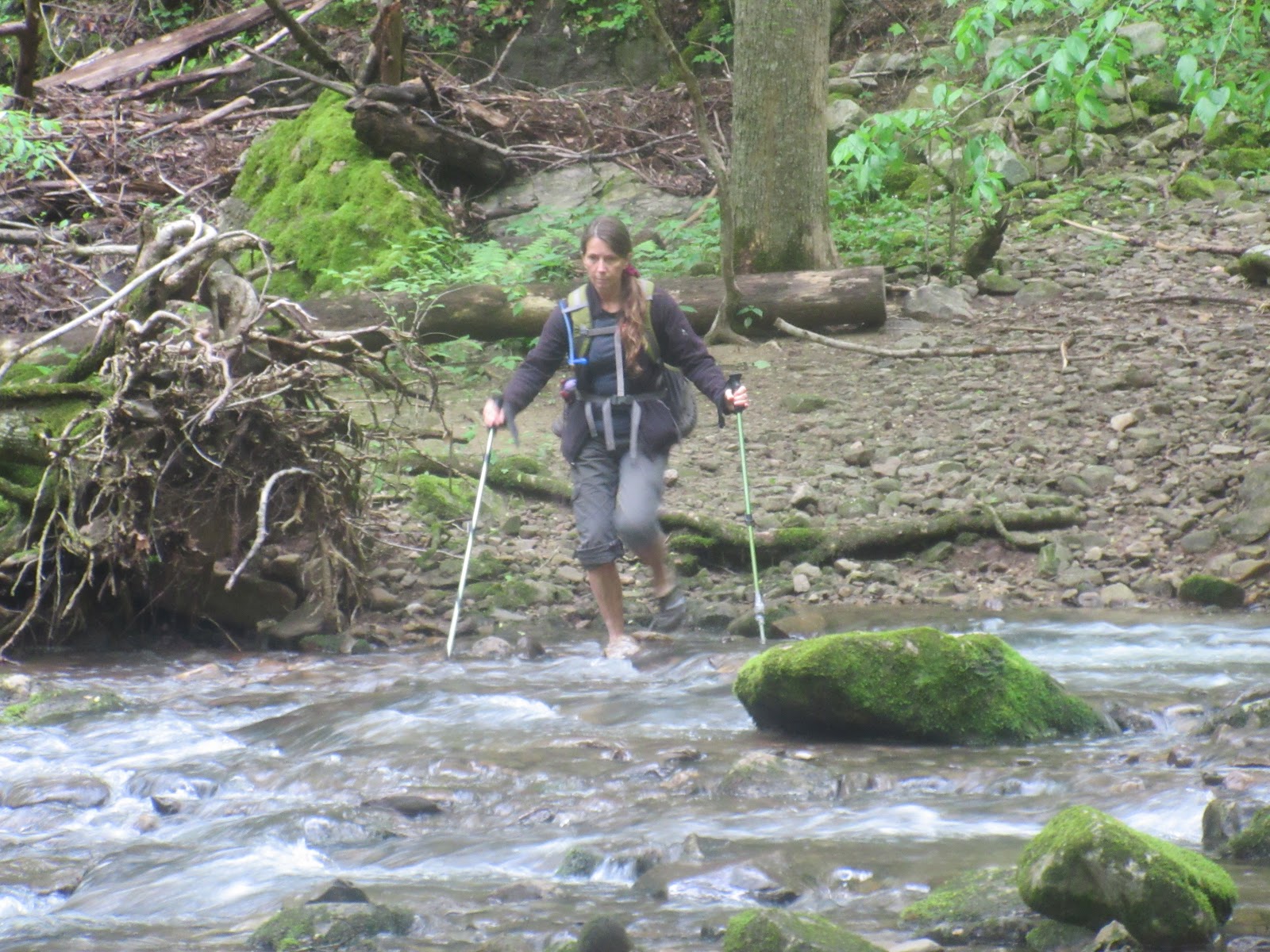
So we crossed several times changing our boots to water shoes almost every time sometime keeping our water shoes on. The trail was overgrown in places with dog hobble. Since we had our pants rolled up for the creek crossings the dog hobble was rough on us. Lots of wild flowers on the way, but nothing like what we were going to see. Just where the trail leaves the creek, we found a nice camping spot and had lots of downed trees for firewood. The water source was great. We left the tarps off to watch the stars. We tried calling in owls that night with no luck.

The next morning an owl woke us up. We saw it as we climbed up the side of the mountain leaving camp. We followed the trail to meet the Benton MacKaye at Sandy Gap. There is a gravel road FSR50 at the gap. The Benton was a constant up and down following the ridge line. The views were great without leaves on the trees. The wind was blowing like crazy. We were amazed at all the wildflowers we saw on this section. Not just the numbers of them, but by the amount of different flowers we saw.

We ate lunch on the trail and then after the final climb we came to the signed intersection of the Benton and Brookshire creek. The two trails actually follow each other for quite a few miles. We dropped down into the creek valley and started looking for a good camping area. There are lots of places to camp, just don't know about creek access with all the rhododendron. We found a spot with a previous campfire a couple of miles down. We were early enough for bath time. Lot's of fire wood to be had. A group from the Great Smokies Hiking and Adventure Group came by doing the same loop we were doing, but backwards. We visited with them for a while as Lora knew a couple of them. The rest of the night was peaceful. We put up the tarps expecting rain later in the night and we were not disappointed.

The next morning we had breakfast under tarp, but by the time we packed up the rain had stopped for the day. We continued down the creek. Just an amazing amount of wildflowers all along this trail. At the trail junction, the Benton crossed the creek at a couple of waterfalls. The rest of our trail was pretty much roadbed. Most of the tributaries were through culverts until they got really wide and deep. That is were we did our crossings. Just a couple and the last one before the road. We had lunch at the road and then walked on to our car.

With rain coming in for Sunday we decided to do some driving. We drove on through on FSR126 to Tellico River road. We stopped at Green Cove Pond to check it out. Surprising to see so many people in a backwoods area. It is a fishing pond for seniors and children. We scoped out campsites along Tellico River road to the border and back. 

On a potty break on the way home, we found a trail on the side of  Pumpkin Hollow road that lead to an old settlement. Can't find any information about it on the web.

List of flowers: 8 different Trilliums: Large Flowered White, Sweet White, Bent, Red, Sweet Betsy, Yellow, Painted, Catesby's. Showy Orchis, Mandarin, Dutchman's Breeches, Star Chickweed, Foam Flower, Squaw Root, Anemone, Mayapple, Canada Violets, Wood Violets, Yellow woodland and Halberdleaf, Sweet White, Marsh blue.
Dog Hobble, Wild Strawberry, Cohosh, Carpet Bugle, Canada Mayflower, Spring Beauties, Toothwort-cutleaf and fineleaf, Wild Geranium, Dolls Eyes, Yellow Stargrass, Dwarf Crested Iris, Sweet Shrub, Robin's Plantain,Phlox.


Pictures:

Saturday, April 11, 2020

Armstrong Road


Lora and I worked on our deck until the weather warmed up and then headed to the lake. We put in on Armstrong road off Hixon Pike. First we crossed under Hixson Pike and paddled that area and then we headed West and went up the next slough. There were fishermen everywhere! Even the fish got out of the water because it was so crowded. We went a little further West and then headed back against the wind just because.

Pictures:

Saturday, April 4, 2020

First Trip 2020


With the hiking trails closed for the Coronavirus we took the canoe out for the first time this year. We head down 60 and put in at the Cherokee Removal Memorial Park. Our plans were to canoe the Hiwassee Wildlife Refuge. When we backed down the ramp we found out that the water level was down below the ramp. Made an interesting unloading of the canoe. Of course when we got to the dam that we always float over, it was two foot higher than the water level. Change of plans took us along the side of the island and back. We saw lots of birds, turtles, and fish. We even saw a lot of sun which we are still getting over.

Pictures:

Sunday, March 29, 2020

Stinging Fork New trail


Craig and I explored the new segment of the Cumberland Trail being built between Stinging Fork SNA and the Head of the Sequatchie. Didn't know we would have a creek crossing, we didn't take crocs so we took off our boots and socks and waded across. Not as painful as January crossings, but Craig went slow enough in front of me to make it pretty refreshing. Lunch was by a pretty little stream.

We hiked until we found the End of Trail sign, then followed the flagging thru the woods for a little while until the holes hidden under the pine needles and the greenbriar got the best of us. I had heard the trail was 10 miles long and 7 of it had been built. The 3 miles needing to be built must be in the middle, where we were.
We will have to explore from the other end.

Pictures:

Saturday, March 28, 2020

Shakerag Hollow


Shakerag Hollow is well know for spring wildflowers, and it was right on track today. Sara, her friend Sara, Michael, Marietta, Marcia, Sherlene, and me. Not sure who was the most excited about seeing the blooms. Ooos and aaahhhs all over  the place. Sherlene pointed out so many blooms and found the Jack in the Pulpits and Dutchman's Breeches for me, first I've seen this spring. And the white trilliums were showing off. Then we saw the Red trillium. The Celandine poppys were gorgeous. Hillsides covered with spring beauties. Thank you Sara for the invite. We worked hard to not hug and stay the appropriate 6 feet apart due the the Virus of the Century. So many parks shutting down, we were happy to have this trail to hike on the Sewanee campus property.

Pictures:

Sunday, March 22, 2020

Little Cedar Mountain


Sunday afternoon hike with Sara. I got there early, paper was scattered all over the place from the turnoff to the kiosk. The parking lot was covered, it was in the grass too. I put on gloves and got a shopping bag out of the car and started picking up paper. Got bitten by black ants on my arm. People pulling in asked me if the papers were mine, LOL. A few folks that pulled int helped pick up some of it. I filled up both their trash cans with the paper. Looked like travel magazines you find in rest stops, someone had torn the pages out and scattered them. The police officer that drove thru waved at me, wouldn't even stop to ask questions. What would possess someone to trash this place???

Sara got there and we started our loop hike. Wildflowers were out! We saw trillium, larkspur, purple phacelia, stonecrop, Little Brown Jugs, wood sorel, and a yellow flower I think is Hoary Puccoon.

The views of Nickajack Lake were really pretty. Several family groups on the trails, everyone happy to be out on a pretty day.

Stopped on the way home at Stone Cave Bakery for some fresh baked bread. Washed my itchy arm in the cool spring water across the road from the bakery, swallowed a Benedryl and tried not to scratch.

Pictures:


Monday, March 16, 2020

Mammoth Cave Weekend


Backpack on a rainy weekend? Nope, let's take the camper out. Decision made on Friday, Craig is at work, so I (Lora) packed the camper and hooked up the rig! We won't talk about how long it took....

Saturday morning I met Craig in Cookeville, we made it to Mammoth Cave National Park in time to set up camp, eat lunch and get to our 1:30 tour, the Extended Historic Tour with Ranger Steven and Ranger Steven. Ranger Steven #1 knows his history, stories and legends. I never imagined how mammoth the rooms in the cave could be. It's incredible to see, and then the fat man's misery tunnel you walk thru (sideways), the coffin, the elevator, so many cool things to see.  And then the Ranger turns off the lights so you can experience the darkness in the cave. One story was of a guy who got lost in there and they found him by the sound of him banging rocks together. He said he banged rocks because the quietness in the cave would make you crazy, all he could hear was his heart beating. It was pouring rain after our tour so we hung out in the camper, Craig sank my battleship, twice. It quit raining long enough for a walk around the campground with a headlamp.

Sunday morning, no rain in sight. We hiked the trails around Mammoth Cave. Down to the Green River, Sunset Overlook, River Stix, White's Cave, and a few trails not on the map and some on the map that were in the wrong place. Either the map needs work or the trail markers need work. We got to see woodpeckers, deer, squirrels, and chipmunks. There is a sight where the old ferry used to come into the park.

We made it back to camp in time to eat lunch and pack to go. On the way home we stopped by Standing Stone State Park and hiked along the lake. We parked at the visitor center and took the tea room spur to the lake trail and back up the cabin spur. Lot's of wildflowers out.

Pictures:

Saturday, March 7, 2020

Big Frog TTA


Jan and Kathy planned a hike up Big Frog Mountain on a beautiful sunny day. I met them at Thunder Rock Campground by the Ocoee River. A crew was there sawing trees that were down in the parking lot and campground area. The bathroom floor had been painted too. Spring cleaning I guess.

Another hiker Jan from Nashville met us and we carpooled up the forest service road to the trail. The ladies were telling us about their last time being here, that their directions took them on a scenic drive the wrong way on the forest service road. They had better directions this time and got us to the trailhead without any issues.
We didn't have any trouble finding parking space, we were the only car. Yay, we have the forest to ourselves!

Big Frog trail # 64 starts at 2,160 feet elevation. The top of the mountain is 4,220 feet. We climbed. There are lots of views as you climb, winter time views. No big open views, but so much beauty thru the trees. And the climb is a nice one, easy to moderate, and so many different  forest types. The top is tree covered so no big views at the top.
A couple of campsites at the trail junctions, and one at the top and end of the ridge. At that campsite I saw a little glass jar tucked into an opening in the bottom of a tree. Looked like tissue it it, so not knowing if the tissue was used or not, I didn't touch it. May have been a geocache, but who knows. After seeing the abandoned sleeping bag/bivy and gas canister at the trail sign, you never know...

Big Frog Trail has a lot of trail junctions, all of them were signed. The trail descriptions say there's an excellent spring wildflower display here, but we didn't find any. May have to come back later this spring.  I did find an old growth tree to hug. 

Pictures:


Saturday, February 29, 2020

Stinging Fork Falls


Lora and I decided to hike the Stinging Fork Falls part of the Cumberland trail. We went in off Shut in Gap Road on top of the mountain. We went to the overlook first and then down to the falls. We followed the Cumberland trail along Little Soak Creek for about two miles before we headed back out. It was a beautiful day of hiking. On the way out we checked out the new section of the Cumberland trail that isn't opened yet. Yea, new trail!

Pictures: