Saturday, December 8, 2012

Sequatchie Valley Institute


My hiking partner was on shift today so I visited the Sequatchie Valley Institute  They were having an open house and craft sale. They also offered hiking their trails. The Institute is all about sustainable living.

Got there around 11 and followed the host up the trail from the parking lot. It was a mile to the main house called Moonshadow. There are many other structures on the property. Built out of rocks, clay, straw and logs powered by the sun built by folks during workshops on sustainable living. I toured the grounds, checking out the organic gardens, greenhouse full of cacti, orchard, and the main house. The crafts were set up inside the main house. It is heated by solar and a fireplace. They collect rainwater too. There were lots of talented folks showing their crafts of wood, glass, paper, and more.

There are 400 acres belonging to the Institute. I walked back to my car, got my pack and hiking stick, got directions from the host and started up the ridge. I was heading for the rock house on the top of the ridge. They had it marked with ribbons so it was fairly easy to follow even with all the leaves on the ground. It was pretty steep climbing. When I reached the top i explored the rock house taking in the views of the Sequatchie Valley. Beautiful! Found another hiker at the top who had "found an alternate route up" (goat trail). We hiked down together, He agreed my route was easier.
It was a beautiful day to be in the woods and explore a really interesting place.

Pictures:

Tuesday, November 20, 2012

AT- Wayah Bald to Fontana Dam


Wayah Bald to Rocky Bald 8 Miles
Rocky Bald to Jump Up 14.2
Jump Up to Brown Fork Gap 11
Brown Fork Gap to Cable Gap 6.1
Cable Gap to Fontana Dam 6.9
Total Miles: 46.2

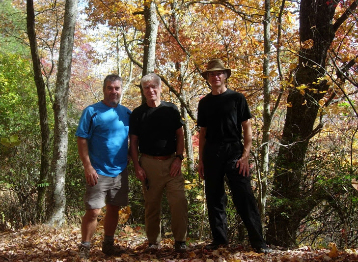
Well we finally got another five day section of the AT in.  We started back at Wayah Bald where we left off last time.  This time we actually had a view from the tower as last time we were clouded in.  It was around two o'clock when we headed out.  We stopped by the Wayah Bald shelter to check it out and then headed on down the mountain.  We crossed 1397 and started climbing Copper Ridge Bald.  The Cold Spring Shelter is right on the trail.  They have just finished remodeling it and it looks good.  We really appreciate the trail maintainers and volunteer workers.  We climbed up Rocky Bald and took the side trail up the rock to see the views.  Then we hiked down to the campsite just down and on the left with the spring at it.  This was night one right at eight miles in.  We saw some giant grasshoppers, a turkey, and one hiker in this section.  We heard owls that night as we set up camp and were sitting around the campfire.

DAY TWO
We got up in the morning knowing that we had 12 miles to make today.  When we got to Tellico Gap we found a couple of trucks with hunters and dogs.  They were hunting bear and as we started up the trail we heard the dogs doing there tracking.  We listened to them for quite some time as there path was heading the same as the trail.  We climbed up to Wesser Bald and climbed the lookout tower.  It was another beautiful 360 degree view.  We had to get a picture of all the moss growing on the trees by the tower.

We stopped for lunch and while we were visiting, I heard a noise in the leaves.  I asked Lora to be quite and we listened as it got closer.  A gray fox walked right up to within ten feet of us.  He stared at us for a while and did the head bob thing.  After he didn't get anything out of us, he turned around and went back down the side of the mountain.

After lunch we came to the "Jump up" or boulder outcropping that had a great view of the valley below.  We passed a father with two sons doing a backpack.  We continued the steep descent down to the NOC.  We saw a building that was right off the trail which we first thought was a shelter and then decided that maybe it was a fancy hunting blind.  Later on down the trail we found the Rufus Morgan Shelter.  When we got to the NOC we were tired of going downhill.  The NOC is seasonal so the store and restaurant is the only businesses open in the winter.  We were going to use the restroom facilities across the river but we found those locked as well.  We crossed the railroad tracks and start the climb out of the river gorge.  This is when we thought about the water that we were going to get at the NOC.  Well, we counted on the spring at the campground before Grassy Gap.

We passed another couple hiking the other direction.  The lady had sprained her ankle and was hopping slowly down the trail.  Not a good day for her.

When we got to the campground we realized that there was no water.  Our next choice was to keep going until we found some.  We finally found a spring coming out of a rock area across the trail.  We filled up and then the hunt was on for a flat spot with our headlamps on.  After we climbed the "Jump Up" there was a flat spot next to the trail and we called it a night.  Our twelve mile day had turned into a fourteen mile day.  No fire, just rest tonight.

DAY THREE
We slept in this morning.  We had cut our eight mile hike today down to six miles so we slowly got ready and climbed toward Cheoah Bald.  We stopped at the Sassafras Gap shelter and filled our water up.  Cheoah Bald, the last time I was up here with Dad and Steve was a beautiful cloud.  This time you could see for miles and miles.  The sun was shining and the views were wonderful.  We took us a good rest before we descended to Locust Cove Gap.  We passed some more bear hunters and their dogs.

It was lunch time now so we studied the map and trail descriptions.  We were feeling good and there was a piped spring at Stecoah Gap.  It would only be an eight mile day, nine if we went to the next level spot.  Off we went!

After the major descent into Stecoah Gap we were pretty much tired out.  We went in search of our piped spring.  We searched and searched to no avail.  Finally we broke out the map and found the 2.5 miles to Brown Fork Gap shelter the next water.  We started the climb and came across two backpackers coming down the trail drinking beer.  Wow, they are good!  After talking to them, they told us there was beer just ahead on the side of the trail.  No, I did not run Lora over......it was more of a push.  After my beautiful wonderful beer, I was in happy land hiking up the trail wondering why Lora was not so happy.

There is one hell of climb to get up to Brown Fork  from Sweetwater Gap.  It was killer after a long day.  We got into the shelter just as it got dark enough to use a headlamp.  Our short day had now been eleven miles.  We did a campfire and watched the shooting stars for a while before bed.  

DAY FOUR
We slept in and then enjoyed breakfast around the fire.  We packed up and hiked about three miles then took a break at Cody Gap.  After a short nap we continued our hike.  We stopped for lunch and if someone would have hiked by us he would have though that we were in a wreck.  Our shoes were off, our packs scattered, and we were laying by the trail fast asleep.  The last couple of days had caught up to us.  We only had six miles to do today to get back on our schedule so we took advantage of it.

Cable Gap shelter kind of sneaks up on you.  Your walking the side of a mountain and all of the sudden there it is.  We set up camp, gathered wood, and collected water.  It wasn't long before we had a fire going, dinner done, and watched the stars come out.  We slept well again, except for the one visitor that got my full attention in the middle of the night.  I heard it coming from the shelter and walk around the tent.  It walked away for a few steps and then nothing.  I listened and listened.  I knew I needed to use the bathroom now, but I waited.  Finally I unzipped the tent to find that it was gone and we were all alone.  It had to be a bear with as heavy and loud it was walking.

DAY FIVE
This was our final day.  We had 6.9 miles to Fontana Dam.  Another beautiful morning and a hiking we went.  I did have to make contact with our shuttle as there was no service last night.  After a few different attempts, I finally got to leave a message for them.

Somewhere before Walker Gap we came across a thru hiker.  As he was talking he said that he had got caught in the Smoky's in a snow storm.  Lora of course said that she had read in the news paper where a hiker had to be rescued by helicopter from the AT and he said yes, that was him.  Solo has a journal that you must read of his survival in the shelter.  He went to sleep in the shelter to wake up to over four feet of snow when hurricane Sandy went through.  Check out his link!  He was now finishing the trail with two very injured feet and with a very positive attitude.

We began the long decent down to Fontana Lake.  By the time we got to the bottom the knees and feet were hurting a bit.  Another mile and a half and we made it to the dam where Mom and Dad were waiting for us.

We did a late lunch at the NOC and then they took us to our car.  We walked back out to the tower so that they too could see the view that they missed the last trip.

Pictures:

Sunday, November 11, 2012

Roaring Creek - Cumberland Trail


Lora and I headed out to hike the Roaring Creek segment of the Cumberland trail.  This trailhead is in Graysville off Brayton Mountain Road and is a two mile section that has not been connected yet to any other section of the trail.  We met the Plateau Chapter of the Tennessee Trails Association at the trailhead.  They had just finished the hike.  The trail follows Roaring Creek and then turns uphill and ends currently at an overlook of Graysville.  From the overlook you can see the mountains of East Tennessee and the Soddy Nuclear Plant.  We got to watch a hawk flying over while we were eating our lunch.

Pictures:

Map:

Sunday, November 4, 2012

Pilot/Wine Loop Trail - Big South Fork


Day One:
Pilot / Wines Loop 8.2 miles
Day Two:
Pilot / Wines Loop 5
Dome Rockhouse 1.2 miles
Pilot / Wines Loop 1.6
Bronco Overlook trail 1.8 miles
Total Miles: 17.8

Lora and I headed out for an overnight hike.  We went to the Big South Fork area and hiked the Pilot Wine loop plus a little extra.

We started out at the Station Camp East trailhead and hiked counterclockwise.  We passed a quite a few horse riders out this time.  The last time that I hiked this trail with Troy, we missed Pilot Rock.  I was determined not to miss it this time.  Once again as we hiked through the rock wall section when the trail turned steeply downhill off to the right, I pulled out the trail description.  There is no trail to Pilot rock.  There may have been at one time, so Lora and I headed straight out the ridge and BANG, there it is.  You cannot see it from the trail, but a few yards in and there is a huge rock sitting on top of the ridge.  I was excited to find it this time!

After Pilot rock we headed down to Grassy branch where we followed the horse trail off down stream to find a place to camp.  If you stay to the right and go upstream on Williams branch there is a place in the woods that makes a good campsite.  We did some exploring in the area after we set up camp and collected firewood.  We heard a couple of owls that night.

The next morning we got up and started the steep climb out of the river gorge.  The leaves that were still hanging on were green or red making a pretty picture.  There were so many leaves on the trail that we didn't hear much wildlife let alone our conversation with each other.  When we came to the second connection with the Big Island Loop we meet some horse riders that were trying to figure out what to see today.  We told them about stuff in the area and they too took the trail to the Dome Rockhouse.

The Dome Rockhouse is like a large room in a cave with a large opening.  It is really cool with the rock being different colors in the dome part.  After that we hiked back to the Pilot Wine Loop trail and made it back to the parking lot. 

We dropped the packs and hiked the Bronco Overlook (Station Camp East Overlook) trail.  This is an easy walking trail through the woods to a good overlook of the Big South Fork Gorge.

Pictures:

Sunday, October 21, 2012

Father / Son Trip 2012


Day One: 9.3
Mt. Sterling Trail 0.5
Long Bunk Trail 3.6
Little Cataloochee Trail 4.1
Palmer Creek Trail 0.8
Pretty Hollow Gap Trail 0.3
Campsite #39
Day Two: 8.4
Pretty Hollow Gap Trail 0.3
Palmer Creek Trail 3.3
Balsam Mt. Road 0.7
Balsam Mt. Trail 4.1
Laurel Gap Shelter
Day Three: 8.7
Balsam Mt. Trail 0.2
Mount Sterling Ridge Trail 5.8 to tower
Mt. Sterling Ridge Trail 0.5
Mt. Sterling Trail 2.2
Total Miles: 26.4

We started out with the family get-to-gather at the ponderosa.  The ladies didn't wait for us to get on the trail this year.  They started early heating up the credit cards.  Steve and Dad were doing chores before I arrived and somehow I missed out on the work.  We ate lunch and discussed how we could make a simple hike difficult.  We had two hikes on the books this year and they had settled on a loop hike.  I had figured a good loop with a big climb on the front end and the rest down hill.  Who would have thought about doing it backwards.......well I mean besides Dad?

We headed out on Thursday for the Mt. Sterling Gap trailhead.  After we shook off Dad's van racing, we hiked up the Mt. Sterling trail to the Long Bunk trail.  The first people we passed were an older couple who were doing a sixteen mile day hike.  That was only about the same as our first two days.  They were the heroes today.  When we got to Little Cataloochee trail we got to tour a few buildings and grave yards.  They have restored a couple of cabins and a church from a former life.  It is always fun to see history in the Smoky's.  Somewhere along this trail Dad mumbled something about not remembering this trail being so steep.  As we were climbing we heard and saw two Hawks flying overhead.  That was followed by an owl doing some talking.  Towards the end of the trail, on a down hill section, a turkey walked across the trail dragging his beard.

Just before we got to our campsite we met the older couple again heading down the trail.  They might have made it out before dark, but not by much.  When we got to camp there was a woman camping alone.  She went by the trail name "Sunshine".  She visited with us around the campfire that night.  She had a history of hiking including a thru hike of the AT.  She was a nurse from the Asheville North Carolina area.  She was going to meet up with her boyfriend at the Laural Gap shelter the next evening.  Surprise, that was where we were going.  We had a clear night with lots of stars. 

Sometime in the night a very strong wind came through.  I woke to my tarp beating my hammock.  I heard Steve getting up to adjust his tarp.  I got up to cover my pack as I figured the rain would be blowing hard soon.  The wind died out and later we got a light rain which was all done by the time we got up.
We got up and headed out after breakfast.  Sunshine caught up to us and hiked with us for a time before heading on.  For some reason there was alot of climbing today.  We hiked up into the clouds and the scenery was limited.  We had a good climb up to our shelter.  When we got there Sunshine and her boyfriend Chris were there.  We did some searching and came up with enough fire wood.  Slowly but surely people started showing up.  We ended up with 12 in the shelter and three pitched a tent.  We were entertained with lots of stories and with a beginner hiking trio.

We had two retired police officers from Atlanta to tell stories.  They had a son in law with them.  The three hikers from Chicago were fresh to hiking.  We tried to help them out with some tips for their next trip starting with some real clothing.  They had eaten granola and jerky for the first two days.  Tonight they were going to try Mountain House meals.  They pulled out their two liter nonstick stove top pan and started trying to make a fire.  Someone finally felt sorry for them and heated some water on the stove for them.  They were trying to save weight by not bringing a stove.  The other one pulled out a full size bottle of Gold Bond to cover his feet.  They had blisters on their blisters.  They pulled out their pocket knives to use as spoons, but they really were impressed with Mountain House.

After a night of rolling from one sore spot to the next, like shelters make for some reason, we got up and headed out.  We hiked the Mt. Sterling Ridge trail up to the tower on Mt. Sterling.  We got some good views from the tower and then ate lunch at the base.  We saw another couple as we headed back to the Mt. Sterling trail and down to the car.

We stopped for a celebration ice cream in Wears Valley and headed home for the pizza celebration at the ponderosa.  After dinner we had a serous card game while we waited for Marco and Natalie to show up.  Then we celebrated their wedding with another party.

The next day we headed out to Metcalf Bottoms for a hike and picnic.  Lots of people were out enjoying the wonderful fall colors of the mountains.  We enjoyed the love of family.

Pictures:

Sunday, October 14, 2012

Cataloochee, Smoky Mountains


Rough Fork Trail 2.9
Caldwell Fork Trail 1.5
Campsite #41
Day one total: 4.4 Miles
Caldwell Fork Trail 2.1
Boogerman Trail 4.1
Caldwell Fork Trail 0.8
Road walk 2.7
Day two total: 9.4
Total Miles: 14.1

Lora and I went to Cataloochee in the Great Smoky Mountain National Park.  This was the first time in that area for both of us.  She wanted to see the Elk and old growth trees.  We went in on Cove Creek Road and the colors were wonderful.  On the way in after you pass the campground, there is the Ranger House, a church, a school house and another house that have been restored.  When we got to the fields the road was lined with cars and people setting out in lawn chairs.  It looked like they where waiting for the Elk to be released.  We drove to the end of the park to our trailhead for the Rough Fork Trail.

After we packed up, we headed into the woods and within the first hundred yards we had seen six Elk.  The first three were laying by the side of the trail.  It was funny to think that all those people were in the fields waiting.

We did do a tour of the Woody house, another restored structure on the trail, on the way through.  Campsite #40 is a smaller campsite covered with large downed trees by the creek.  It has three different small sites.

We got to see some large trees, but also an incredible large poplar tree off the trail before campsite #41.  Campsite #41 is a large campsite along the creek.  There were four other groups in the campsite before we got there.  We got to listen to an owl during the evening hours while setting around the campfire.  We had a very peaceful night with lots of stars.

The next morning we headed out again.  We got to see more large trees, many rock walls, and old home sites.  There is one section of the Boogerman trail that has numerous large old growth trees.

When we got back to the valley we got to see two different herds of Elk and a flock of turkeys.  Cars were once again parked all along the fields with people in lawn chairs.  This time they did have something to look at.  We got in the car and then took the Mt. Sterling road on the way out.  It is a long mostly one lane gravel road that curves through the mountains.  A very beautiful trip.

Pictures:

Sunday, October 7, 2012

Soddy Creek - Cumberland Trail

After church Lora and I decided to hike on the Cumberland trail.  We were already in Soddy so we headed up Hotwater road to the trailhead.  We headed South on the trail through the old mining area.  We didn't get,   but a couple of miles in and my foot started bothering me again so we headed back.  It was a beautiful day to be on the trail.

Pictures:

Saturday, October 6, 2012

Honey Creek - TTA


TTA hike with Upper Cumberland. Pete K. was our leader for the Honey Creek Hike. I drove thru fog, mist, sprinkles and cloudy skies to the trailhead. It was a cool fall day. 12 hikers set out to see the best that Big South Fork has to offer. It stopped sprinkling before we started.

We started at the overlook, and then climbed down the ladders to the trail. I took my crocs just in case the creek crossings were high. We found a couple of places that the trail was too muddy and the rocks too slick to climb down, but not to worry….Pete had a rope! He tied off to a tree and we used it to descend. I didn’t need my crocs, the creeks were low, just rock hopping.

We had lunch on an open area of rock. We were amazed at the rock bluffs on this trail. Such a cool area to hike. The sun finally broke thru and warmed us up a little. You have to watch for the blazes on this trail, some are painted on the rocks you have to climb thru and around.  This is the 4th time I’ve hiked Honey Creek and I always manage to lose the trail. Pete kept us on track and we climbed back up the ladders to the overlook to finish the hike. It was great. I love this trail.

I wanted to stop in Allardt for the Pumpkin Festival. I got right to town and the highway was shut down for the parade. I watched folks get out of their cars and walk up to the street to watch the parade. This is a main highway! I got out and walked up to the police officer stopping traffic to let the parade out of the side street, and said “so in this town it’s alright to park my car in the highway and leave it to watch the parade?” and he says “No ma’am, it’s not ok” and I asked how long we would be sitting still, “about 45 more minutes” he said. It only took about 15 really when we started moving. I had to go around 2 vacant cars, wonder where those folks were? hmmm. I parked in a field and walked thru the craft areas. SO much BBQ cooking, all pork, no chicken. So I got a Nathan’s hot dog smothered with grilled onions and mustard and a big glass of fresh squeezed lemonade. Mmmmmm.

Coming into Pikeville I saw the sign for the Harvest Festival happening today. I missed it, but caught the last few minutes of the music. Cody McCarver was singing, glad I stopped by.

It was a great day.


Pictures:

Sunday, September 30, 2012

Possum Creek


Lora and I headed out after a rainy morning to do some canoeing.  We went to Possum Creek RV Park and Campground's boat ramp on Lee Pike.  It cost $3 for a pass, but is a good safe place to put in.  We went under the bridge and followed the coast line around and then up to the Creek.  We went up the creek until we got stopped by a bridge for a driveway next to McCallie Ferry road.  We did have to navigate under a big tree and break some branches off another.  We came back out and followed the opposite coast line back to the boat ramp.  Another great place for canoe or kayaking.

Pictures:

Sunday, September 23, 2012

Hornsby Hollow - Watts Bar Lake


Lora and I headed to Watts Bar Lake for the weekend.  We got a site at Hornsby Hollow Campground and canoed for two days.  The campground is great!  Friendly owners, clean bathrooms, clean campground, great boat ramp, good campstore, and its on the lake at a great location.

The first day, after we set up camp, we canoed South along the shore.  When we go into the big lake, the wind was whipping and the waves where high.  We ended up turning North and going around the big Island and back into the covered inlets for calm water.  We had a great time.  Sat out on the dock for sunset and enjoyed a fire under the stars that night.  The next day we got up and did some more exploring along the coast heading North again.  Light winds today so it was more enjoyable.  Made it back for our three o'clock checkout and headed home.

Pictures:

Sunday, September 16, 2012

Colorado 2012


This was Lora and My first trip to Colorado.  Steve and Kathy invited us to join them on their vacation trip that they take every three years to Colorado.  We took a flight out of Nashville to Charlotte.  Who knew North Carolina was between Tennessee and Colorado?

I do have to tell you about the guy that sat next to me on one of the flights.  You know you always get one.  Well as soon as he sat down, he went into a coughing fit.  I mean a serous one.  I was thinking that I was on vacation and this guy is going down.  Anyways he got control of himself for a couple of minutes and then did it again.  Now I'm thinking he probably has something contagious and I'm going to die.  He gets control again.  After we take off he buys a lunch from the airline.  You should of heard this guy as he eats;  smacking, sucking, slobbering, and chips are going everywhere.  Well he finally finishes and gets up to go to the bathroom.  He seat is full of chip crumbs.  He gets back and pulls out a meal from a fast food joint and it all starts over again.  I can feel biscuit crumbs hitting my leg as he makes all the awful noises again.  Finally he is done.  Yep, the coughing fit again.......AHHHHHH!!!

We flew into Montrose Colorado where Steve and Kathy met us at the airport.  I texted them saying that we will just meet them out front.  Well we get out of the airplane and walk across the ramp.  They open a door and there they stood.  It is also the same room the luggage pickup is in.  Small airport!  We stopped and had dinner at a Mexican restaurant in town. Then we head to Ridgeway State Park where Kathy gave us a thorough tour of the park looking for the trailer.  We even got to see the boat ramp.  Anyway this is where we set up our base camp.  They have a new trailer that they are in the process of building into a camping trailer.  We sat around the campfire under the beautiful stars and discuss our plans for the following day.

There are two kinds of trails in Colorado, Steep and Granny gear steep.  You go by altitude instead of miles. The mountains are actually falling apart all the time.  I give credit to the trail keepers as that has to be one of the toughest groups I know.  They have to clear landslides, rebuild cliffs, and I don't know how they hang off the sides of the trails to do all that.  Anyone that has climbed the 14ers......you are tough.  Mt. Sneffels is one that you don't have to use a rope.....right!  Don't buy that one!  I asked Steve about the trails that we were backpacking on.  He said that the Bear Creek trail did have a cliff that you walk next to for a half mile.  I spent the next few days worrying and asking questions about this one.

Our first hike was the Blue Lakes Trail in the Mt. Sneffels wilderness area.  This was for us to get used to the altitude.  It was amazing how quickly you go into panting mode sucking for oxygen.  I did get a mild headache that first day.  We worked those leg muscles pretty good.  Everywhere that you go in this area you are in a picture.  Everywhere you look is just beautiful.  All the way!  We started at 9200 feet.  Lower Blue lake is at 11000 feet which we just had to get in to cool off the feet. As we sat at the Lower lake we heard a land slide up on the mountain face across the lake.  Falling apart I tell you.  From there we hiked to Upper Blue lake which is at 11760 feet.  Lora and I decided to go ahead and climb the Blue Lake pass that is at 13000 and we were about two switch backs from the top when the trail became to dangerous to stay on.  There was no more flat trail at all and the sharply slanted trail was covered in loose rock.  Not good for the pace maker!  We quit and got our hearts stabilized before heading back down.  It was 5.7 miles to the pass.  We got to see deer, chipmunks, marmots, squirrels, and trout in the lake.  That was enough to wear us out.  Back to camp and drinks around the campfire.  We cooked out some burgers.

On our second day we went into Ouray.  It is known as little Switzerland.  It sits at 7792 feet in a canyon surrounded by mountains.  It is an historic Gold and Silver mining town with a natural hot springs.  Very beautiful.  We hiked the 2.2 mile Sutton Neosho Mine trail.  That gave us great views of Ouray and Bear Creek where we were going to do our backpack trip later in the week.  We got to see the Nesosho mine and buildings.  It is known for the Antique sign that you can see from the Million Dollar Hwy.  We ate lunch there at the mine and then hiked back.  We took the  Perimeter Trail which  heads to the Box Cañon high bridge. Cross the suspended bridge over Cañon Creek's spectacular gorge to Ouray's old water tunnel. (The ceiling is low; watch your head.) Past the tunnel, steep stairs lead down the cliff along the gorge.  We ended up in town where we took time out for an ice cream.  Afterwards Steve and I hiked back to the truck and met the ladies  back in town where they managed to get a little shopping in.  We hiked up to see the Cascade falls and watched the impressive deer walk through town.  We did manage to stop at the Buen Tiempo for some margaritas before we headed back to camp for a cookout and fire.

On our third day they were calling for rain.  We took the Million Dollar Hwy to Silverton.  The Million Dollar Hwy goes through the mountains and there is no guard rail.  Kathy had a gravity problem with that.  She leaned into the corners like we were riding motorcycles.  One time I told her to just put a pillow in Steve's lap she got so far over.  We stopped along the way for pictures and looking at some old mines.  

We dropped off the trailer at South Mineral Campground near the trailhead for Ice Lake.  Then we headed into Silverton.  We did a tour of the old mining town and did lunch at the Handlebars.  After that we headed out to see the abandoned mining town of Animas Forks.  It is on one of the four wheel drive tours and really cool to see.  Lots of history in this area.  On the way up, Kathy spotted some sheep up above us.  Well before long we were surrounded by sheep.  They were herding 1200 head down the road into town for transporting.  It was really cool to watch them work the sheep.  After touring the old buildings, we headed back to town for ice cream and then to the campground where we spent the evening visiting in the trailer listening to the rain.

The next morning we got ready and hiked up to Ice Lake.  Another beautiful trail through the mountains.  We  started at 9860 feet and went up to 12257 in six miles.  We got to see many waterfalls and glacier lakes along with lots of wildlife.  It started raining just as we got to Ice lake so we had to huddle around a large rock to protect ourselves from the wind.  We did lunch under ponchos which is always exciting.  It stopped raining as we headed down with a little on and off showers.  Beautiful area and another great workout.  When we got back we took the Million Dollar Hwy back to Ridgeway with a stop at O'Brien's Pub for some dinner in Ouray.  We spent the night back at our base camp.    

The fifth day was the start of our backpack.  We loaded up and went to the Bear Creek trailhead.  We left Kathy with the packs, drove back to town and dropped off the truck and trailer.  We hiked the Perimeter Trail to Ice Park trail to Old Hardrocker's trail to the Bear Creek trailhead.  Then we were ready to start hiking.  Bear Creek trail is noted for it's drop offs and is not for the weary or weak of heart!  The trail is carved out of the side of a cliff for one portion.  You start right out with a 1000 foot gain on switch backs with a total gain of 4200 feet up to Horsethief trail in 4.2 miles.  The cliff walk that I so worried about was not as bad as I pictured.  It was alot like our hike in the Grand Canyon.  You passed people in corners coming the other way and you know who didn't go to the outside.  We took a break after the cliff to eat a snack and get our nerves calmed.  Did a little exploring at Grizzly Bear mine and then climbed up to the Yellow Jacket mine for the night.  After a serious climb like today we didn't stay up long at the campfire.  The stars were beautiful and the sky's clear.

The second day we hiked Horsethief trail to Difficulty Creek where we stayed a night.  This trail crosses the American Flats and hit's an elevation of 12700.  It seems like you can look forever in the wide open area here.  There were alot of ups and downs going across the tundra.  Lora showed us up taking a side trail to the top of another mountain.  I had to drop my pack to chase her down and get her on the right trail.  You really got to keep an eye on her!

We stopped for a snack break and a little chipmunk came by just screaming at us.  I couldn't understand him, but Kathy came back and told us she about used the bathroom on one.  OH!

We searched around a little while on Difficulty Creek, but found an established site in a nice location.  There was an Elk head tied to one of the trees.  The sun was still hot so we had the chance to wash up in the creek before dinner.  We had a nice campfire as the temperature dropped down to freezing that night.  Sometime in the night we got barked at.  Not really sure what it was, but it sounded like a little dog out here in the middle of nowhere.  We scared it off the first time, but it came back two more times to bark that night.

On the third day we climbed up to the Bridge of Heaven where the spectacular panorama of mountains makes the climb worthwhile. Here, for a short distance, the trail follows a ridge with a steep dropoff on each side. The elevation of the Bridge is 12,300 feet. Lora and I were the first up there and when we got there all we could see was a thin trail walking the narrow ridge of the mountain.  We were trying to figure out how we were going to manage to be able to walk this trail, when Lora went further and saw that the main trail dropped off to the left.  Got some good pictures there before we started the long down hill back to Ouray.   I managed to only fall once and it was on this trail on some loose gravel.  At least it wasn't over a cliff.  We stopped along the cliff side to eat some lunch.  Afterwards we found the Old Horsethief trail which led us steeply down to town.  

We met an old man that was climbing up to the top.  Somehow he managed to make it to the trailhead and then passed us on the way back down.  Yea, didn't make us look too good.  We definitely didn't look as good as the naked man in sandals that was heading up for a day hike.  OK, he wasn't naked but didn't have anything on but a pair of shorts with a small pack slung over his shoulder.  He was one of those long haired guys that think highly of themselves.  When he asked where we hiked in from he was impressed with of those "OH!" 

The Old Horsethief trail was a beautiful, but steep trail.  The bottom half was washed out in many places and lots of loose rocks close to very steep edges.

Once in Ouray we stopped at the Buen Tiempo for some margaritas to celebrate the wonderful trip and Lora's birthday.  Steve and Kathy dropped us off at our hotel in Montrose where we took the shuttle the next morning to the airport.

We used the Ouray Trail Group for trail information.

Pictures:

My Brothers Story and Pics:

Sunday, September 2, 2012

Forney Ridge Trail - Smoky Mountains


Forney Ridge Trail 5.6
Spinghouse Branch Trail 4.2
To campsite #71 9.8 miles

Forney Creek Trail 8.6
Forney Ridge Trail 1.1
To Clingmans Dome 9.7 miles

Total Miles: 19.5

Lora and I headed out for Clingmans Dome.  We miscalculated our travel time so we got to Clingmans Dome at 2pm and had ten miles to hike before dark.  It was 63 degrees on top and you could see for miles. We had rain on the way up, but it was clear for hiking now.  There were people everywhere and we were lucky to find a spot to park in the actual parking area.  Right off the start we knew it was going to be a good hike.  We got to eat fresh raspberries from the sides of the trail.  We saw lots of people until we got passed Andrews Bald which is a popular hike from Clingmans Dome.  After that we didn't see anyone until we got to camp.

Forney Ridge is a good hiking trail.  It drops 2400 feet in 5.6 miles.  You get a lot of good views of the surrounding mountains.  From there we took Springhouse Branch trail which you climb 200 feet and then drop 1900 feet.  By the time we got to campsite #71 we were tired of going down hill.  I did manage to step off the trail one time to show Lora that you don't want to do that when it drops off sharply.  Always fall uphill!

There were three other groups of campers in the campground and luckily we found a site off by ourselves.  We put the tent up and it started to rain.  We got everything in the tent and were heading to creek to wash up when the rain stopped.  That was it for the night.  We had a nice campfire and looked at the stars.

We got up the next morning and after breakfast and headed up the Forney Creek Trail.  We had been warned by the lady from reservations that this would be a rough trail to go up on.  She was right.  It is a beautiful trail with some difficult creek crossings.  Lots of very slippery rocks.  Lora did a dance on one of them which landed her on her butt.  One wet foot, but all was well.  We met one other couple on the way up.

Forney Creek goes up 3500 feet to meet Forney Ridge.  The last 1700 feet are over a 2.5 mile stretch.  We stopped at campsite #68 for quick bath in the creek.  That sure felt good!  There are actually two campsites #68.  At the upper there is a two step flat slab rock cascade each about 50 feet long.

We stopped at the last water crossing for lunch.  After that it was all climb.  When we got to Forney Ridge we got back into the people.  We ate some more raspberries on the way out.  It is kind of disappointing to come out of the wood into a crowd of people.  Lot's of tourist on Clingmans Dome.

Flowers we saw: Bee balm, Lobelia, Pinesap, Sunflowers, Turtleheads, Gentain, Indian Cucumber root, Jack in the Pulpit berries, and some we didn't know the names of :)

Pictures:


Thursday, August 30, 2012

Snake Den Trail- Smoky Mountains


Day One:
Snake Den Ridge Trail 4.6
Maddron Bald Trail 1.5
Campsite #29 6.1 Miles

Day Two:
Maddron Bald Trail 1.5
Snake Den Ridge Trail 0.7
Appalachian Trial 2.3
Camel Gap Trail 4.7
Big Creek Trail 0.5
Campsite #37  9.7 Miles

Day Three:
Low Gap Trail 5.4 Miles

Total Miles: 21.2

Having the time and trying to get into shape for an upcoming hike in Colorado, I talked my Dad into doing a three day backpack in the Smoky's.  I offered him a few suggestions and as usual he found another to test my shape.

We headed to Cosby and took the Snake Den trail up.  You gain 3400 feet in 5.3 miles.  There is one level spot......oh never mind, there isn't.

It starts out as a gravel road and at 0.7 it has an old traffic circle and becomes trail.  At this point we started our wildlife viewing as a doe walks down the trail towards us. I think that she would have actually passed us on the trail until Dad stepped aside to let her by and she jumped off the trail and circled around us.  We followed this up with the discovery of a three and a half foot timber rattler on the side of the trail.  He was not happy with us bothering him and showed it with his rattle.  After waiting for him to move on, we decided that we were going to have to move this guy.  Dad picked up a LONG stick, scooped the snake up, and threw him off the trail.  He was still rattling as we walked off.  Shortly after the last visitor, we jumped up another doe.

During one of our breaks as we were sitting on the side of the trail, we heard a very loud burp.  Well, we figured if it was a bear the good news was that it was full.  Then a backpacker came down the trail.  He was surprised to see us, but blamed the noise on something behind him.  He would be the only other person we saw until camp.

We took the Maddron Bald trail down to campsite #29.  There was a view at the top of Maddron Bald which we got a picture from.  When we got to the campsite there was a couple and their daughter from Grand Rapids, Michigan.  We visited with them that night and next morning.

The next morning we hiked back up to the Appalachian trail.  As we took a break at the Camel Gap trailhead a backpacker came by.  He had started at Springer and was on day 36 of his 39 day backpack.  He said he was a long section hiker of the AT.

We took Camel Gap down to Big Creek and campsite #37.  We did stop once at the creek to cool down.  At campsite #37 we had to do some major searching for firewood.  We did manage and had a calm night around the fire telling lies and taking cough medicine.

The next morning we took Low Gap trail out to Cosby.  You go up 1350 feet in 2.5 miles and then drop 2000 feet in 2.9 miles.  Good practice.  Thanks Dad!

Pictures:

Sunday, August 26, 2012

Big Creek Trail- Smoky Mountains


Plateau and East TN TTA had a joint hike in the Smokies. I met Cheryl and crew in Crossville, and we met everyone else in Knoxville. 20 hikers ready for the trail! The Big Creek Trail was originally built by the CCC as a motorway. The camping area at Big Creek was the site of a logging mill. I was carrying my backpack fully loaded today. Just for fun! hmmmm. I did bring my camera from home; it's in my car in Crossville.... the pictures are links to Cheryl and Pat's.

It's a beautiful creek walk along this trail. The Rock House is supposed to be visible from the trail but I didn't see it? But I did see Mouse Creek Falls...pretty. There are a lot of big boulders in the creek and pools to splash in.

I did manage to spot a snake on this trail. A real pretty rattlesnake all coiled up. I managed to get real clooooossssssssse before I saw it. No screaming, just jumped about 5 feet.

We stopped for lunch along the creek. Then hiked to the junction of Swallow Fork Trail. A few of us hiked .2 miles further to the junction with Low Gap Trail.  Lower Walnut Bottoms Campsite 37 is located here; it has several campsites in this pretty area.

It was a pretty hike. Always good to be in the mountains.  


Pictures:

More Pictures:

Soddy Creek

Lora and I went to Soddy Daisy to do some canoeing after church.  We loaded in at the public park area down town.  We paddled back up Soddy Creek to where the rocks stopped us.  Not very far.  We came back under the bridges and stopped at the campground to eat lunch.  Unfortunately, a yellow jacket got in our tea jug and Lora tried to swallow it.  She got stung in the mouth.  We had to make an emergency trip to the drug store for some Benadryl.  Good news is she is alright.

Friday, August 24, 2012

Gunstocker Creek- Hiwassee River


Lora got off work early so I picked her up with the canoe in tow.  Trying to get to the Hiwassee river we finally found a place to put in on Gunstocker Creek.  There is a launch site on the West side of the bridge on Blythe Ferry Road.  This is a really good area for canoes or kayaks.  The water is shallow so no boats or jet ski's. 

There is a little parking area and a short launch site for boats.  We put in and then went under the bridge first and explored all of that area.  Lots of wildlife and an old rock wall that is partway under water.  We went as far as we could up river until the tree fall stopped us.  There is beaver sign everywhere.  After that area we headed out toward the main channel.  There is a campsite at the point off the end of Woods Road.  We stopped and ate dinner there. 

There are some houses right before you get to the main channel on the East side next to hwy 58.  Quite a variety of houses and boat docks.  This is where we found the redneck paddle boat.  We paddled around the islands by hwy 58 and then paddled across to the West side and followed it back to the car. 

Great place for paddling.

Pictures:

Saturday, August 18, 2012

Spring City - Canoe and party


Lora and I headed out to Spring City.  We had a church picnic to attend and thought that we would go early and do some canoeing in Watts Bar Lake.  It happens to be the Piney River section of the lake.

There were lots of Islands just out from the Spring City boat ramp.  We traveled around them and saw lots of wild life.  We saw fish, deer, and lots of birds.  We checked out a couple of campsites on the islands as well.

We canoed over to the party and were entertained by the Mt. LaConte band.  Lots of fun, dancing, and games.  Not even to mention all the food you could want.  Life is good.

Pictures:

Sunday, August 12, 2012

Noel Island- Dale Hollow Lake


Lora and I headed out for the weekend.  The weather is finally getting back to where one can sleep in a tent.  Wanting to stay cool we headed back to Dale Hollow Lake.  We launched out from Lillydale recreation area.  We paddled around Phillip's Island and along the shore line on the far side.  Finally we paddled to Noel island and set up camp.  We got some beach time in.  After dinner we hiked around our island and then paddled back to Phillip's Island and hiked some more.  We paddled back and enjoyed the evening around the campfire.  We watched meteorites on through the night.

That night we found that Noel is very popular with the fishermen as we got to hear them talk all night as each group pulled up along  side the bluff we were camping at.

The next morning we went back to car and dropped off camping items.  Then we took the shore line back down to County Line Island.  We circled the island then spent the afternoon at the campsite on it.  Later that afternoon we headed back.

Dale Hollow is a very clear and pretty lake.  No houses on the shore.  You can get camping information at their site Dale Hollow.

Pictures:

Sunday, August 5, 2012

Ohio / Michigan 2012


Marco, Lora, and I headed out to spend three days camping with the grandchildren.  Samatha and Kaylyn stayed the night at our house and then went with us and we picked up Braedon when we got there.  Mom and Dad joined us at the Hickory Lakes Campground in West Salem, Ohio.

We enjoyed three days of swimming, hiking, and playing at the play ground.  We had campfires at night and told ghost stories with Smore's in our hands.  We played Mom's slinging ball game and had a great laugh when Mom got her balls hung in a tree.

After we dropped the grandchildren off we headed to Steve's house in Michigan where Deanna and children joined us for some family time.  We set up the campers in the yards and the party started. 

We headed out to Muskegon State Park on Lake Michigan the first day.  We did some hiking on the dunes and then enjoyed the beach.  The dunes had trees growing on them so we enjoyed the shade while hiking.  We got to see some Eagles that were nesting in the dunes.  Practiced our swimming and played some water football.  Deanna and I cannot swim straight if we had too.  We even got to do some wave busting when the ferry went by.  We finished up with a dead battery on the car.  After we got back to the house we celebrated Betty's birthday with chicken and sliders.

The second day we headed to the Muskegon river to do a little canoeing.  We rented five canoes from Wisner in Newaygo, Michigan and did the twelve mile trip.  We got to see lots of wildlife.  There ain't no telling how many snapping turtles we saw.  Marco took this special time to give Adam advise on life.  Adam did him some learning.  After we got back to the house we celebrated Betty's birthday with Kabobs.

The next day we headed back to Muskegon State Park and did some more hiking, kayaking, and then did some sailing on Steve's sailboat.  That was a new experience for all of us.  I was amazed at how little wind you need to sail as we went through the channel.  Lot's of fun.  Aunt Miki caught up with us afterwards as we celebrated Betty's birthday with pizza. 

Saturday Deanna and family left in the morning.  We broke out the cards.  Betty was the usual shark in this adventure, but did manage to give us break every now and then.  Afterwards we celebrated Betty's birthday with homemade soup.

Sunday morning we headed back to Tennessee.  Another great family vacation!  Oh yea, Marco gained five pounds sometime while we were on vacation.

Pictures:

Sunday, July 15, 2012

Dayton Paddling


Lora and I headed to Dayton after church to do some paddling.  We were going to eat at Point Park.  Lora opened up the trunk and asked where I put the cooler.  I looked in the back seat and realized that I didn't put the cooler anywhere.  I asked her where she put it.  So we went to Subway for lunch and then put the canoe in at Point Park.  We explored the area there and went up Richland Creek through Dayton until we were stopped by some water lines up three bridges.  We did see some Muskrats up this river.  Then we paddled back past the park and headed out to the main river.  We stopped a few times to cool off in the river.  We went past the Blue Water campground to cover all the area and then came back to it to swim.  There were two storms coming in so the race was on.  Dodging boats as we went, we made it back and got loaded up just before the rain started.

Pictures:

Saturday, July 14, 2012

TTA Burgess Falls hike

Saturday July 14, 2012


I met some Nashville TTA hikers at Burgess Falls State Park for a hike. Tom Vickstrom was our leader, Wanda came with him, and Pat from East TN TTA and me. Thunderstorms were forecast but we had sunny skies and lots of humidity to start our hike. We enjoyed all the water from the recent rains making the waterfalls a sight to behold. One mishap as one hiker propped their poles against the rails of an overlook platform, only to see them fall ground 25 feet below us. There was no way to retrieve them, so bye bye hiking poles. We hiked to the bottom of the big falls, climbed around the rocks enjoying the spray of cool water from the falls. Looking up at the top of the falls, we saw the big black cloud and decided to head for the top. The thunder really booms down in the gorge. The rain splattered on us as we hiked back to the top.

We drove out of the park to a little roadside fruit and vegetable stand to get an ice cream. They have Blue Bell ice cream cones for $1. Big scoop! Their veggies are organically grown so I was in heaven. I picked up a cantaloupe, Vidalia onion, and peaches. mmmmmm! Cockspur Farm Local Table - A Guide To Food And Farming In Middle Tennessee - Farm List: Putnam

We caravanned to Rock Island State Park for the next part of our hike. We ate lunch, (after ice cream), under the pavilion waiting for the rain and thunder to stop. We hiked down into the gorge passing a waterfall and then along the river bed toward the Twin Falls. We hiked back out and stood at the Mill watching youngsters jumping off the falls behind the mill. The witch’s castle is there across the road from the Mill. We had a couple more trails on the schedule but the storms didn’t agree with our plans. We drove back across the river and drove to the dam, hiked down to the overlook of the Twin Falls. It’s a spectacular site to see where part of the Collins River runs underground to spill thru the rocks there. Will have to get back to Rock Island to hike all the other trails we missed today.
 
Pictures:

Saturday, July 7, 2012

Mud Creek Area


We put in off Fisher Road this time and headed towards the main river channel.  We went East to Gillespie Slough and checked it out then went West to the Richland Creek.  It was hot so we pulled over often to do some swimming.  We saw alot of duck blinds.  We saw deer and all sorts of birds and fish.  Another good area to paddle.

Pictures:

Sunday, July 1, 2012

Cotton Port WMA II


Lora and I went back to the Cotton Port WMA to finish exploring the area.  We put in off Maple Springs Road.  We headed West into the WMA and finished the other areas that we had not covered off the smaller lake.  Purser slough and Crooked branch.  We had a great time and did some swimming too.

Pictures:

Friday, June 22, 2012

Elkmont TTA Camping Trip


Joan Hartvigsen from Highland Rim TTA planned a camping/day hiking trip to the Smokies. Sara Pollard and Tony Jones from M’Boro and Sydney from Alabama went early Friday and hiked in the Elmont area, Cucumber Gap. I had to work Friday but got off at 2 and headed to the mountains. I got to Elkmont and found the campsite, threw my gear in the tent, and took a walk around the campground and up the road toward the trails. Picked a few dew berries and a few blackberries. Got back to camp and the others returned from their hike hungry for supper. It started thundering and the sky got dark. We all got in Sydney’s Taj Mahal tent to wait out the rain. Joette dropped by to say hi. She was staying in town to hike with Upper Cumberland the next day.

When we went to bed the owls started talking. Kids in the campground were still playing with flashlights, dogs were still restless, and the campers were still loud. Another rain shower sent everyone to bed. We got up with the birds singing about the beautiful morning. Cooked breakfast and headed out. Ramsey Cascades was our destination for the day. We stopped by Sugarland Visitor Center to pick up some GSMNP stuff and look around. Then on to the trail. The trail was beautiful. We saw Bee Balm, whorled coreopsis, several other DYF, and some white ones too. The rhododendron was blooming everywhere on the trail. So pretty! We finally huffed and puffed our way to the Cascades and had lunch…with all the other hikers that came to see the Cascades. On the way back down we saw a colorful snake. No timber rattler this time. When we got off the trail, we had to drive thru Gatlinburg to get back to Elkmont. We stopped at the Hard Rock Café for supper. It was pretty tasty. We walked around for a little while and then back to the camp. We hung out for a while talking and sipping cough syrup. A fine evening.

Sunday morning, birds singing come out and play….we got up and took down the camp and headed to the next trail adventure. We went to Laurel Falls. Pretty hike and the most popular one in the Park; trail is paved and accessible to most everyone. It’s only 1.3 miles to the waterfall. Lots of folks at the falls, we seemed to be the only ones going on further. Tony decided to hang out and take pictures. The rest of us walked on. Up, up, up we were headed to Cove Mountain tower. We were walking thru virgin forest in awe of the size of the trees. Just amazing. Feel so blessed that the loggers didn’t get them all. Saw lots more Bee Balm and I think Bergamot but could have been different Bee Balm; it was white. We also found about 20 piles of bear scat. We got to the tower and had lunch while the gnats tried to have us for lunch. We headed back down and got back to the Cascades where the crowd was. There were some folks letting their children climb on the rocks so they could get pictures of them doing dangerous things. Ignorance is bliss. Either that or they didn’t read the signs saying CONTROL YOUR CHILDREN, Dangerous! Slippery Rocks. Back to the parking lot. No bears. Wait….what’s Tony so excited about? HE saw a bear AND got pictures. While coming down the trail from the Cascades he saw a bear!

We drove into Townsend and had ice cream and milkshakes. You’ll have to ask Tony and Sydney how big their milkshakes were.

Another beautiful weekend in the mountains.

Pictures:

Little River Hike Pictures:

Ramsey Cascade Hike Pictures:

Laurel Falls Hike Pictures:

Saturday, June 16, 2012

Cottonport WMA


Lora and I had the afternoon off so we did a little canoeing at the Cottonport WMA out of Dayton on the Tennessee River. We got to see lots of wildlife including all sorts of birds, lots of turtles, and deer. Quite a few boaters out today.

Pictures:

Monday, June 11, 2012

Roan Mountain Trip


Lora and I set out to explore the Roan Mountain Area.  This is a week before the rhododendron festival, but everything has bloomed a week or two early this year.  We were just on time!  We got a room at Mountain Harbour B&B to stay at and used the appalachiantreks.blogspot.com for information on area sights.

We highly recommend the Mountain Harbour B&B to anyone that is going to stay in the area.  A very nice place with a wonderful cook and owner.  They are located just off the AT on Hwy 19 and have a hiker Hostel too.  Or you can just pitch your tent in their yard.  I recon it is already popular as we had about thirty people for breakfast on two different mornings. 

We started out at the Unicoi Cherokee National Forest station,  We bought all the maps we needed and got some more information on the area attractions.  One being a covered bridge just down from the station.

From there we headed out to see some water falls.  We started at Millstone Creek Falls. Well actually we started out on the wrong trail.  You know it's all about the miles.  We hiked a mile or so up a trail that came to a dead end.  When we got to the car and actually read through the directions all the way, we were about 100 yards from the trail. The falls is only 150 yards from the road.  Oh well, we needed to stretch out after the car ride anyways.

From there we went to the Cherokee National Forest and hiked to Sill Branch falls. Then we hiked to Pine Ridge Falls.  Both of these hikes were about a half mile each. When we parked the car to hike to the Pine Ridge Falls, we found some black raspberries at the trailhead.  We had to take a break for some refreshments.  The falls were wonderful.  After the falls we checked into our B&B and went for dinner at the recommended Smoky Mountain Bakery.  We had a great pizza cooked in a stone oven right in the same room.  We ate out on the picnic table next to the garden where they grow their own ingredients.

The next morning we and 27 other hikers enjoyed a wonderful spread for breakfast.  It was beautiful!  All home made.  We also found that there were alot of thru hikers heading to Maine this time of year.  We packed up and rolled out the door.

We headed out to Roan Mountain (6285ft).  We parked at Carvers Gap and hiked the AT 2.2 miles up to the  Old Cloudland Hotel spot.  It is no longer there except for a small porch.  From here we took the 1.2 mile Cloudland trail to the sunset overlook, the gardens, and then to the Roan High Knob.  Sunset overlook had a beautiful view over the mountains.  The gardens had paved walkways through the rhododendron and a viewing deck built overlooking the flowers.  Roan High Knob was another great overlook.  

We stopped at the Roan High Knob shelter on the way back and also stopped for a lunch break. Once at Carvers Gap we hiked the AT 2 miles to Round Bald, Jane Bald, Grassy Bald, and another .6 miles to Grassy Ridge.  The balds were covered with rhododendron and the back side of Jane Bald with azalea.  This part of the AT had more flowers than the gardens on Roan Mountain.  It is also very popular as we meet many hikers. 

We got in atleast 12.7 miles today.  We headed to town and ate dinner at Highlander BBQ (recommended).  Very good food here.  Afterwards we drove to the trailhead of the AT on Hwy 19 to see how far it was from the B&B.  Three quarters of a mile and we found our fellow resident standing at the trailhead.  He had hiked from Carvers Gap to Hwy 19.  So we gave him a ride back.  That night we headed back into town to have ice cream at Bob's Dairyland.  WOW!

Saturday morning we had breakfast with 17 other hikers.  Then we headed out to Unaka Mountain Wilderness Area.  We started out with a short hike and big climb to Red Fork Falls.  Very beautiful and well worth the hike.  Then we headed up to Stomping Ground Ridge for a short mile long hike to what we thought was a bald.  The actual bald advertised was right at the beginning of the trail with a small campsite.  We found out that it was also home to a very large rattlesnake.  As Lora was about to step on it there was an ear piercing scream.  No, not from the snake, from Lora.  Lora jumped,I jumped, the snake jumped.  Lora panicked, I panicked, the snake panicked.  We did get some pictures after the snakes heart calmed down and he slid off the trail.

From here we drove to the Mountain overlook and then to the AT trailhead at 230.  We climbed to the summit of Unaka Mountain (5180ft) and ate lunch.  Then we hiked back down and hiked out to the Beauty Spot to check out the view.  Lots and lots of wild flowers everywhere.  After we got back to the car we drove to Rock Creek campground and hiked 2.3 miles to the Rock Creek Falls upper and lower.  Another great day of hiking.  12.8 miles.

We drove to Erwin and had dinner at Dari-Ace cafe.  Really good food there too.  We headed back to the B&B.

Sunday we got up and ate breakfast with 30 hikers.  We checked out and headed to Elk Falls which was just past the North Carolina boarder.   A 0.2 mile hike and there it is. Afterwards we headed to Hampton and hiked 1.3 miles to Laurel Falls.  Strenuous climb, but worth it.  After that we headed into Elizabethton to see the covered bridge on 3rd street.  We also walked around the block looking at historic houses.  Then we ate lunch at Dino's.  After lunch these happy hikers headed home.

Pictures:

More Pictures:

Sunday, June 3, 2012

Possum Creek Segment - Cumberland trail


Lora and I hiked the Possum Creek segment of the Cumberland trail.  We just had the afternoon so we hiked from Retro-Hughes Road to Imodium Falls and back.  It was about 8 miles round trip.  We got to see lots of birds, a Black Racer snake, and lots of flowers.  The trail is in excellent condition.

Pictures:

Saturday, June 2, 2012

National Trails Day


National Trails Day June 2
I went to Fall Creek Falls Saturday to hike the Gilbert Gaul Trail. The hike was led by Ranger Matt. We started at the Inn so the Ranger could arrange the shuttle. The trail goes around the edge of the lake. There was lots of signs of beaver activity, we didn't see any beaver. We did see snakes. Ranger Matt saw a black racer in the trail and tried to catch it. It sped into the woods. So the Ranger took a couple of steps into the edge of the woods to try and catch it. I saw another snake and said there's a copperhead! He said No it's a black racer and I said I don't think so. He had almost stepped on it when he realized it was a timber rattler. He picked it up with my hiking stick as I backed up several feet from it. He laid it down on the trail where it started to sing for us. Ewwwww creepy crawley! it was either fat or about to have babies. Ranger Matt explained that the black racer was about to have lunch....rattlesnake sandwich? We saved it!??????and its babies. Oh good, more rattlers in the woods.

We left the Gilbert Gaul Trail to check out the new trail that is being built. It will be called the Link Trail and will link the Overnight Trail to the Gilbert Gaul and backpackers can have the option of another campsite. The trail ended on the south entrance road. The van was waiting for us with t shirts and soda from the American Hiking Society.
Pictures:

Monday, May 28, 2012

Burgess Falls State Park


Lora and I took the grand daughters out for Memorial Day to Burgess Falls State Park.

We checked out the butterfly garden, but someone had already picked them all. Then we went hiking.

The 1.5-mile round-trip River Trail/Service Road Loop is a moderately strenuous hike taking visitors past four waterfalls on the Falling Water River. The waterfalls are 20' cascades, 30' upper falls, 80' middle falls, and 136' lower falls in height.

We did do a swim at the bottom of the big falls. We went back to the car and did a picnic lunch and then did some more swiming by the parking lot. They took full advantage of the playground too.

This was a very popular park today. Good clean trails and facilties.

Pictures:

Sunday, May 20, 2012

Sale Creek Canoe Trip


Lora and I decided to take the canoe out. We went to Sale Creek and canoed upstream towards I-27. It was a very good area for canoeing even on a weekend. Just a few fishing boats.

Pictures:

Friday, May 18, 2012

Nick's Graduation


Our Nephew Nick graduated with the democratic scholarship worth $750, presidents award for excellence in academics, Lion's club award, community service award, and other awards. He also got a $67,000 scholarship for academics to Carson Newman University. We have attached photos.

Pictures:

Thursday, May 3, 2012

Scott Moutain Hike


School House Gap 2.2
White Oak Sinks 1.0
Scott Mountain 3.6
Campsite #6
Day One: 6.8 Miles
Crooked Arm Ridge 2.2
Rich Mountain Loop 2.0
Cross to Cades Cove Picnic Area 0.5
Anthony Creek 0.2
Crib Gap 1.6
Unnamed 0.1
Finley Cane 2.8
Bote Mountain 1.5
Day Two: 10.9
Total Miles: 17.7

After a night without sleep I picked up Lora and we headed to the Smoky's. We registered at Tremont and started our hike at the School House Gap trailhead. The Smoky Mountain Wildflower Pilgrimage was occurring so we saw lots of people with name tags on.

We hiked up School House Gap to the White Oak Sinks which are known for their numerous wildflowers. It is an unmarked trail that goes off the School House Gap trail just past the Turkeypen Ridge trail intersection. It is a well used trail off to the left that has a horse block.

I thought for sure that I could find a yellow Ladies Slipper for Lora, but none were to be found. She did find some other flowers that she had not seen. She got to see the fall and cave as well. Then we headed back out to School House Gap and headed up to Scott Mountain.

It is a steady climb with views and flowers all along the way. When you get to the end of Schoolhouse Gap you walk right into a private yard. The Scott Mountain Trail is off at an angle to your left.

When we got to the private yard there was a pickup truck in the road and a guy was talking to a guy in the cabin. We talked to the guy for a while and found out that he owns the cabin and the house on the top of the mountain. Real nice guy. After we had been talking a while here comes the cowboy riding a horse down from the man’s house on top. He talked loud enough that you could've heard him in Cades Cove. He had ridden his hoss on every trail in the Smoky Mountains and never had seen a view as beautiful as the one he just saw at the top of road. Why everyone should go up and look at the view. We left and after we had hiked a good hundred yards you could still hear him plain as day talking about how the man should charge people to go up and look at his view.

Scott Mountain Trail is a beautiful trail to hike. We headed up to campsite #6 and set up for the night. It was a clear night and we saw lighting bugs and listened to owls.

The next morning we hiked down Crooked Arm Ridge. It has some great views of Cades Cove. It was a steep downward hike to the cove. When we got to the intersection of Crooked Arm Ridge and Rich Mountain Loop, we saw two guys with camera’s that had just seen a bear. We decided to hike to John Olivers' cabin. Just as we crossed a creek we saw the bear off to our left. He was hiding, but you could see his ears on each side of the small tree he was hiding behind. We hiked on.

After we visited the cabin we headed back towards the orientation shelter. As we got to the edge of the field, we saw our bear again. This time he was eating something, probably another hiker, down in a ditch area. We watched for a while and then hiked on.

You can't walk past the Cove's store without getting an ice-cream cone. So we did. Then we hiked through the picnic area to Anthony Creek Trailhead. We headed up the trail to Crib Gap Trail.

We had a hoss rider catch up to us right at Laurel Creek Road. We crossed over the road and noticed a bunch of cars down around the corner. We figured "Bear Jam" and that is what it was. As we hiked passed there were lots of camera’s and people pointing at us. Somewhere in between am sure there was a bear, but we could not see it. We hiked to the end of the trail and then took the connector trail that crosses under Laurel Creek Road through a tunnel or bridge since that is where the creek goes under the road.

Shortly after we got on the Finley Cane trail we stopped and had some lunch. We came across one other couple on horses on this trail. All really good trails to hike. We got on Bote Mountian trail and took it to the car.

Pictures:

Tuesday, April 24, 2012

Water Fall HikeP


I drove to Savage Gulf, Greeter Falls trailhead to meet up with Upper Cumberland TTA. It was raining when I got to the parking lot, cold rain, zipped the pant legs on, too cold for shorts. Two cars pulled up, nine hikers emerged ready to hike. Richard, Kathleen, Margaret, Pete, Louise, Gary, Mike, Cindy and Pokey Pete. The rain stopped as we started out. This park is loaded with waterfalls. It’s a short hike to Upper Greeter Falls and Lower Greeter Falls. Lots further to the last one we would see today. I tried to get pictures of them all, along with the wildflowers blooming along the way.

The Mountain Laurel was starting to show its blooms. All the early spring blooms are gone and the late spring ones are blooming now. Stonecrop, Maple leaf viburnum, Sweet Betsy Trillium, just to name a few. If you look at the pictures you will notice I didn’t label them all. (cause I don’t know what they were).

Board Tree Falls was pretty. We hiked into the Gulf. The Sinks didn’t have any water but Ranger Falls was flowing great. There were pretty purple blooms all over the rocks leading to the falls, not sure what the tree is. The Ranger we met on the trail thought it was a Princess Tree. I looked at images online later and found that it is invasive. Pretty blooms though.

We hiked the Connector trail to the junction with Collins Gulf and took a spur trail to Schwoon Spring which is really cool to see coming out of the cave.

Then on to Horsepound Falls and then Suter Falls coming off the trail at Collins West trailhead. 14 miles today.

We stopped at Mary’s in Coalmont for supper. I think they were a little surprised by all of us coming in at once. They didn’t mind our muddy boots and the food was good. Stop in for the sweet tea. It’s good.

No cell service in the area so if you need to call someone to tell them you’re going to be late, you have to get back on Hwy 111 to get service for Verizon. Sorry to worry you Mom and Craig. Great hike, now home for shower and sleep….zzzzzzzz

Pictures:

Monday, April 16, 2012

Hannah Mountain Hike


Diane's Easter weekend backpack got scheduled for the weekend after Easter. So 6 of us set out for the Smokies on Friday: Diane, Sue, Nancy, Amy, Garnett and me. We met up at Garnett's, and after a tour of her lovely home we headed to Cade's Cove. Driving around the loop road we saw a mama bear with her baby feeding on the side of the road. A Ranger was warning folks about the bears, don’t get too close!

We drove up Parson Branch Road to drop two cars, had lunch there (with jelly beans for dessert) and went on to Abrams Creek Ranger Station to start the hike on Rabbit Creek Trail.

We traveled most of the day so our hike to campsite 14 was a short hike, only 3.5 miles. We saw lots of Dwarf Crested Iris along the way. #14 is a big camping area so we all had a flat spot to set up our tents. Ever had a tent pole break? Nancy had a small issue with a tent pole, quickly fixed with duct tape. We gathered a lot of firewood and stacked it up. Sue showed us how to really get a fire started, didn't need the dryer lint or starter log. After supper we passed around the cough medicine and watched the stars come out. We got to listen to the creek sing us to sleep. Sweet.

Saturday we packed up and crossed the creek, show off those legs Miss Garnett! Wee, that water is COLD! Diane had bandanas for each of us to dry our feet. Gifts from the Easter Bunny. We hiked back to the Hannah Mt junction to Abram's Creek. We saw all the huge trees that blew down during last April’s tornado. The trail was in great shape thanks to the trail crews that cleared all those trees. There were lots of wildflowers and the dogwoods were in full bloom among the trees that were left. Crossvine was blooming, adding color to the trees, and we saw Magnolia blossoms, and Silverbell blossoms. So much beauty among the broken trees. The forest renewing, and still very much alive.

We watched two dads with their sons cross Abram's Creek only getting water in one boot hanging from a pack. We climbed back up to the trail junction and had lunch at campsite 16. Then on toward campsite 14.

We stopped for a break to cool off and a backpacker came by and asked if we were headed for #14. Yes. He said there would be 4 of them plus us. Then told Sue "you work at REI" and hiked on. When we got there we left the area around the firering for them and set up on the slope. Slanted sleeping. Diane scouted the area for water and reported there was a seep down the hill with a small pool of water that would require scooping a cup full to pour into a bigger container, or the creek 375 paces up the trail. Seep or creek....hmmm. We hiked to the creek and filled up all the water bags and bladders and munched on brook lettuce.

When we got back to camp two of the other guys had set up and the 4th came in right behind them. They were talking about all they had seen along the trail and were comparing pictures of wildflowers. We shared what we had seen and looked at their pictures. They told us to watch for the flame azaleas tomorrow along the trail. We told them about the Gaywings and pink Lady Slippers going the other way. They asked if we had heard about the Park Superintendant wanting to start charging backpackers $4 per person per night for campsites and shelter use in the backcountry. We had heard a little about it. They gave us info about their website, GotSmokies.com and asked us to check it out. I hope you will check it out too. The fees will come in 2013. They told us about a protest at Sugarland Visitor Center on April 21. You can also get info from Southern Forest Watch.

We cooked supper and then one by one the ladies went to their tents to read and study maps. I stayed up to watch the stars. Glad I did cause the lightning bugs showed up too. First ones I've seen this year. Craig and the Outcasts had seen them at Natchez Trace a couple weeks ago. One of the guys recognized me from the blog. I was wearing my Outcast shirt and he knew the name from the blog. How cool. They were wearing Southern Highlanders shirts. I got to watch them cook supper over the campfire; bacon wrapped steak on a big stick. Only one went into the fire, quickly recovered from the ashes and put back on the stick. Very entertaining. A little more cough medicine and visiting and star watching then a night slanted sleeping. The wind howed across the Gap most of the night. Gaps seem to attract the wind that way....

Sunday morning we were serenaded by a turkey gobbling his way along the gap below us. Then the songbirds and woodpeckers. No sleeping in this morning. He must have strutted for a half hour but we never did see him. After a good oatmeal breakfast we packed up did some yoga and said goodby to the guys.

It wasn't very far from the creek that we started seeing the flame azaleas. So bright orange! Met a couple that said there were bears about a mile ahead. They had seen 9 this morning, coming in from Cades Cove. Sure enough, a mile later the mama and two cubs crossed the trail and ran down the slope. They stopped anwatched us. Mama Bear stood up and checked us out. I couldn't get a good pic, I hope someone did. We also got to see the huge tulip poplar 6 feet in diameter right by the trail. We passed a group of day hikers that recognized Diane from hiking in the parks around Nashville, then another recognized Garnett. We made it to the parking lot and retrieved our cars. The parking lot was full. We drove back to Abram's Creek Ranger Station to get the other cars. The kiosk at the campground had a bat trapped inside the glass.

We headed out with Nancy and Amy heading to Cades Cove for more hiking and the rest of us drove to Maryville for lunch at a sweet little place called the Tomato Head. Thanks Diane for another great weekend of hiking with the ladies!

Pictures: